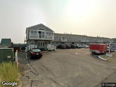
496 Shore Rd Unit 12 Truro, MA 02652
Truro NeighborhoodEstimated Value: $663,000 - $712,000
2
Beds
2
Baths
581
Sq Ft
$1,184/Sq Ft
Est. Value
About This Home
This home is located at 496 Shore Rd Unit 12, Truro, MA 02652 and is currently estimated at $687,971, approximately $1,184 per square foot. 496 Shore Rd Unit 12 is a home located in Barnstable County with nearby schools including Truro Central School.
Ownership History
Date
Name
Owned For
Owner Type
Purchase Details
Closed on
Jan 30, 2025
Sold by
Mccusker James T
Bought by
Silver City Lodging Sober
Current Estimated Value
Purchase Details
Closed on
Sep 27, 2004
Sold by
Coastal Cape Dev Inc
Bought by
Mccusker James T
Home Financials for this Owner
Home Financials are based on the most recent Mortgage that was taken out on this home.
Original Mortgage
$410,000
Interest Rate
5.89%
Mortgage Type
Purchase Money Mortgage
Create a Home Valuation Report for This Property
The Home Valuation Report is an in-depth analysis detailing your home's value as well as a comparison with similar homes in the area
Home Values in the Area
Average Home Value in this Area
Purchase History
| Date | Buyer | Sale Price | Title Company |
|---|---|---|---|
| Silver City Lodging Sober | $700,000 | None Available | |
| Silver City Lodging Sober | $700,000 | None Available | |
| Mccusker James T | $550,000 | -- | |
| Mccusker James T | $550,000 | -- |
Source: Public Records
Mortgage History
| Date | Status | Borrower | Loan Amount |
|---|---|---|---|
| Previous Owner | Mccusker James T | $410,000 | |
| Previous Owner | Mccusker James T | $410,000 |
Source: Public Records
Tax History Compared to Growth
Tax History
| Year | Tax Paid | Tax Assessment Tax Assessment Total Assessment is a certain percentage of the fair market value that is determined by local assessors to be the total taxable value of land and additions on the property. | Land | Improvement |
|---|---|---|---|---|
| 2025 | $3,173 | $513,500 | $0 | $513,500 |
| 2024 | $2,911 | $486,000 | $0 | $486,000 |
| 2023 | $3,038 | $464,600 | $0 | $464,600 |
| 2022 | $3,059 | $395,700 | $0 | $395,700 |
| 2021 | $2,922 | $395,900 | $0 | $395,900 |
| 2020 | $3,119 | $425,500 | $0 | $425,500 |
| 2019 | $2,710 | $363,700 | $0 | $363,700 |
| 2018 | $2,580 | $350,100 | $0 | $350,100 |
| 2017 | $2,449 | $350,800 | $0 | $350,800 |
| 2016 | $2,353 | $347,500 | $0 | $347,500 |
| 2015 | $2,015 | $303,900 | $0 | $303,900 |
Source: Public Records
Map
Nearby Homes
- 496 Shore Rd Unit 16
- 496 Shore Rd Unit 7
- 496 Shore Rd Unit 21
- 496 Shore Rd Unit 10
- 494 Shore Rd
- 522 Shore Rd Unit 3
- 433 Shore Rd
- 334 Shore Rd Unit 7
- 566 Shore Rd Unit 4
- 433 Shore Rd
- 596 Shore Rd Unit G
- 307 Shore Rd Unit 8-SB3
- 307 Shore Rd Unit 8-SB3
- 945 Commercial St Unit 2B
- 945 Commercial St Unit 9B
- 945 Commercial St Unit U9B
- 963 Commercial St Unit 18
- 953 Commercial St Unit 5
- 929 Commercial St Unit 501
- 897 Commercial St
- 496 Shore Rd Unit 15
- 496 Shore Rd Unit 8
- 496 Shore Rd Unit 12
- 496 Shore Rd Unit 13
- 496 Shore Rd Unit 4
- 496 Shore Rd Unit 19
- 496 Shore Rd Unit 6
- 496 Shore Rd Unit 5
- 496 Shore Rd Unit 1
- 496 Shore Rd Unit 9
- 496 Shore Rd Unit 11
- 496 Shore Rd Unit 3
- 496 Shore Rd Unit 14
- 496 Shore Rd Unit 18
- 496 Shore Rd Unit 20
- 496 Shore Rd Unit 2
- 496 Shore Rd
- 491 Shore Rd
- 491 Shore Rd
- 497 Shore Rd Unit 2