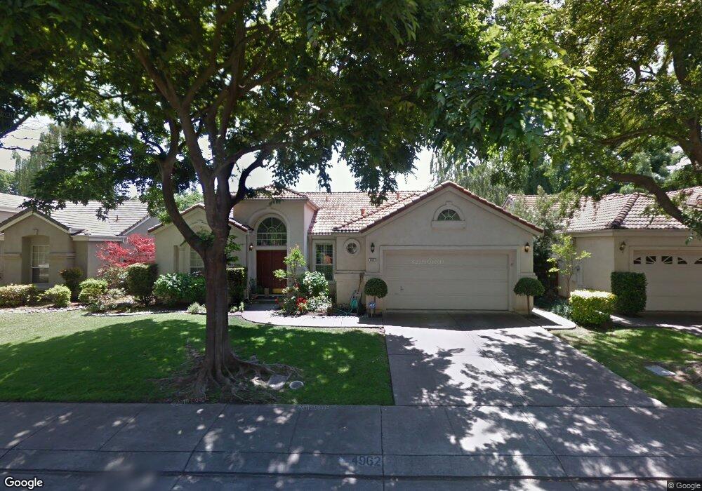
4962 Innisbrook Dr Unit 2 Stockton, CA 95219
Brookside NeighborhoodEstimated Value: $398,000 - $557,000
3
Beds
2
Baths
1,723
Sq Ft
$289/Sq Ft
Est. Value
About This Home
This home is located at 4962 Innisbrook Dr Unit 2, Stockton, CA 95219 and is currently estimated at $498,536, approximately $289 per square foot. 4962 Innisbrook Dr Unit 2 is a home located in San Joaquin County with nearby schools including Brookside, Sierra Middle School, and Lincoln High School.
Ownership History
Date
Name
Owned For
Owner Type
Purchase Details
Closed on
Nov 1, 2016
Sold by
Hart Kathleen A
Bought by
Hart Kathleen A and Kathleen A Hart 2016 Revocable
Current Estimated Value
Purchase Details
Closed on
Apr 28, 2004
Sold by
Stull David John and Stull Diane Walker
Bought by
Stull David John and Stull Diane Walker
Purchase Details
Closed on
Aug 12, 2002
Sold by
Moore Karen P
Bought by
Hart Kathleen A
Home Financials for this Owner
Home Financials are based on the most recent Mortgage that was taken out on this home.
Original Mortgage
$188,000
Outstanding Balance
$78,869
Interest Rate
6.43%
Estimated Equity
$419,667
Purchase Details
Closed on
Jun 22, 2000
Sold by
Basilio Peter and Basilio Esther
Bought by
Moore Karen P
Home Financials for this Owner
Home Financials are based on the most recent Mortgage that was taken out on this home.
Original Mortgage
$129,500
Interest Rate
8.53%
Create a Home Valuation Report for This Property
The Home Valuation Report is an in-depth analysis detailing your home's value as well as a comparison with similar homes in the area
Home Values in the Area
Average Home Value in this Area
Purchase History
| Date | Buyer | Sale Price | Title Company |
|---|---|---|---|
| Hart Kathleen A | -- | None Available | |
| Stull David John | -- | Financial Title Co | |
| Hart Kathleen A | $260,000 | Old Republic Title Company | |
| Moore Karen P | $190,000 | First American Title Co |
Source: Public Records
Mortgage History
| Date | Status | Borrower | Loan Amount |
|---|---|---|---|
| Open | Hart Kathleen A | $188,000 | |
| Previous Owner | Moore Karen P | $129,500 |
Source: Public Records
Tax History Compared to Growth
Tax History
| Year | Tax Paid | Tax Assessment Tax Assessment Total Assessment is a certain percentage of the fair market value that is determined by local assessors to be the total taxable value of land and additions on the property. | Land | Improvement |
|---|---|---|---|---|
| 2025 | $4,482 | $376,539 | $112,960 | $263,579 |
| 2024 | $4,384 | $369,157 | $110,746 | $258,411 |
| 2023 | $4,346 | $361,920 | $108,575 | $253,345 |
| 2022 | $4,119 | $354,825 | $106,447 | $248,378 |
| 2021 | $4,060 | $347,868 | $104,360 | $243,508 |
| 2020 | $4,066 | $344,302 | $103,290 | $241,012 |
| 2019 | $3,999 | $337,552 | $101,265 | $236,287 |
| 2018 | $3,932 | $330,934 | $99,280 | $231,654 |
| 2017 | $3,853 | $324,446 | $97,334 | $227,112 |
| 2016 | $3,810 | $318,087 | $95,426 | $222,661 |
| 2014 | $3,387 | $279,000 | $84,000 | $195,000 |
Source: Public Records
Map
Nearby Homes
- 3635 Hidden Brook Dr
- 3669 Whispering Creek Cir
- 6503 Pine Meadow Cir
- 6486 Pine Meadow Cir
- 3668 Whispering Creek Cir
- 6541 Brook Hollow Cir
- 3287 Amberfield Cir
- 6472 Brook Hollow Cir
- 6337 Brook Hollow Cir
- 6439 Brook Hollow Cir
- 6243 Riverbank Cir
- 6219 Riverbank Cir
- 2930 Driftwood Place Unit 51
- 3743 Saint Andrews Dr
- 3604 Fourteen Mile Dr
- 3653 Saint Andrews Dr Unit 14
- 3663 Saint Andrews Dr Unit 16
- 4313 Rockwood Ct
- 3864 Fourteen Mile Dr
- 4135 Riverbrook Ct
- 4950 Innisbrook Dr
- 5008 Innisbrook Dr
- 3310 Willowbrook Cir
- 3312 Willowbrook Cir
- 3308 Willowbrook Cir
- 4938 Innisbrook Dr
- 5020 Innisbrook Dr
- 4961 Innisbrook Dr
- 3314 Willowbrook Cir
- 5007 Innisbrook Dr
- 4949 Innisbrook Dr
- 3306 Willowbrook Cir
- 5019 Innisbrook Dr
- 3316 Willowbrook Cir
- 4937 Innisbrook Dr
- 5032 Innisbrook Dr
- 3398 Willowbrook Cir
- 3354 Willowbrook Cir
- 3311 Willowbrook Cir
- 3356 Willowbrook Cir