Estimated Value: $343,000 - $363,000
3
Beds
2
Baths
1,768
Sq Ft
$199/Sq Ft
Est. Value
About This Home
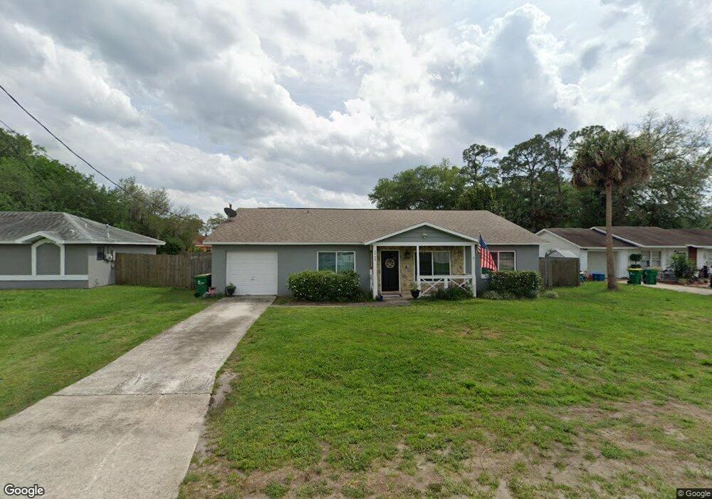
This home is located at 4963 Patricia St, Cocoa, FL 32927 and is currently estimated at $351,943, approximately $199 per square foot. 4963 Patricia St is a home located in Brevard County with nearby schools including Atlantis Elementary School, Space Coast Junior/Senior High School, and Sculptor Charter School.
Ownership History
Date
Name
Owned For
Owner Type
Purchase Details
Closed on
Aug 25, 2004
Sold by
Miller Robert V and Miller Caprice M
Bought by
Harrington Shannon and Harrington Cheryl
Current Estimated Value
Home Financials for this Owner
Home Financials are based on the most recent Mortgage that was taken out on this home.
Original Mortgage
$137,750
Outstanding Balance
$75,695
Interest Rate
7.55%
Estimated Equity
$276,248
Purchase Details
Closed on
Jun 28, 2001
Sold by
Cafasso Angela C and Chodorowski Angela C
Bought by
Miller Robert V and Miller Caprice M
Home Financials for this Owner
Home Financials are based on the most recent Mortgage that was taken out on this home.
Original Mortgage
$86,560
Interest Rate
7.17%
Purchase Details
Closed on
Sep 6, 1996
Sold by
Chodorowski Thomas R
Bought by
Chodorowski Angela C
Create a Home Valuation Report for This Property
The Home Valuation Report is an in-depth analysis detailing your home's value as well as a comparison with similar homes in the area
Home Values in the Area
Average Home Value in this Area
Purchase History
| Date | Buyer | Sale Price | Title Company |
|---|---|---|---|
| Harrington Shannon | $145,000 | Fidelity Natl Title Ins Co | |
| Miller Robert V | $87,500 | -- | |
| Chodorowski Angela C | $36,500 | -- |
Source: Public Records
Mortgage History
| Date | Status | Borrower | Loan Amount |
|---|---|---|---|
| Open | Harrington Shannon | $137,750 | |
| Previous Owner | Miller Robert V | $86,560 |
Source: Public Records
Tax History
| Year | Tax Paid | Tax Assessment Tax Assessment Total Assessment is a certain percentage of the fair market value that is determined by local assessors to be the total taxable value of land and additions on the property. | Land | Improvement |
|---|---|---|---|---|
| 2025 | $1,695 | $126,050 | -- | -- |
| 2024 | $1,657 | $122,500 | -- | -- |
| 2023 | $1,657 | $118,940 | $0 | $0 |
| 2022 | $1,546 | $115,480 | $0 | $0 |
| 2021 | $1,555 | $112,120 | $0 | $0 |
| 2020 | $1,021 | $76,160 | $0 | $0 |
| 2019 | $958 | $74,450 | $0 | $0 |
| 2018 | $959 | $73,070 | $0 | $0 |
| 2017 | $959 | $71,570 | $0 | $0 |
| 2016 | $968 | $70,100 | $18,000 | $52,100 |
| 2015 | $977 | $69,620 | $15,000 | $54,620 |
| 2014 | $982 | $69,070 | $11,000 | $58,070 |
Source: Public Records
Map
Nearby Homes
- 7155 Export Ave
- 5080 Mayflower St
- 4824 Curtis Blvd
- 5200 Frisco St
- 7245 Grissom Pkwy
- 5155 Mayflower St
- 5165 Patricia St
- 7275 Durban Ave
- 6990 Camden Ave
- 4760 Ivan St
- 5150 Melody St
- 4625 Curtis Blvd
- 4790 Greenhill St
- 6820 Caliph Ave
- 5095 Hogan Place
- 6620 Grissom Pkwy
- 0 Cinnamon Fern Blvd
- 7310 Joshua Place
- 4852 Alfred St
- 6990 Bryant Rd
- 4951 Patricia St
- 4971 Patricia St
- 4940 Mayflower St
- 4950 Mayflower St
- 4930 Mayflower St
- 4943 Patricia St
- 4983 Patricia St
- 4964 Patricia St
- 4956 Patricia St
- 4972 Patricia St
- 4960 Mayflower St
- 4920 Mayflower St
- 4948 Patricia St
- 4985 Patricia St
- 4980 Patricia St
- 4970 Mayflower St
- 4927 Patricia St
- 4910 Mayflower St
- 4940 Patricia St
- 4945 Mayflower St
Your Personal Tour Guide
Ask me questions while you tour the home.