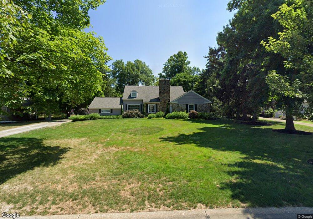
4967 Countryside Rd Cleveland, OH 44124
Estimated Value: $441,000 - $460,791
4
Beds
3
Baths
2,203
Sq Ft
$205/Sq Ft
Est. Value
About This Home
This home is located at 4967 Countryside Rd, Cleveland, OH 44124 and is currently estimated at $451,448, approximately $204 per square foot. 4967 Countryside Rd is a home located in Cuyahoga County with nearby schools including Sunview Elementary School, Greenview Upper Elementary School, and Memorial Junior High School.
Ownership History
Date
Name
Owned For
Owner Type
Purchase Details
Closed on
Feb 1, 2007
Sold by
Risk James A
Bought by
Risk Kristina M
Current Estimated Value
Purchase Details
Closed on
Jan 6, 2005
Sold by
Rice Lois D and Rice Richard E
Bought by
Risk James A and Risk Kristina M
Home Financials for this Owner
Home Financials are based on the most recent Mortgage that was taken out on this home.
Original Mortgage
$150,000
Interest Rate
5.9%
Mortgage Type
Purchase Money Mortgage
Purchase Details
Closed on
Dec 8, 1992
Sold by
Rice Richard C
Bought by
Rice Lois D
Purchase Details
Closed on
Jun 9, 1982
Sold by
Dice Kenneth G
Bought by
Rice Richard C
Purchase Details
Closed on
Aug 24, 1976
Sold by
Dice Kenneth G and Dice Mildred I
Bought by
Dice Kenneth G
Purchase Details
Closed on
Jan 1, 1975
Bought by
Dice Kenneth G and Dice Mildred I
Create a Home Valuation Report for This Property
The Home Valuation Report is an in-depth analysis detailing your home's value as well as a comparison with similar homes in the area
Home Values in the Area
Average Home Value in this Area
Purchase History
| Date | Buyer | Sale Price | Title Company |
|---|---|---|---|
| Risk Kristina M | -- | Attorney | |
| Risk James A | $269,000 | Real Living | |
| Rice Lois D | -- | -- | |
| Rice Richard C | $104,000 | -- | |
| Dice Kenneth G | -- | -- | |
| Dice Kenneth G | -- | -- |
Source: Public Records
Mortgage History
| Date | Status | Borrower | Loan Amount |
|---|---|---|---|
| Previous Owner | Risk James A | $150,000 | |
| Closed | Risk James A | $104,600 |
Source: Public Records
Tax History Compared to Growth
Tax History
| Year | Tax Paid | Tax Assessment Tax Assessment Total Assessment is a certain percentage of the fair market value that is determined by local assessors to be the total taxable value of land and additions on the property. | Land | Improvement |
|---|---|---|---|---|
| 2024 | $9,550 | $139,825 | $28,805 | $111,020 |
| 2023 | $7,998 | $94,330 | $21,210 | $73,120 |
| 2022 | $7,951 | $94,325 | $21,210 | $73,115 |
| 2021 | $7,881 | $94,330 | $21,210 | $73,120 |
| 2020 | $8,167 | $85,750 | $19,290 | $66,470 |
| 2019 | $7,356 | $245,000 | $55,100 | $189,900 |
| 2018 | $7,317 | $85,750 | $19,290 | $66,470 |
| 2017 | $7,099 | $76,380 | $17,540 | $58,840 |
| 2016 | $7,047 | $76,380 | $17,540 | $58,840 |
| 2015 | $6,545 | $76,380 | $17,540 | $58,840 |
| 2014 | $6,545 | $71,370 | $16,380 | $54,990 |
Source: Public Records
Map
Nearby Homes
- 5027 Bristol Ct
- 5079 Haverford Dr
- 1667 Richmond Rd
- 5144 Oakmont Dr
- 5159 Haverford Dr
- 1333 Clearview Rd
- 5103 Eastover Rd
- 1512 Parkside Cir
- 1691 Harwich Rd
- 5204 Haverford Dr
- 4800 Farnhurst Rd
- 5243 Oakmont Dr
- 4695 Mayfield Rd Unit A
- 4685 Mayfield Rd Unit F
- 5227 E Farnhurst Rd
- 1503 Oakmount Rd
- 1271 Dorsh Rd
- 1368 Irene Rd
- 4866 Fairlawn Rd
- 1443 Churchill Rd
- 4965 Countryside Rd
- 4971 Countryside Rd
- 4973 Countryside Rd
- 4963 Countryside Rd
- 4970 Countryside Rd
- 4960 Countryside Rd
- 4956 Countryside Rd
- 4977 Countryside Rd
- 4955 Countryside Rd
- 4976 Countryside Rd
- 4948 Countryside Rd
- 4943 Middledale Rd
- 1564 Richmond Rd
- 5035 Bristol Ct
- 4947 Countryside Rd
- 4979 Countryside Rd
- 4931 Middledale Rd
- 4940 Countryside Rd
- 5037 Bristol Ct
- 5033 Bristol Ct