4967 E Muggy Rd Port Clinton, OH 43452
Estimated Value: $375,951 - $514,000
3
Beds
2
Baths
1,544
Sq Ft
$291/Sq Ft
Est. Value
About This Home
This home is located at 4967 E Muggy Rd, Port Clinton, OH 43452 and is currently estimated at $448,738, approximately $290 per square foot. 4967 E Muggy Rd is a home with nearby schools including Bataan Memorial Primary School, Bataan Memorial Intermediate School, and Port Clinton Middle School.
Ownership History
Date
Name
Owned For
Owner Type
Purchase Details
Closed on
Nov 2, 2017
Sold by
Thomspon D Jean
Bought by
Thompson Nathan R
Current Estimated Value
Home Financials for this Owner
Home Financials are based on the most recent Mortgage that was taken out on this home.
Original Mortgage
$122,500
Outstanding Balance
$104,291
Interest Rate
3.83%
Mortgage Type
New Conventional
Estimated Equity
$283,563
Purchase Details
Closed on
May 9, 2012
Sold by
Thompson Thomas D and Thompson Jean D
Bought by
Thompson D Jean
Create a Home Valuation Report for This Property
The Home Valuation Report is an in-depth analysis detailing your home's value as well as a comparison with similar homes in the area
Home Values in the Area
Average Home Value in this Area
Purchase History
| Date | Buyer | Sale Price | Title Company |
|---|---|---|---|
| Thompson Nathan R | $154,000 | None Available | |
| Thompson D Jean | -- | Hartung |
Source: Public Records
Mortgage History
| Date | Status | Borrower | Loan Amount |
|---|---|---|---|
| Open | Thompson Nathan R | $122,500 |
Source: Public Records
Tax History Compared to Growth
Tax History
| Year | Tax Paid | Tax Assessment Tax Assessment Total Assessment is a certain percentage of the fair market value that is determined by local assessors to be the total taxable value of land and additions on the property. | Land | Improvement |
|---|---|---|---|---|
| 2024 | $2,622 | $80,875 | $35,070 | $45,805 |
| 2023 | $2,622 | $78,113 | $35,070 | $43,043 |
| 2022 | $2,783 | $78,113 | $35,070 | $43,043 |
| 2021 | $2,778 | $78,110 | $35,070 | $43,040 |
| 2020 | $2,055 | $55,590 | $22,480 | $33,110 |
| 2019 | $2,035 | $55,590 | $22,480 | $33,110 |
| 2018 | $4,966 | $55,590 | $22,480 | $33,110 |
| 2017 | $2,793 | $56,750 | $21,960 | $34,790 |
| 2016 | $2,803 | $56,750 | $21,960 | $34,790 |
| 2015 | $2,808 | $56,750 | $21,960 | $34,790 |
| 2014 | $2,722 | $56,750 | $21,960 | $34,790 |
| 2013 | $2,731 | $56,750 | $21,960 | $34,790 |
Source: Public Records
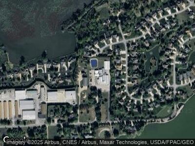
Map
Nearby Homes
- 891 Lost Lake Rd
- 834 Lost Lake Rd
- 1239 Catawba Bay Dr
- 1229 Catawba Bay Dr
- 5409 Pintail Dr
- 1509 N Point Dr Unit 3-1
- 971 N Falling Waters Blvd
- 1623 NE Catawba Rd
- 1623 NE Catawba Rd Unit 137
- 1789 N Windward Dr Unit H11
- 1789 N Windward Dr
- 1510 Dockside Dr
- 687 N Hidden Harbor Dr
- 1600 N Buck Rd Unit 76
- 1600 N Buck Rd Unit 19
- 4597 E Island Pines Dr
- 5198 E Gardner Rd
- 0 NW 1425 Rd Unit LOT 8 5040465
- 116 Rathbun Dr
- 5655 E Windjamer Ave
- 4967 E Muggy Rd
- 1070 Lost Lake Rd
- 4937 E Muggy Rd
- 4917 E Muggy Rd
- 1056 Lost Lake Rd
- 1084 Lost Lake Rd
- 4906 E Wood Duck Ct
- 1042 Lost Lake Rd
- 4964 E Muggy Rd
- 1112 Lost Lake Rd
- 4885 E Muggy Rd
- 4890 E Wood Duck Ct
- 4930 E Muggy Rd
- 1126 Lost Lake Rd
- 1028 Lost Lake Rd Unit 6
- 1028 Lost Lake Rd
- 1055 Lost Lake Rd
- 4874 E Wood Duck Ct
- 1091 Lost Lake Rd
- 4990 E Blue Teal Dr