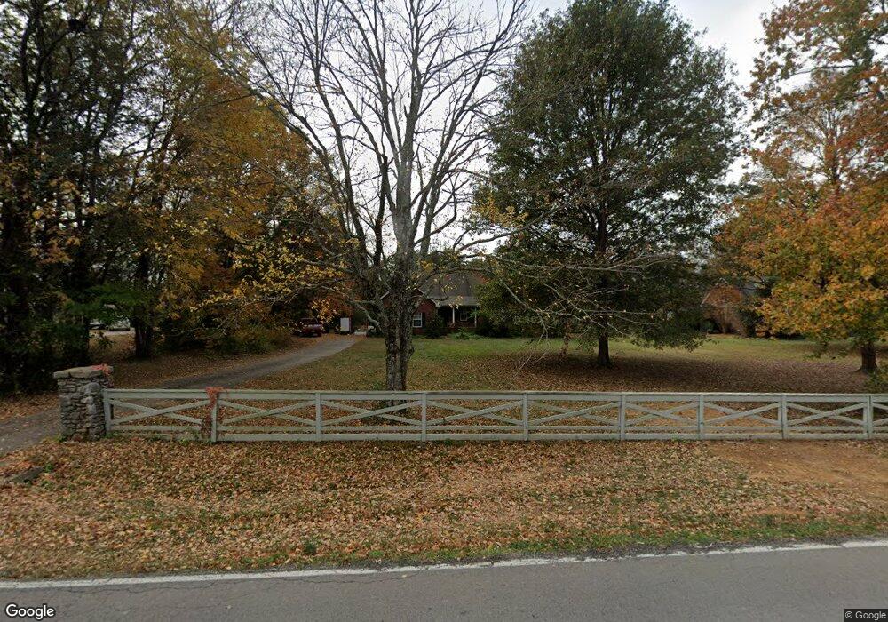
4967 Windrow Rd Rockvale, TN 37153
Estimated Value: $369,000 - $436,000
--
Bed
2
Baths
1,827
Sq Ft
$220/Sq Ft
Est. Value
About This Home
This home is located at 4967 Windrow Rd, Rockvale, TN 37153 and is currently estimated at $402,756, approximately $220 per square foot. 4967 Windrow Rd is a home located in Rutherford County with nearby schools including Rockvale Elementary School, Rockvale Middle School, and Rockvale High School.
Ownership History
Date
Name
Owned For
Owner Type
Purchase Details
Closed on
Aug 9, 2006
Sold by
Blasingim Mark T
Bought by
Wallis Miles A
Current Estimated Value
Home Financials for this Owner
Home Financials are based on the most recent Mortgage that was taken out on this home.
Original Mortgage
$135,600
Outstanding Balance
$81,013
Interest Rate
6.67%
Mortgage Type
Purchase Money Mortgage
Estimated Equity
$321,743
Purchase Details
Closed on
May 12, 1995
Sold by
C & M Enterprises Inc
Bought by
Pate Mark E
Purchase Details
Closed on
Jan 11, 1995
Sold by
Vaudel Properties
Bought by
C & M Enterprises Inc
Create a Home Valuation Report for This Property
The Home Valuation Report is an in-depth analysis detailing your home's value as well as a comparison with similar homes in the area
Home Values in the Area
Average Home Value in this Area
Purchase History
| Date | Buyer | Sale Price | Title Company |
|---|---|---|---|
| Wallis Miles A | $169,500 | -- | |
| Wallis Miles A | $169,500 | -- | |
| Pate Mark E | $100,000 | -- | |
| C & M Enterprises Inc | $160,500 | -- |
Source: Public Records
Mortgage History
| Date | Status | Borrower | Loan Amount |
|---|---|---|---|
| Open | Wallis Miles A | $135,600 | |
| Closed | Wallis Miles A | $8,000 | |
| Closed | C & M Enterprises Inc | $135,600 |
Source: Public Records
Tax History Compared to Growth
Tax History
| Year | Tax Paid | Tax Assessment Tax Assessment Total Assessment is a certain percentage of the fair market value that is determined by local assessors to be the total taxable value of land and additions on the property. | Land | Improvement |
|---|---|---|---|---|
| 2025 | $1,479 | $78,825 | $13,750 | $65,075 |
| 2024 | $1,479 | $78,825 | $13,750 | $65,075 |
| 2023 | $1,479 | $78,825 | $13,750 | $65,075 |
| 2022 | $1,274 | $78,825 | $13,750 | $65,075 |
| 2021 | $1,218 | $54,900 | $12,500 | $42,400 |
| 2020 | $1,218 | $54,900 | $12,500 | $42,400 |
| 2019 | $1,218 | $54,900 | $12,500 | $42,400 |
| 2018 | $1,153 | $54,900 | $0 | $0 |
| 2017 | $1,021 | $38,100 | $0 | $0 |
| 2016 | $1,021 | $38,100 | $0 | $0 |
| 2015 | $1,021 | $38,100 | $0 | $0 |
| 2014 | $947 | $38,100 | $0 | $0 |
| 2013 | -- | $39,350 | $0 | $0 |
Source: Public Records
Map
Nearby Homes
- 109 Lafayette Ct
- 5124 Old Salem Rd
- 3435 Middleton Dr
- 5414 Old Salem Rd
- 5407 Constantine Dr
- 5614 Constantine Dr
- 4492 Old Salem Rd
- 5509 E Overall Creek Rd
- 331 Needham Blvd
- 5415 Constantine Dr
- 5727 Dockside Dr
- 5665 Old Salem Rd
- The Alston A Plan at Shelton Square
- The Albany A Plan at Shelton Square
- The Hathaway Plan at Shelton Square
- The Hawkins Plan at Shelton Square
- Magellan Plan at Salem Landing
- 1850 Elevation JKL Plan at Salem Landing
- Armstrong Plan at Salem Landing
- Haley Plan at Salem Landing
- 4987 Windrow Rd
- 4933 Windrow Rd
- 3011 Middleton Dr
- 3015 Middleton Dr
- 1502 Jarratt Dr
- 1405 Trotters Ln
- 5027 Windrow Rd
- 4699 Windrow Rd
- 1503 Jarratt Dr
- 3019 Middleton Dr
- 1411 Trotters Ln
- 3008 Middleton Dr
- 1509 Jarratt Dr
- 1510 Jarratt Dr
- 1404 Trotters Ln
- 5121 Windrow Rd
- 3023 Middleton Dr
- 1515 Jarratt Dr
- 1419 Trotters Ln
- 3008 Berry Patch Trail