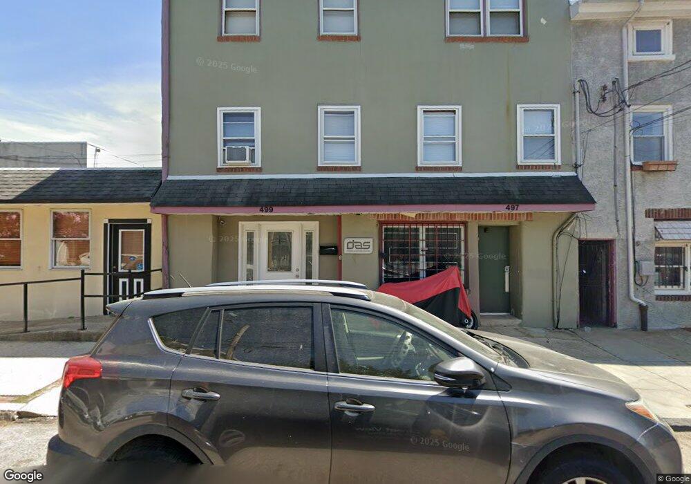
497-99 Conarroe St Philadelphia, PA 19128
Roxborough NeighborhoodEstimated Value: $700,000 - $822,000
--
Bed
3
Baths
2,975
Sq Ft
$257/Sq Ft
Est. Value
About This Home
This home is located at 497-99 Conarroe St, Philadelphia, PA 19128 and is currently estimated at $764,461, approximately $256 per square foot. 497-99 Conarroe St is a home located in Philadelphia County with nearby schools including James Dobson Elementary School, Roxborough High School, and Holy Child School.
Ownership History
Date
Name
Owned For
Owner Type
Purchase Details
Closed on
Dec 22, 2009
Sold by
Gunning Charles E and Gunning Dorothy S
Bought by
497 Conarroe Street Llc
Current Estimated Value
Home Financials for this Owner
Home Financials are based on the most recent Mortgage that was taken out on this home.
Original Mortgage
$200,000
Outstanding Balance
$129,646
Interest Rate
4.78%
Mortgage Type
Future Advance Clause Open End Mortgage
Estimated Equity
$634,815
Create a Home Valuation Report for This Property
The Home Valuation Report is an in-depth analysis detailing your home's value as well as a comparison with similar homes in the area
Home Values in the Area
Average Home Value in this Area
Purchase History
| Date | Buyer | Sale Price | Title Company |
|---|---|---|---|
| 497 Conarroe Street Llc | $362,500 | None Available |
Source: Public Records
Mortgage History
| Date | Status | Borrower | Loan Amount |
|---|---|---|---|
| Open | 497 Conarroe Street Llc | $200,000 |
Source: Public Records
Tax History Compared to Growth
Tax History
| Year | Tax Paid | Tax Assessment Tax Assessment Total Assessment is a certain percentage of the fair market value that is determined by local assessors to be the total taxable value of land and additions on the property. | Land | Improvement |
|---|---|---|---|---|
| 2025 | $7,446 | $798,000 | $159,600 | $638,400 |
| 2024 | $7,446 | $798,000 | $159,600 | $638,400 |
| 2023 | $7,446 | $531,900 | $106,300 | $425,600 |
| 2022 | $6,334 | $531,900 | $106,300 | $425,600 |
| 2021 | $6,334 | $0 | $0 | $0 |
| 2020 | $6,334 | $0 | $0 | $0 |
| 2019 | $6,131 | $0 | $0 | $0 |
| 2018 | $6,131 | $0 | $0 | $0 |
| 2017 | $3,527 | $0 | $0 | $0 |
| 2016 | $3,528 | $0 | $0 | $0 |
| 2015 | $3,377 | $0 | $0 | $0 |
| 2014 | -- | $252,000 | $75,000 | $177,000 |
| 2012 | -- | $40,000 | $4,800 | $35,200 |
Source: Public Records
Map
Nearby Homes
- 481 Conarroe St
- 472 Lyceum Ave
- 6106 Ridge Ave
- 517 Conarroe St
- 451 Green Ln
- 452 Green Ln
- 434-36 Conarroe St
- 432 Martin St
- 200 Monastery Ave
- 435 Martin St
- 4359 Mitchell St
- 4531 Mitchell St
- 407 Conarroe St
- 4381-83 Pechin St
- 389 Conarroe St
- 603 Green Ln
- 4538 Mitchell St
- 4416 Pechin St
- 468 Leverington Ave
- 610 Martin St
- 495 Conarroe St
- 493 Conarroe St
- 491 Conarroe St
- 6076 Ridge Ave
- 6076 Ridge Ave Unit 4
- 6076 Ridge Ave Unit 5
- 489 Conarroe St
- 6070 Ridge Ave
- 6068 Ridge Ave Unit 2
- 487 Conarroe St
- 6080 Ridge Ave
- 6080 Ridge Ave Unit 1
- 6080 Ridge Ave Unit 2
- 6080 Ridge Ave Unit 3
- 6080 Ridge Ave Unit 4
- 490 Conarroe St
- 476 Lyceum Ave
- 6064 Ridge Ave
- 474 Lyceum Ave
- 6100 Ridge Ave Unit C