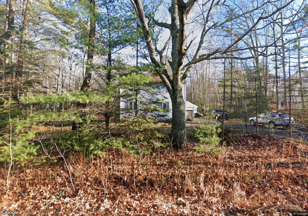
497 Blackstrap Rd Falmouth, ME 04105
Estimated Value: $581,000 - $792,000
3
Beds
1
Bath
2,178
Sq Ft
$308/Sq Ft
Est. Value
About This Home
This home is located at 497 Blackstrap Rd, Falmouth, ME 04105 and is currently estimated at $670,436, approximately $307 per square foot. 497 Blackstrap Rd is a home located in Cumberland County with nearby schools including Falmouth Middle School and Falmouth High School.
Ownership History
Date
Name
Owned For
Owner Type
Purchase Details
Closed on
Feb 6, 2007
Sold by
Holbrokk Lisa J
Bought by
Castaldi Louis M and Castaldi Donna L
Current Estimated Value
Home Financials for this Owner
Home Financials are based on the most recent Mortgage that was taken out on this home.
Original Mortgage
$216,956
Interest Rate
6.16%
Mortgage Type
FHA
Create a Home Valuation Report for This Property
The Home Valuation Report is an in-depth analysis detailing your home's value as well as a comparison with similar homes in the area
Home Values in the Area
Average Home Value in this Area
Purchase History
| Date | Buyer | Sale Price | Title Company |
|---|---|---|---|
| Castaldi Louis M | -- | -- |
Source: Public Records
Mortgage History
| Date | Status | Borrower | Loan Amount |
|---|---|---|---|
| Open | Castaldi Louis M | $207,671 | |
| Closed | Castaldi Louis M | $25,000 | |
| Closed | Castaldi Louis M | $216,956 |
Source: Public Records
Tax History Compared to Growth
Tax History
| Year | Tax Paid | Tax Assessment Tax Assessment Total Assessment is a certain percentage of the fair market value that is determined by local assessors to be the total taxable value of land and additions on the property. | Land | Improvement |
|---|---|---|---|---|
| 2024 | $5,492 | $410,500 | $183,200 | $227,300 |
| 2023 | $5,177 | $409,600 | $183,200 | $226,400 |
| 2022 | $4,882 | $409,600 | $183,200 | $226,400 |
| 2021 | $3,627 | $235,700 | $114,500 | $121,200 |
| 2020 | $1,570 | $235,700 | $114,500 | $121,200 |
| 2019 | $1,570 | $235,700 | $114,500 | $121,200 |
| 2018 | $1,570 | $235,700 | $114,500 | $121,200 |
| 2017 | $1,570 | $235,700 | $114,500 | $121,200 |
| 2016 | $3,557 | $235,700 | $114,500 | $121,200 |
| 2015 | $3,448 | $235,700 | $114,500 | $121,200 |
| 2014 | $3,182 | $235,700 | $114,500 | $121,200 |
| 2012 | -- | $235,700 | $114,500 | $121,200 |
Source: Public Records
Map
Nearby Homes
- 20 Babbidge Rd
- 11 Fox Run Rd
- 239 Hunter Way
- 148 Hunter Way
- 440 Blackstrap Rd
- 43 Lakeside Dr
- 104 Cottage Rd
- 1 Orchard Rd
- 12 Summit Terrace
- 12 Laurence Way
- 22 Linsausiq Way
- 0 Pointer Way Unit LOT 57
- 19 Independence Way
- 7 Independence Way
- 8 Koorbano Ln
- 328 Blackstrap Rd
- 57&57D Tinker Ln and Pointer Way
- 0 Tinker Ln Unit 57D
- 12 Critter Dr
- 7 Birdsong Ln
- 495 Blackstrap Rd
- 499 Blackstrap Rd
- 0 Blackstrap Rd
- 2 Meadow Ln
- 492 Blackstrap Rd
- 4 Meadow Ln
- 511 Blackstrap Rd
- 488 Blackstrap Rd
- 0 Babbidge Rd
- 1 Meadow Ln
- 6 Babbidge Rd
- 9 Babbidge Rd
- 510 Blackstrap Rd
- 1 Fox Run Rd
- 3 Fox Run Rd
- 482 Blackstrap Rd
- 10 Babbidge Rd
- 3 Meadow Ln
- 7 Spoondrift Rd
- 2 Fox Run Rd