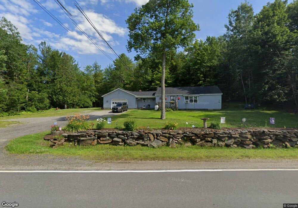
497 Central St Bucksport, ME 04416
Estimated Value: $213,000 - $258,000
3
Beds
1
Bath
1,160
Sq Ft
$208/Sq Ft
Est. Value
About This Home
This home is located at 497 Central St, Bucksport, ME 04416 and is currently estimated at $240,875, approximately $207 per square foot. 497 Central St is a home located in Hancock County with nearby schools including G. Herbert Jewett School, Miles Lane School, and Bucksport Middle School.
Ownership History
Date
Name
Owned For
Owner Type
Purchase Details
Closed on
Jul 30, 2012
Sold by
Mcguire Richard
Bought by
Saunders Jeffrey W
Current Estimated Value
Purchase Details
Closed on
Apr 25, 2007
Sold by
Washington Mutual Bank
Bought by
Mcguire Richard
Home Financials for this Owner
Home Financials are based on the most recent Mortgage that was taken out on this home.
Original Mortgage
$106,500
Interest Rate
6.27%
Mortgage Type
Unknown
Create a Home Valuation Report for This Property
The Home Valuation Report is an in-depth analysis detailing your home's value as well as a comparison with similar homes in the area
Home Values in the Area
Average Home Value in this Area
Purchase History
| Date | Buyer | Sale Price | Title Company |
|---|---|---|---|
| Saunders Jeffrey W | -- | -- | |
| Mcguire Richard | $80,000 | -- |
Source: Public Records
Mortgage History
| Date | Status | Borrower | Loan Amount |
|---|---|---|---|
| Previous Owner | Mcguire Richard | $110,500 | |
| Previous Owner | Mcguire Richard | $106,500 | |
| Previous Owner | Mcguire Richard | $80,000 |
Source: Public Records
Tax History Compared to Growth
Tax History
| Year | Tax Paid | Tax Assessment Tax Assessment Total Assessment is a certain percentage of the fair market value that is determined by local assessors to be the total taxable value of land and additions on the property. | Land | Improvement |
|---|---|---|---|---|
| 2024 | $2,212 | $166,980 | $28,220 | $138,760 |
| 2023 | $2,129 | $166,980 | $28,220 | $138,760 |
| 2022 | $1,849 | $109,080 | $25,660 | $83,420 |
| 2021 | $1,773 | $109,080 | $25,660 | $83,420 |
| 2020 | $1,540 | $109,080 | $25,660 | $83,420 |
| 2019 | $1,328 | $109,080 | $25,660 | $83,420 |
| 2018 | $1,452 | $109,080 | $25,660 | $83,420 |
| 2017 | $1,779 | $108,480 | $32,800 | $75,680 |
| 2016 | $1,790 | $108,480 | $32,800 | $75,680 |
| 2015 | $1,864 | $109,000 | $33,000 | $76,000 |
| 2014 | $1,535 | $108,777 | $32,799 | $75,978 |
| 2013 | $1,475 | $108,780 | $32,800 | $75,980 |
Source: Public Records
Map
Nearby Homes
- 12 Twin Oaks Ln
- 61 Baxter Blvd
- 19 Katahdin Dr
- 30 Katahdin Dr
- 89 Millvale Rd
- 53-04 Race Course Rd
- 53-03 Race Course Rd
- 54 Robin Hood Cir
- 326 Silver Lake Rd
- 104 State Route 46
- 52 State Route 46
- Map2Lot24 Park St
- Map2Lot27 Park St
- Map2Lot68 Park St
- Lot 96 Pond Street Extension St
- 63 Pond St
- 48 Pond St
- 62 Pine St
- 5 Scotts Ln
- 659 State Route 46
- 494 Central St
- 511 Central St
- 23 Royal Ridge Ln
- 7 Royal Ridge Ln
- 7 Royal Ridge Ln
- 493 Central St
- 474 Central St
- 480 Central St
- 522 Central St
- 473 Central St
- 32 Royal Ridge Ln
- 75 Royal Ridge Ln
- 46 Royal Ridge Ln
- 2 Twin Oaks Ln
- 534 Central St
- 43 Royal Ridge Ln
- 454 Central St
- 000 Millvale Rd
- 00 Lot 2 Millvale Rd
- 539 Central St