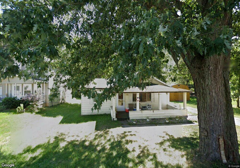
497 King St Mansfield, OH 44903
Estimated Value: $45,916 - $76,000
2
Beds
1
Bath
962
Sq Ft
$65/Sq Ft
Est. Value
About This Home
This home is located at 497 King St, Mansfield, OH 44903 and is currently estimated at $62,479, approximately $64 per square foot. 497 King St is a home located in Richland County with nearby schools including Foundation Academy, Mansfield Elective Academy, and Interactive Media & Construction (IMAC) Academy.
Ownership History
Date
Name
Owned For
Owner Type
Purchase Details
Closed on
Jul 10, 2024
Sold by
Right Way Properties Llc
Bought by
Iht Investments Llc
Current Estimated Value
Purchase Details
Closed on
Oct 20, 2012
Sold by
Galley Adam
Bought by
Right Way Properties Llc
Purchase Details
Closed on
Jun 5, 2009
Sold by
Robertson James P and Hamilton Bart W
Bought by
Galley Adam
Purchase Details
Closed on
Nov 9, 1992
Sold by
Northover Sharon L
Bought by
Ball Leslie
Create a Home Valuation Report for This Property
The Home Valuation Report is an in-depth analysis detailing your home's value as well as a comparison with similar homes in the area
Home Values in the Area
Average Home Value in this Area
Purchase History
| Date | Buyer | Sale Price | Title Company |
|---|---|---|---|
| Iht Investments Llc | $26,000 | None Listed On Document | |
| Iht Investments Llc | $26,000 | None Listed On Document | |
| Right Way Properties Llc | $8,500 | Attorney | |
| Galley Adam | $1,000 | Chicago Title Agency Of Nort | |
| Ball Leslie | $15,000 | -- |
Source: Public Records
Tax History Compared to Growth
Tax History
| Year | Tax Paid | Tax Assessment Tax Assessment Total Assessment is a certain percentage of the fair market value that is determined by local assessors to be the total taxable value of land and additions on the property. | Land | Improvement |
|---|---|---|---|---|
| 2024 | $428 | $9,140 | $1,750 | $7,390 |
| 2023 | $428 | $9,140 | $1,750 | $7,390 |
| 2022 | $304 | $5,440 | $1,590 | $3,850 |
| 2021 | $306 | $5,440 | $1,590 | $3,850 |
| 2020 | $313 | $5,440 | $1,590 | $3,850 |
| 2019 | $347 | $5,440 | $1,590 | $3,850 |
| 2018 | $342 | $5,440 | $1,590 | $3,850 |
| 2017 | $333 | $5,440 | $1,590 | $3,850 |
| 2016 | $393 | $6,230 | $2,520 | $3,710 |
| 2015 | $393 | $6,230 | $2,520 | $3,710 |
| 2014 | $371 | $6,230 | $2,520 | $3,710 |
| 2012 | $359 | $6,550 | $2,650 | $3,900 |
Source: Public Records
Map
Nearby Homes
- 512 Burns St
- 0 Highway 30
- 426 Mcpherson St
- 0 State Route 314 Unit 9069650
- 0 State Route 314 Unit 9067316
- 0 State Route 314 Unit 225021979
- 283 Bulkley Ave
- 0 Voegele Ave Unit Lot 6048, 6049, 6
- 371 Bell St
- 526 Bowman St
- 269 Parkway Dr
- 237 Helen Ave
- 743 Bowman St
- 362-364 W 6th St
- 212 Penn Ave
- 156 Buckingham Ave Unit 158
- 674 Averill Ave
- 641 Averill Ave
- 185 Rowland Ave
- 118 Raymond Ave