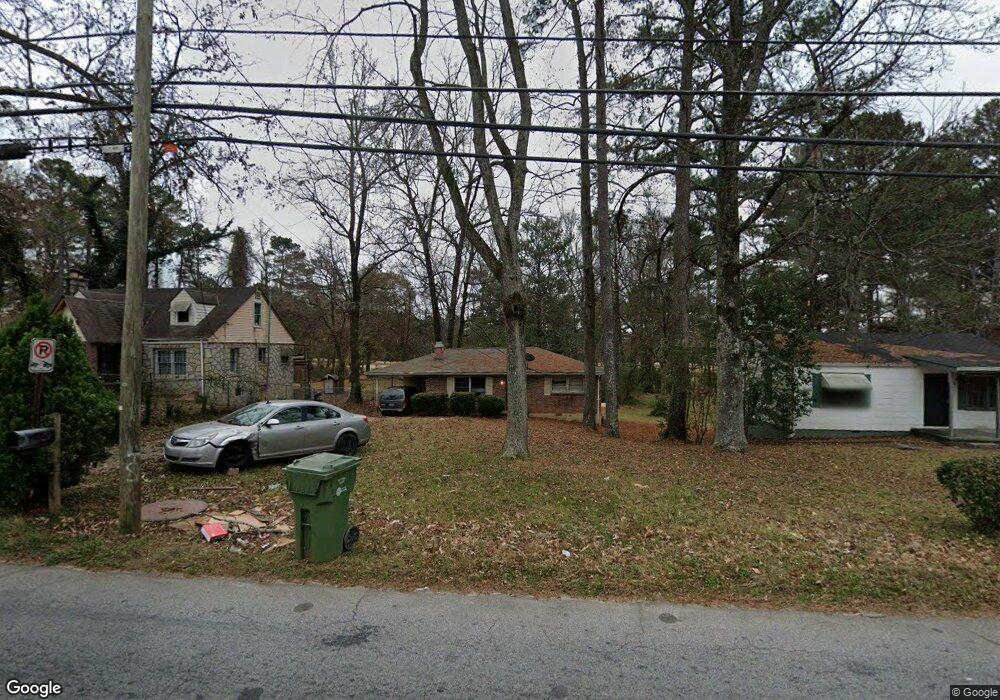
497 Mcwilliams Rd SE Atlanta, GA 30315
Browns Mill Park NeighborhoodEstimated Value: $176,000 - $204,591
3
Beds
1
Bath
972
Sq Ft
$193/Sq Ft
Est. Value
About This Home
This home is located at 497 Mcwilliams Rd SE, Atlanta, GA 30315 and is currently estimated at $187,148, approximately $192 per square foot. 497 Mcwilliams Rd SE is a home located in Fulton County with nearby schools including Dobbs Elementary School, Long Middle School, and South Atlanta High School.
Ownership History
Date
Name
Owned For
Owner Type
Purchase Details
Closed on
Dec 21, 2020
Sold by
Downs Betsy
Bought by
Sherborne Llc
Current Estimated Value
Purchase Details
Closed on
Sep 30, 2010
Sold by
Federal Home Loan Mortgage Corporation
Bought by
497 Mcwilliams Rd Llc
Purchase Details
Closed on
May 4, 2010
Sold by
Chase Hm Fin Llc
Bought by
Federal Home Loan Mortgage Corporation
Purchase Details
Closed on
Feb 29, 2000
Sold by
Shanks Barbara A
Bought by
Jones D Harston
Home Financials for this Owner
Home Financials are based on the most recent Mortgage that was taken out on this home.
Original Mortgage
$54,000
Interest Rate
8.37%
Mortgage Type
New Conventional
Create a Home Valuation Report for This Property
The Home Valuation Report is an in-depth analysis detailing your home's value as well as a comparison with similar homes in the area
Home Values in the Area
Average Home Value in this Area
Purchase History
| Date | Buyer | Sale Price | Title Company |
|---|---|---|---|
| Sherborne Llc | -- | -- | |
| Downs Betsy | $120,000 | -- | |
| 497 Mcwilliams Rd Llc | -- | -- | |
| Federal Home Loan Mortgage Corporation | -- | -- | |
| Chase Hm Fin Llc | $18,000 | -- | |
| Jones D Harston | $50,000 | -- |
Source: Public Records
Mortgage History
| Date | Status | Borrower | Loan Amount |
|---|---|---|---|
| Previous Owner | Jones D Harston | $54,000 |
Source: Public Records
Tax History Compared to Growth
Tax History
| Year | Tax Paid | Tax Assessment Tax Assessment Total Assessment is a certain percentage of the fair market value that is determined by local assessors to be the total taxable value of land and additions on the property. | Land | Improvement |
|---|---|---|---|---|
| 2025 | $2,753 | $96,000 | $58,840 | $37,160 |
| 2023 | $4,203 | $101,520 | $58,840 | $42,680 |
| 2022 | $3,016 | $74,520 | $31,000 | $43,520 |
| 2021 | $1,462 | $36,080 | $11,960 | $24,120 |
| 2020 | $552 | $13,480 | $3,600 | $9,880 |
| 2019 | $490 | $13,480 | $3,600 | $9,880 |
| 2018 | $558 | $13,480 | $3,600 | $9,880 |
| 2017 | $451 | $10,440 | $2,840 | $7,600 |
| 2016 | $452 | $10,440 | $2,840 | $7,600 |
| 2015 | $940 | $10,440 | $2,840 | $7,600 |
| 2014 | $365 | $12,520 | $2,840 | $9,680 |
Source: Public Records
Map
Nearby Homes
- 2318 Browns Mill Rd SE
- 568 Mcwilliams Rd SE
- 585 Mcwilliams Rd SE Unit 2003
- 585 Mcwilliams Rd SE Unit 1406
- 585 Mcwilliams Rd SE Unit 604
- 444 Sargent Dr SE
- 2306 Carey Dr SE
- 388 Sargent Dr SE
- 2242 Jernigan Dr SE
- 2209 Browns Mill Rd SE
- 2239 Carey Dr SE
- 2203 Browns Mill Rd SE
- 2197 Jernigan Dr SE
- 319 E Rhinehill Rd SE
- 296 Bromack Dr SE
- 2276 Sargent Place SE
- 322 E Rhinehill Rd SE
- 305 Banberry Dr SE
- 493 Mcwilliams Rd SE
- 501 Mcwilliams Rd SE
- 489 Mcwilliams Rd SE
- 503 Mcwilliams Rd SE
- 485 Mcwilliams Rd SE
- 515 Mcwilliams Rd
- 486 Mcwilliams Rd SE
- 475 Browns Mill Rd SE Unit 1
- 475 Browns Mill Rd SE
- 523 Mcwilliams Rd SE
- 1585 Mcwilliams Rd SE Unit 1802
- 0 Mcwilliams Rd SE
- 0 Mcwilliams Rd SE Unit 7207923
- 0 Mcwilliams Rd SE Unit 8692786
- 0 Mcwilliams Rd SE Unit 8643204
- 0 Mcwilliams Rd SE Unit 8644099
- 0 Mcwilliams Rd SE Unit 8642780
- 0 Mcwilliams Rd SE Unit 8477157
- 0 Mcwilliams Rd SE Unit 8417664
- 0 Mcwilliams Rd SE Unit 8390348