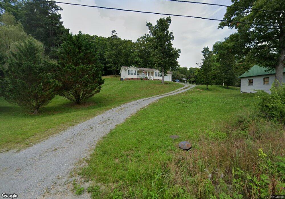
4974 Lone Mountain Rd New Tazewell, TN 37825
Estimated Value: $270,000 - $330,000
--
Bed
2
Baths
1,014
Sq Ft
$289/Sq Ft
Est. Value
About This Home
This home is located at 4974 Lone Mountain Rd, New Tazewell, TN 37825 and is currently estimated at $292,685, approximately $288 per square foot. 4974 Lone Mountain Rd is a home located in Claiborne County.
Ownership History
Date
Name
Owned For
Owner Type
Purchase Details
Closed on
Oct 1, 2009
Sold by
Singleton Harold
Bought by
Singleton Harold
Current Estimated Value
Purchase Details
Closed on
Feb 28, 2006
Sold by
Patterson Jennifer Rosenba
Bought by
Singleton Harold
Purchase Details
Closed on
Dec 22, 2005
Sold by
Patterson Joel W
Bought by
Singleton Harold
Purchase Details
Closed on
Nov 3, 2004
Sold by
Rosenbalm Kari B
Bought by
Patterson Joel W
Purchase Details
Closed on
Oct 29, 2004
Sold by
Patterson Joel W
Bought by
Keck Kari B
Purchase Details
Closed on
Jun 13, 1997
Sold by
Rosenbalm Theodore L and Rosenbalm E
Bought by
Rosenbalm Theodore
Purchase Details
Closed on
Sep 11, 1989
Purchase Details
Closed on
Jan 2, 1983
Bought by
Rosenbalm Theodore L and Jennifer Ros E
Purchase Details
Closed on
Jan 1, 1983
Purchase Details
Closed on
Jan 3, 1948
Create a Home Valuation Report for This Property
The Home Valuation Report is an in-depth analysis detailing your home's value as well as a comparison with similar homes in the area
Home Values in the Area
Average Home Value in this Area
Purchase History
| Date | Buyer | Sale Price | Title Company |
|---|---|---|---|
| Singleton Harold | -- | -- | |
| Singleton Harold | $21,000 | -- | |
| Singleton Harold | $21,000 | -- | |
| Patterson Joel W | $8,000 | -- | |
| Keck Kari B | $8,000 | -- | |
| Rosenbalm Theodore | -- | -- | |
| -- | $3,500 | -- | |
| Rosenbalm Theodore L | -- | -- | |
| -- | -- | -- | |
| -- | -- | -- |
Source: Public Records
Tax History Compared to Growth
Tax History
| Year | Tax Paid | Tax Assessment Tax Assessment Total Assessment is a certain percentage of the fair market value that is determined by local assessors to be the total taxable value of land and additions on the property. | Land | Improvement |
|---|---|---|---|---|
| 2024 | $811 | $34,650 | $5,200 | $29,450 |
| 2023 | $811 | $34,650 | $5,200 | $29,450 |
| 2022 | $693 | $34,650 | $5,200 | $29,450 |
| 2021 | $687 | $26,650 | $4,400 | $22,250 |
| 2020 | $687 | $26,650 | $4,400 | $22,250 |
| 2019 | $687 | $26,650 | $4,400 | $22,250 |
| 2018 | $687 | $26,650 | $4,400 | $22,250 |
| 2017 | $687 | $26,650 | $4,400 | $22,250 |
| 2016 | $695 | $26,925 | $4,375 | $22,550 |
| 2015 | $668 | $26,925 | $4,375 | $22,550 |
| 2014 | $668 | $26,909 | $0 | $0 |
Source: Public Records
Map
Nearby Homes
- 739 Loop Hollow Rd
- 0 Summer Breeze Ln
- 555 Lake Ln
- 0 Lake Ln
- 0 Tortoiseshell Cir Unit 1301255
- 421 Mystic Star Dr
- Lot 432 Beryl Ct
- 0 Beryl Ct Unit 1305175
- 0 Graphite Ct Unit RTC2936510
- 0 Graphite Ct Unit 1298967
- 390 Graphite Ct
- Lot 440 Feldspar Rd
- LOT 421 Mystic Star Dr
- 0 Mystic Star Dr Unit 1303005
- 0 Mystic Star Dr Unit 1280830
- Lot 491 Citron Ln
- 164 Feldspar Rd
- 517 Mystic Star Dr
- Lot 410 Mystic Star Dr
- 518 Mystic Star Dr
- 4948 Lone Mountain Rd
- 4956 Lone Mountain Rd
- 5000 Lone Mountain Rd
- 5026 Lone Mountain Rd
- 456 Straight Creek Church Rd
- 470 Straight Creek Church Rd
- 482 Straight Creek Church Rd
- 5039 Lone Mountain Rd
- 141 Hurd Cadle Ln
- 4907 Lone Mountain Rd
- 4896 Lone Mountain Rd
- 400 Straight Creek Church Rd
- 171 Hurd Cadle Ln
- 372 Straight Creek Rd
- 550 Straight Creek Church Rd
- 4861 Lone Mountain Rd
- 5091 Lone Mountain Rd
- 108 Jamie St
- 0 Hurd Cadle
- 217 Neely Dr