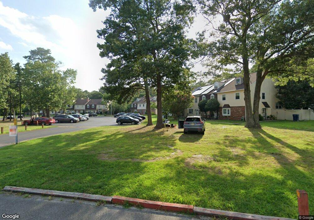
4976 Flintshire Ct Mays Landing, NJ 08330
Estimated Value: $244,559 - $274,000
--
Bed
--
Bath
1,828
Sq Ft
$143/Sq Ft
Est. Value
About This Home
This home is located at 4976 Flintshire Ct, Mays Landing, NJ 08330 and is currently estimated at $261,640, approximately $143 per square foot. 4976 Flintshire Ct is a home located in Atlantic County with nearby schools including George L. Hess Educational Complex, Joseph Shaner School, and William Davies Middle School.
Ownership History
Date
Name
Owned For
Owner Type
Purchase Details
Closed on
Sep 4, 2019
Sold by
Guy Jensyl Durham
Bought by
Terrell Dupree Sherrie
Current Estimated Value
Purchase Details
Closed on
Apr 3, 2019
Sold by
Wells Fargo Bank Na
Bought by
Durham Guy Jensyl
Purchase Details
Closed on
Feb 20, 2019
Sold by
Clements Rose A and State Of New Jersey
Bought by
Wells Fargo Bank Na
Purchase Details
Closed on
Nov 26, 1997
Sold by
Bendl Daniel A
Bought by
Clements Rose A
Create a Home Valuation Report for This Property
The Home Valuation Report is an in-depth analysis detailing your home's value as well as a comparison with similar homes in the area
Home Values in the Area
Average Home Value in this Area
Purchase History
| Date | Buyer | Sale Price | Title Company |
|---|---|---|---|
| Terrell Dupree Sherrie | $126,000 | Agents Title Llc | |
| Durham Guy Jensyl | $84,000 | Servicelink Llc | |
| Wells Fargo Bank Na | $1,000 | None Available | |
| Clements Rose A | $78,000 | -- |
Source: Public Records
Tax History Compared to Growth
Tax History
| Year | Tax Paid | Tax Assessment Tax Assessment Total Assessment is a certain percentage of the fair market value that is determined by local assessors to be the total taxable value of land and additions on the property. | Land | Improvement |
|---|---|---|---|---|
| 2025 | $3,122 | $107,300 | $35,000 | $72,300 |
| 2024 | $3,122 | $91,000 | $35,000 | $56,000 |
| 2023 | $2,936 | $91,000 | $35,000 | $56,000 |
| 2022 | $2,936 | $91,000 | $35,000 | $56,000 |
| 2021 | $2,607 | $81,000 | $25,000 | $56,000 |
| 2020 | $2,607 | $81,000 | $25,000 | $56,000 |
| 2019 | $2,291 | $71,000 | $15,000 | $56,000 |
| 2018 | $2,211 | $71,000 | $15,000 | $56,000 |
| 2017 | $2,038 | $66,500 | $10,500 | $56,000 |
| 2016 | $1,862 | $62,500 | $6,500 | $56,000 |
| 2015 | $1,799 | $62,500 | $6,500 | $56,000 |
| 2014 | $1,936 | $73,700 | $7,500 | $66,200 |
Source: Public Records
Map
Nearby Homes
- 4944 Flintshire Ct
- 5022 Laydon Ct
- 4930 Denbigh Ct
- 4922 Denbigh Ct
- 14 Strathmere Rd
- 0 E Black Horse Unit 22520085
- 3 Woodmere Ave
- 1553 Madison Ct Unit 153
- 1544 Benjamin Franklin Ct
- 1544 Ben Franklin Ct
- 1531 Hamilton Ct Unit 231
- 1531 Hamilton Ct
- 1535 Benjamin Franklin Ct
- 1574 John Adams Ct Unit 1574
- 1553 John Adams Ct Unit 653
- 4830 Green Ash Ln Unit 287
- 4772 Summersweet Dr
- 4915 Winterbury Dr Unit B14
- 4945 Rosebay Place Unit B17
- 4944 Rosebay Place
- 4974 Flintshire Ct
- 4972 Flintshire Ct
- 4978 Flintshire Ct
- 4980 Flintshire Ct
- 4982 Flintshire Ct
- 4970 Flintshire Ct
- 4986 Flintshire Ct
- 4988 Flintshire Ct
- 4966 Flintshire Ct
- 4990 Flintshire Ct
- 4964 Flintshire Ct
- 4962 Flintshire Ct
- 4960 Flintshire Ct
- 4958 Flintshire Ct
- 4956 Flintshire Ct
- 4998 Laydon Ct
- 4996 Laydon Ct
- 5000 Laydon Ct
- 4994 Laydon Ct
- 5002 Laydon Ct