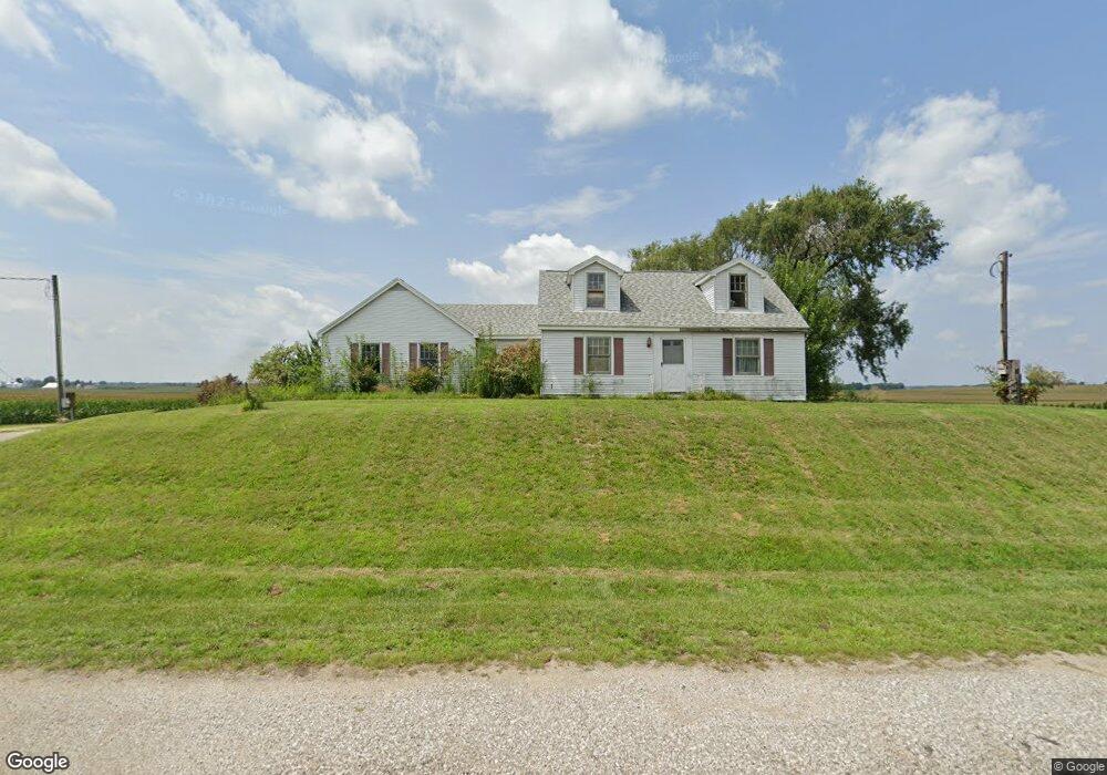
4985 Industrial Rd Mount Vernon, IN 47620
Estimated Value: $194,000 - $230,000
3
Beds
1
Bath
1,952
Sq Ft
$108/Sq Ft
Est. Value
About This Home
This home is located at 4985 Industrial Rd, Mount Vernon, IN 47620 and is currently estimated at $211,169, approximately $108 per square foot. 4985 Industrial Rd is a home located in Posey County with nearby schools including Mount Vernon Junior High School, Mount Vernon High School, and St. Matthew Elementary School.
Ownership History
Date
Name
Owned For
Owner Type
Purchase Details
Closed on
Sep 12, 2005
Sold by
Posey County Land Development Inc
Bought by
Johnson Theodore L
Current Estimated Value
Home Financials for this Owner
Home Financials are based on the most recent Mortgage that was taken out on this home.
Original Mortgage
$127,000
Outstanding Balance
$81,418
Interest Rate
9.2%
Mortgage Type
Adjustable Rate Mortgage/ARM
Estimated Equity
$129,751
Create a Home Valuation Report for This Property
The Home Valuation Report is an in-depth analysis detailing your home's value as well as a comparison with similar homes in the area
Home Values in the Area
Average Home Value in this Area
Purchase History
| Date | Buyer | Sale Price | Title Company |
|---|---|---|---|
| Johnson Theodore L | -- | None Available |
Source: Public Records
Mortgage History
| Date | Status | Borrower | Loan Amount |
|---|---|---|---|
| Open | Johnson Theodore L | $127,000 |
Source: Public Records
Tax History Compared to Growth
Tax History
| Year | Tax Paid | Tax Assessment Tax Assessment Total Assessment is a certain percentage of the fair market value that is determined by local assessors to be the total taxable value of land and additions on the property. | Land | Improvement |
|---|---|---|---|---|
| 2024 | $879 | $129,400 | $32,900 | $96,500 |
| 2023 | $726 | $114,700 | $29,500 | $85,200 |
| 2022 | $664 | $105,500 | $27,100 | $78,400 |
| 2021 | $518 | $92,800 | $16,600 | $76,200 |
| 2020 | $501 | $90,300 | $16,300 | $74,000 |
| 2019 | $478 | $88,600 | $16,600 | $72,000 |
| 2018 | $465 | $88,400 | $18,300 | $70,100 |
| 2017 | $479 | $91,800 | $18,600 | $73,200 |
| 2016 | $457 | $91,800 | $18,700 | $73,100 |
| 2014 | $444 | $92,100 | $18,800 | $73,300 |
| 2013 | $444 | $93,200 | $18,000 | $75,200 |
Source: Public Records
Map
Nearby Homes
- 316 Sunset Dr
- 5620 Red Lake Dr
- 405 Washington Ave
- 317 Kennedy Dr
- 310 Kennedy Dr
- 348 Audubon Dr
- 342 Emmick St
- 1316 Elk St
- 821 E Lincoln Ave
- 1606 Robin Ln
- 1310 Mockingbird Ln
- 331 E Grant St
- 1207 Main St
- 10800 Hwy 69 & Along Ohio River Rd
- 311 W Grant St
- 305 Brown St
- 917 Mill St
- 400 W 9th St
- 626 Mulberry St
- 601 N Canal St
- 4984 Industrial Rd
- 5246 Industrial Rd
- 5260 Industrial Rd
- 5495 Industrial Rd
- 4480 Highway 69 S
- 900 Bellfontaine Cemetery Rd
- 2120 Bellfontaine Cemetery Rd
- 5345 Tile Factory Rd
- 5300 Cumberland Ct
- 5300 Cumberland Ct Unit 9
- 2121 Bellfontaine Cemetery Rd
- 5401 Tile Factory Rd
- 5320 Cumberland Ct
- 5425 Tile Factory Rd
- 5325 Cumberland Ct
- 5455 Tile Factory Rd
- 5401 Red Lake Dr-Lakeland Ridge I Lt 4 Dr
- 5501 Tile Factory Rd
- 2300 Lakeland Dr
- 5330 Cumberland Ct