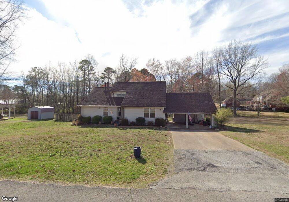
499 Ezra St N Parsons, TN 38363
Estimated Value: $169,000 - $289,221
--
Bed
2
Baths
1,246
Sq Ft
$174/Sq Ft
Est. Value
About This Home
This home is located at 499 Ezra St N, Parsons, TN 38363 and is currently estimated at $217,055, approximately $174 per square foot. 499 Ezra St N is a home located in Decatur County with nearby schools including Parsons Elementary School, Decaturville Elementary School, and Decatur County Middle School.
Ownership History
Date
Name
Owned For
Owner Type
Purchase Details
Closed on
Dec 8, 1995
Bought by
Crawley James F
Current Estimated Value
Purchase Details
Closed on
Oct 1, 1993
Bought by
Mckenzie Vicki
Purchase Details
Closed on
Jun 15, 1989
Purchase Details
Closed on
Sep 3, 1986
Purchase Details
Closed on
Dec 20, 1985
Bought by
White Johnny Neil
Purchase Details
Closed on
Jan 1, 1984
Purchase Details
Closed on
Oct 16, 1978
Purchase Details
Closed on
Feb 18, 1978
Create a Home Valuation Report for This Property
The Home Valuation Report is an in-depth analysis detailing your home's value as well as a comparison with similar homes in the area
Home Values in the Area
Average Home Value in this Area
Purchase History
| Date | Buyer | Sale Price | Title Company |
|---|---|---|---|
| Crawley James F | $72,500 | -- | |
| Mckenzie Vicki | $70,000 | -- | |
| -- | -- | -- | |
| -- | $3,700 | -- | |
| White Johnny Neil | -- | -- | |
| -- | $65,000 | -- | |
| -- | -- | -- | |
| -- | -- | -- |
Source: Public Records
Tax History Compared to Growth
Tax History
| Year | Tax Paid | Tax Assessment Tax Assessment Total Assessment is a certain percentage of the fair market value that is determined by local assessors to be the total taxable value of land and additions on the property. | Land | Improvement |
|---|---|---|---|---|
| 2025 | -- | $48,775 | $0 | $0 |
| 2024 | -- | $26,200 | $2,400 | $23,800 |
| 2023 | $859 | $26,200 | $2,400 | $23,800 |
| 2022 | $899 | $26,200 | $2,400 | $23,800 |
| 2021 | $899 | $26,200 | $2,400 | $23,800 |
| 2020 | $899 | $26,200 | $2,400 | $23,800 |
| 2019 | $791 | $25,100 | $2,400 | $22,700 |
| 2018 | $725 | $25,100 | $2,400 | $22,700 |
| 2017 | $737 | $25,100 | $2,400 | $22,700 |
| 2016 | $742 | $25,100 | $2,400 | $22,700 |
| 2015 | $743 | $25,100 | $2,400 | $22,700 |
| 2014 | $743 | $25,104 | $0 | $0 |
Source: Public Records
Map
Nearby Homes
- 473 Ezra St N
- 502 Ezra St N
- 107 Dogwood Dr
- 474 Ezra St N
- 453 Ezra St N
- 454 Ezra St N
- 31 Dogwood Dr
- 353 Bible Hill Rd
- 52 Magnolia Dr
- 438 Ezra St N
- 437 Ezra St N
- 337 Bible Hill Rd
- 331 Jennings Ave
- 104 Long St
- 143 Dogwood Dr
- 325 Jennings Ave
- 313 Bible Hill Rd
- 60 Dogwood Dr
- 358 Bible Hill Rd
- 18 Dogwood Dr