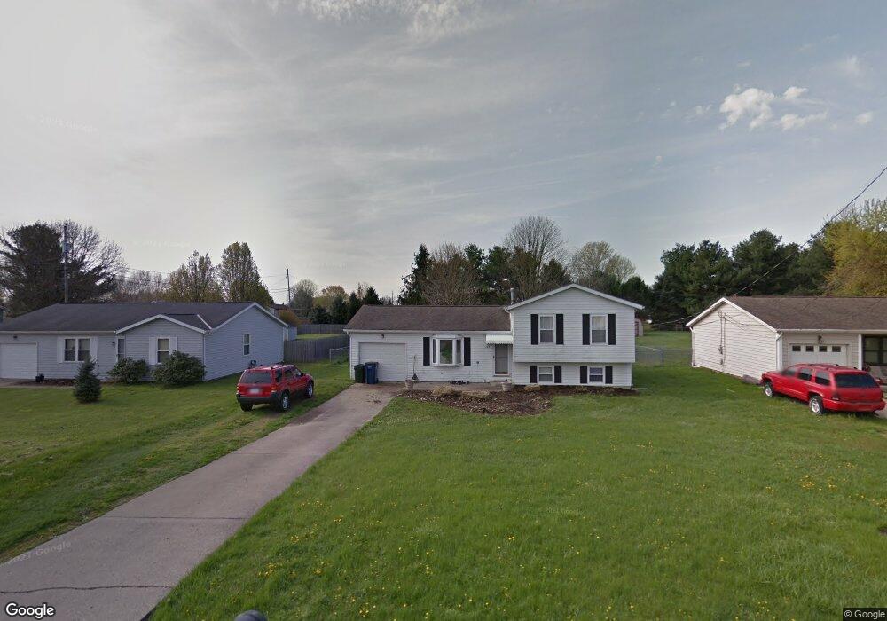
499 Price Rd Newark, OH 43055
Estimated Value: $228,000 - $246,000
3
Beds
1
Bath
1,230
Sq Ft
$194/Sq Ft
Est. Value
About This Home
This home is located at 499 Price Rd, Newark, OH 43055 and is currently estimated at $239,127, approximately $194 per square foot. 499 Price Rd is a home located in Licking County with nearby schools including Legend Elementary School, Liberty Middle School, and Newark High School.
Ownership History
Date
Name
Owned For
Owner Type
Purchase Details
Closed on
Dec 18, 2020
Sold by
Plott Roger A and Plott Sherry L
Bought by
Plott Sherry L and Mills Judith A
Current Estimated Value
Purchase Details
Closed on
Jul 7, 1999
Sold by
Hankins Patricia E
Bought by
Plott Roger A Sherry L
Home Financials for this Owner
Home Financials are based on the most recent Mortgage that was taken out on this home.
Original Mortgage
$94,070
Outstanding Balance
$25,767
Interest Rate
7.28%
Mortgage Type
FHA
Estimated Equity
$213,360
Create a Home Valuation Report for This Property
The Home Valuation Report is an in-depth analysis detailing your home's value as well as a comparison with similar homes in the area
Home Values in the Area
Average Home Value in this Area
Purchase History
| Date | Buyer | Sale Price | Title Company |
|---|---|---|---|
| Plott Sherry L | -- | None Available | |
| Plott Roger A Sherry L | $94,900 | -- |
Source: Public Records
Mortgage History
| Date | Status | Borrower | Loan Amount |
|---|---|---|---|
| Open | Plott Roger A Sherry L | $94,070 |
Source: Public Records
Tax History Compared to Growth
Tax History
| Year | Tax Paid | Tax Assessment Tax Assessment Total Assessment is a certain percentage of the fair market value that is determined by local assessors to be the total taxable value of land and additions on the property. | Land | Improvement |
|---|---|---|---|---|
| 2024 | $2,143 | $59,920 | $22,050 | $37,870 |
| 2023 | $2,139 | $59,920 | $22,050 | $37,870 |
| 2022 | $1,651 | $41,130 | $11,480 | $29,650 |
| 2021 | $1,731 | $41,130 | $11,480 | $29,650 |
| 2020 | $1,770 | $41,130 | $11,480 | $29,650 |
| 2019 | $1,499 | $33,530 | $8,820 | $24,710 |
| 2018 | $1,500 | $0 | $0 | $0 |
| 2017 | $1,577 | $0 | $0 | $0 |
| 2016 | $1,681 | $0 | $0 | $0 |
| 2015 | $1,718 | $0 | $0 | $0 |
| 2014 | $2,200 | $0 | $0 | $0 |
| 2013 | $1,718 | $0 | $0 | $0 |
Source: Public Records
Map
Nearby Homes
- 1831 Churchill Downs Rd
- 437 Hunters Ct
- 681 Woods Edge Ln
- 1684 Churchill Downs Rd
- 1345 Sherwood Downs Rd W
- 1631 W Turkey Run Dr
- 1649 W Turkey Run Dr
- 714 Olde Creek Dr
- 1670 Naughtingham Rd
- 734 Whitetail Loop
- 763 Whitetail Loop
- 750 Whitetail Loop
- 267 N Vernon Ave
- 336 Myrtle Ave
- 752 Whitetail Loop
- 139 Aqueduct Ave
- 1738 Scioto Way
- 1518 Constitution Ct
- 105 Pimlico Ave
- 106 Santa Anita Ave Unit 21A
- 491 Price Rd
- 505 Price Rd
- 513 Price Rd
- 1851 Churchill Downs Rd
- 1845 Churchill Downs Rd
- 1861 Churchill Downs Rd
- 521 Price Rd
- 1488 S Wild Turkey Dr
- 1837 Churchill Downs Rd
- 1484 S Wild Turkey Dr
- 527 Price Rd
- 500 Essex Downs Rd
- 490 Essex Downs Rd
- 506 Essex Downs Rd
- 1480 S Wild Turkey Dr
- 1492 S Wild Turkey Dr
- 514 Essex Downs Rd
- 1823 Churchill Downs Rd
- 535 Price Rd
- 522 Essex Downs Rd