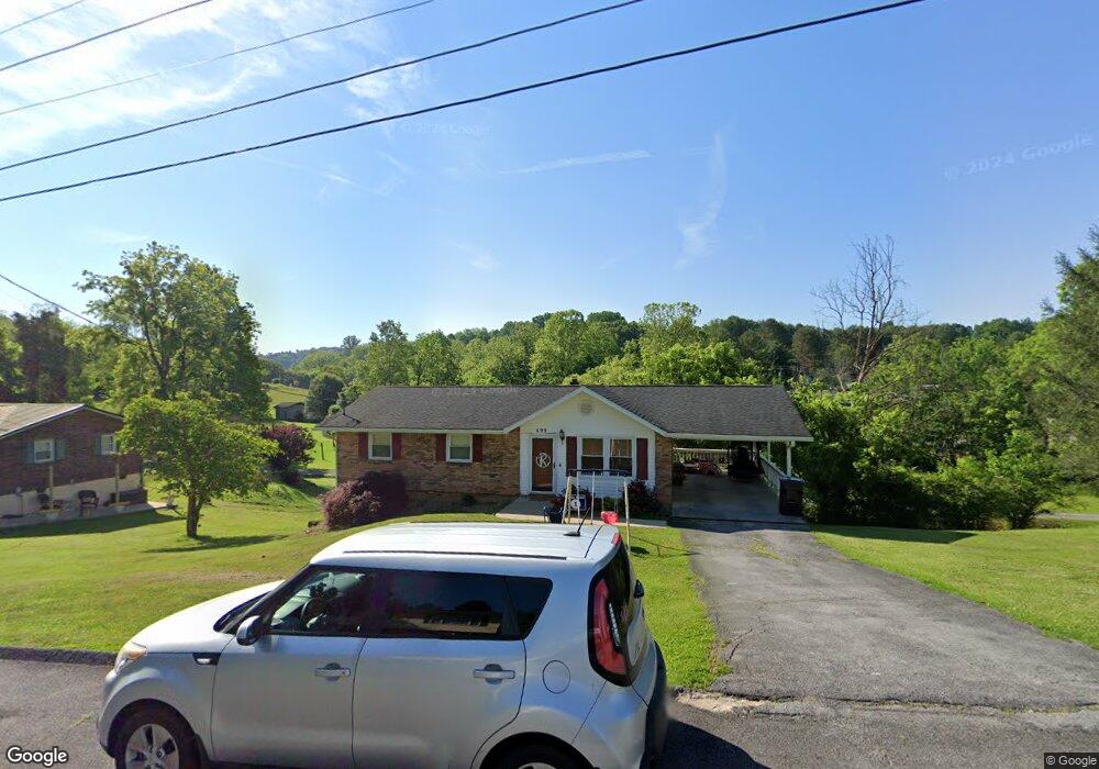
499 Springfield Dr Bristol, TN 37620
Estimated Value: $245,000 - $304,000
4
Beds
3
Baths
2,025
Sq Ft
$133/Sq Ft
Est. Value
About This Home
This home is located at 499 Springfield Dr, Bristol, TN 37620 and is currently estimated at $269,614, approximately $133 per square foot. 499 Springfield Dr is a home located in Sullivan County with nearby schools including Bluff City Elementary School, Sullivan East Middle School, and Sullivan East High School.
Ownership History
Date
Name
Owned For
Owner Type
Purchase Details
Closed on
Dec 13, 2016
Sold by
Lane Gary
Bought by
Roberts Billy James and Roberts Amy Jocelyn
Current Estimated Value
Home Financials for this Owner
Home Financials are based on the most recent Mortgage that was taken out on this home.
Original Mortgage
$132,063
Outstanding Balance
$107,389
Interest Rate
3.75%
Mortgage Type
FHA
Estimated Equity
$162,225
Purchase Details
Closed on
Aug 14, 2015
Sold by
Harvey Regina C
Bought by
Lane Gary
Purchase Details
Closed on
Mar 31, 2006
Sold by
Dotson Danny M
Bought by
Harvey Regina C
Home Financials for this Owner
Home Financials are based on the most recent Mortgage that was taken out on this home.
Original Mortgage
$82,400
Interest Rate
6.2%
Create a Home Valuation Report for This Property
The Home Valuation Report is an in-depth analysis detailing your home's value as well as a comparison with similar homes in the area
Home Values in the Area
Average Home Value in this Area
Purchase History
| Date | Buyer | Sale Price | Title Company |
|---|---|---|---|
| Roberts Billy James | $134,900 | -- | |
| Lane Gary | -- | -- | |
| Harvey Regina C | $103,000 | -- |
Source: Public Records
Mortgage History
| Date | Status | Borrower | Loan Amount |
|---|---|---|---|
| Open | Roberts Billy James | $132,063 | |
| Previous Owner | Harvey Regina C | $82,400 | |
| Previous Owner | Harvey Regina C | $20,600 |
Source: Public Records
Tax History Compared to Growth
Tax History
| Year | Tax Paid | Tax Assessment Tax Assessment Total Assessment is a certain percentage of the fair market value that is determined by local assessors to be the total taxable value of land and additions on the property. | Land | Improvement |
|---|---|---|---|---|
| 2024 | $701 | $28,075 | $3,475 | $24,600 |
| 2023 | $676 | $28,075 | $3,475 | $24,600 |
| 2022 | $676 | $28,075 | $3,475 | $24,600 |
| 2021 | $676 | $28,075 | $3,475 | $24,600 |
| 2020 | $646 | $28,075 | $3,475 | $24,600 |
| 2019 | $646 | $25,150 | $3,475 | $21,675 |
| 2018 | $641 | $25,150 | $3,475 | $21,675 |
| 2017 | $641 | $25,150 | $3,475 | $21,675 |
| 2016 | $648 | $25,150 | $3,475 | $21,675 |
| 2014 | $580 | $25,138 | $0 | $0 |
Source: Public Records
Map
Nearby Homes
- Tbd Hill Dr
- 2158 Vance Tank Rd
- 1237 White Top Rd
- 496 Pleasant Grove Rd
- 3493 Weaver Pike
- TBD Sweet Knobs Trail
- 143 Lazy Acres
- 159 Peoples Rd
- 1026 Deer Harbour Rd
- 292 Peters Rd
- 4045 Weaver Pike
- 1476 Silver Grove Rd
- 1056 White Top Rd
- 403 Martindale Rd
- 302 Martindale Rd
- 216 Old Weaver Pike
- 100 Martindale Rd
- 101 Timberlane Rd
- 316 Timberlane Rd
- 305 Sunnybrook Dr
- 493 Springfield Dr
- 505 Springfield Dr
- 496 Springfield Dr
- 512 Springfield Dr
- 483 Springfield Dr
- 509 Springfield Dr
- 488 Springfield Dr
- 519 Springfield Dr
- 480 Springfield Dr
- 475 Springfield Dr
- 315 Broyles Ln
- 310 Mayfield Dr
- 338 Broyles Ln
- 318 Mayfield Dr
- 302 Mayfield Dr
- 320 Broyles Ln
- 525 Springfield Dr
- 472 Springfield Dr
- 326 Mayfield Dr
- 465 Springfield Dr