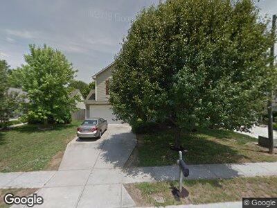
4991 Wheat Dr SW Concord, NC 28027
Estimated Value: $344,000 - $358,000
4
Beds
3
Baths
1,712
Sq Ft
$205/Sq Ft
Est. Value
About This Home
This home is located at 4991 Wheat Dr SW, Concord, NC 28027 and is currently estimated at $351,002, approximately $205 per square foot. 4991 Wheat Dr SW is a home located in Cabarrus County with nearby schools including Pitts School Road Elementary School, Jay M. Robinson High School, and Branch Christian Academy Concord.
Ownership History
Date
Name
Owned For
Owner Type
Purchase Details
Closed on
Oct 4, 2018
Sold by
Progress Residential Borrower 5 Llc
Bought by
Progress Residential Borrower 5 Llc
Current Estimated Value
Purchase Details
Closed on
Dec 15, 2015
Sold by
Walker William F
Bought by
Freo North Carolina Llc
Create a Home Valuation Report for This Property
The Home Valuation Report is an in-depth analysis detailing your home's value as well as a comparison with similar homes in the area
Home Values in the Area
Average Home Value in this Area
Purchase History
| Date | Buyer | Sale Price | Title Company |
|---|---|---|---|
| Progress Residential Borrower 5 Llc | -- | Os National Llc | |
| Freo North Carolina Llc | $135,000 | None Available |
Source: Public Records
Mortgage History
| Date | Status | Borrower | Loan Amount |
|---|---|---|---|
| Previous Owner | Walker William F | $112,000 | |
| Previous Owner | Walker William F | $21,000 |
Source: Public Records
Tax History Compared to Growth
Tax History
| Year | Tax Paid | Tax Assessment Tax Assessment Total Assessment is a certain percentage of the fair market value that is determined by local assessors to be the total taxable value of land and additions on the property. | Land | Improvement |
|---|---|---|---|---|
| 2024 | $3,253 | $326,580 | $60,000 | $266,580 |
| 2023 | $2,233 | $183,030 | $45,000 | $138,030 |
| 2022 | $2,233 | $183,030 | $45,000 | $138,030 |
| 2021 | $2,233 | $183,030 | $45,000 | $138,030 |
| 2020 | $2,233 | $183,030 | $45,000 | $138,030 |
| 2019 | $1,748 | $143,280 | $24,000 | $119,280 |
| 2018 | $1,719 | $143,280 | $24,000 | $119,280 |
| 2017 | $1,691 | $143,280 | $24,000 | $119,280 |
| 2016 | $1,003 | $126,300 | $21,000 | $105,300 |
| 2015 | $1,476 | $126,300 | $21,000 | $105,300 |
| 2014 | $1,476 | $126,300 | $21,000 | $105,300 |
Source: Public Records
Map
Nearby Homes
- 5355 Hackberry Ln SW
- 5012 Wheat Dr SW
- 5307 Hackberry Ln SW
- 4271 Millet St SW
- 5136 Wheat Dr SW
- 849 Treva Anne Dr SW
- 786 Treva Anne Dr SW
- 4532 Lanstone Ct SW
- 4630 Roberta Rd
- 4562 Lanstone Ct SW
- 3619 Grove Creek Pond Dr SW
- 3645 Brookville Ave SW
- 5670 Hammermill Dr
- 5513 Hammermill Dr
- 5375 Josephine Ln SW
- 5312 Allburn Pkwy
- 3898 Longwood Dr SW
- 5386 Josephine Ln SW
- 4145 Wrangler Dr SW
- 4349 Roberta Rd
- 4991 Wheat Dr SW
- 4995 Wheat Dr SW
- 4987 Wheat Dr SW
- 1113 Meadowbrook Ln SW
- 4983 Wheat Dr SW
- 1117 Meadowbrook Ln SW
- 1109 Meadowbrook Ln SW
- 5005 Wheat Dr SW
- 4992 Wheat Dr SW
- 4996 Wheat Dr SW
- 4979 Wheat Dr SW
- 4988 Wheat Dr SW
- 4338 Fescue Place SW
- 1105 Meadowbrook Ln SW
- 1120 Meadowbrook Ln SW
- 4984 Wheat Dr SW
- 5004 Wheat Dr SW
- 4975 Wheat Dr SW
- 4342 Fescue Place SW
- 1101 Meadowbrook Ln SW