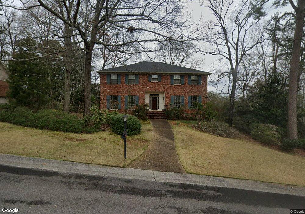
4992 Spring Rock Rd Mountain Brook, AL 35223
Estimated Value: $890,151 - $1,025,000
4
Beds
6
Baths
4,251
Sq Ft
$223/Sq Ft
Est. Value
About This Home
This home is located at 4992 Spring Rock Rd, Mountain Brook, AL 35223 and is currently estimated at $946,788, approximately $222 per square foot. 4992 Spring Rock Rd is a home located in Jefferson County with nearby schools including Cherokee Bend Elementary School, Mt. Brook Junior High School, and Mt. Brook High School.
Ownership History
Date
Name
Owned For
Owner Type
Purchase Details
Closed on
Nov 30, 2010
Sold by
Hobgood James F and Hobgood Rachael M
Bought by
Hobgood James F and Hobgood Rachael M
Current Estimated Value
Purchase Details
Closed on
Jul 21, 2010
Sold by
Huesken Richard and Huesken Mary Ellen
Bought by
Hobgood James F
Purchase Details
Closed on
Oct 15, 2001
Sold by
Samford Carolyn J
Bought by
Huesken Richard and Huesken Mary Ellen
Home Financials for this Owner
Home Financials are based on the most recent Mortgage that was taken out on this home.
Original Mortgage
$366,400
Interest Rate
6.57%
Purchase Details
Closed on
Feb 24, 2000
Sold by
Samford Westcott B and Samford Carolyn J
Bought by
Samford Carolyn J
Create a Home Valuation Report for This Property
The Home Valuation Report is an in-depth analysis detailing your home's value as well as a comparison with similar homes in the area
Home Values in the Area
Average Home Value in this Area
Purchase History
| Date | Buyer | Sale Price | Title Company |
|---|---|---|---|
| Hobgood James F | $500 | None Available | |
| Hobgood James F | $475,000 | None Available | |
| Huesken Richard | $458,000 | -- | |
| Samford Carolyn J | -- | -- |
Source: Public Records
Mortgage History
| Date | Status | Borrower | Loan Amount |
|---|---|---|---|
| Previous Owner | Huesken Richard | $366,400 |
Source: Public Records
Tax History
| Year | Tax Paid | Tax Assessment Tax Assessment Total Assessment is a certain percentage of the fair market value that is determined by local assessors to be the total taxable value of land and additions on the property. | Land | Improvement |
|---|---|---|---|---|
| 2024 | $8,421 | $77,740 | -- | -- |
| 2022 | $8,148 | $75,230 | $19,500 | $55,730 |
| 2021 | $6,498 | $60,100 | $19,500 | $40,600 |
| 2020 | $6,217 | $57,520 | $19,500 | $38,020 |
| 2019 | $5,533 | $56,420 | $0 | $0 |
| 2018 | $5,123 | $52,280 | $0 | $0 |
| 2017 | $4,836 | $49,380 | $0 | $0 |
| 2016 | $4,836 | $49,380 | $0 | $0 |
| 2015 | $4,836 | $49,380 | $0 | $0 |
| 2014 | $4,592 | $48,420 | $0 | $0 |
| 2013 | $4,592 | $48,420 | $0 | $0 |
Source: Public Records
Map
Nearby Homes
- 3833 Moss Creek Cir
- 4251 Cedar St
- 5092 Janet Ln
- 5119 Janet Ln
- 5096 Janet Ln
- 5123 Janet Ln
- 5100 Janet Ln
- 5127 Janet Ln
- 5400 Nottingham Ln
- 5104 Janet Ln
- 5108 Janet Ln
- 5116 Janet Ln
- 5131 Janet Ln
- 760 Nytol Cir
- 5126 Janet Ln
- 5130 Cornell Dr
- 5225 Cornell Dr
- 739 Hagbush Rd
- 3601 Bermuda Dr
- 5210 Paramont Dr
- 4988 Spring Rock Rd
- 4996 Spring Rock Rd
- 4983 Spring Rock Rd
- 4979 Spring Rock Rd
- 4984 Spring Rock Rd
- 4984 Spring Rock Rd
- 4916 Brandywood Dr
- 4975 Spring Rock Rd
- 4920 Branch Mill Cir
- 4916 Branch Mill Cir
- 4980 Spring Rock Rd
- 4971 Spring Rock Rd
- 4924 Branch Mill Cir
- 4929 Brandywood Dr
- 4912 Brandywood Dr
- 4976 Spring Rock Rd
- 4912 Branch Mill Cir
- 4967 Spring Rock Rd
- 4972 Spring Rock Rd
- 4908 Brandywood Dr
Your Personal Tour Guide
Ask me questions while you tour the home.