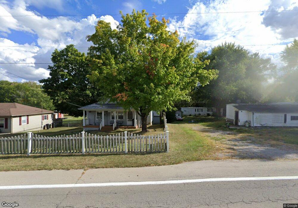
4997 State Route 350 Clarksville, OH 45113
Estimated Value: $222,000
2
Beds
1
Bath
780
Sq Ft
$285/Sq Ft
Est. Value
About This Home
This home is located at 4997 State Route 350, Clarksville, OH 45113 and is currently estimated at $222,000, approximately $284 per square foot. 4997 State Route 350 is a home located in Clinton County with nearby schools including Clinton-Massie Elementary School, Clinton-Massie Middle School, and Clinton-Massie High School.
Ownership History
Date
Name
Owned For
Owner Type
Purchase Details
Closed on
Jan 26, 2005
Sold by
Browning David A
Bought by
Browning David A and Browning Constance C
Current Estimated Value
Home Financials for this Owner
Home Financials are based on the most recent Mortgage that was taken out on this home.
Original Mortgage
$91,800
Outstanding Balance
$44,341
Interest Rate
5%
Mortgage Type
New Conventional
Estimated Equity
$177,659
Purchase Details
Closed on
Apr 5, 1994
Bought by
Browning David A
Create a Home Valuation Report for This Property
The Home Valuation Report is an in-depth analysis detailing your home's value as well as a comparison with similar homes in the area
Home Values in the Area
Average Home Value in this Area
Purchase History
| Date | Buyer | Sale Price | Title Company |
|---|---|---|---|
| Browning David A | -- | -- | |
| Browning David A | -- | -- |
Source: Public Records
Mortgage History
| Date | Status | Borrower | Loan Amount |
|---|---|---|---|
| Open | Browning David A | $91,800 |
Source: Public Records
Tax History Compared to Growth
Tax History
| Year | Tax Paid | Tax Assessment Tax Assessment Total Assessment is a certain percentage of the fair market value that is determined by local assessors to be the total taxable value of land and additions on the property. | Land | Improvement |
|---|---|---|---|---|
| 2024 | $270 | $7,810 | $5,110 | $2,700 |
| 2023 | $270 | $7,810 | $5,110 | $2,700 |
| 2022 | $1,030 | $28,090 | $4,590 | $23,500 |
| 2021 | $1,030 | $28,090 | $4,590 | $23,500 |
| 2020 | $1,012 | $28,090 | $4,590 | $23,500 |
| 2019 | $841 | $23,750 | $5,320 | $18,430 |
| 2018 | $850 | $23,750 | $5,320 | $18,430 |
| 2017 | $414 | $23,750 | $5,320 | $18,430 |
| 2016 | $574 | $16,420 | $6,060 | $10,360 |
| 2015 | $573 | $16,420 | $6,060 | $10,360 |
| 2013 | $592 | $16,280 | $6,060 | $10,220 |
Source: Public Records
Map
Nearby Homes
- 4347 Ohio 350
- 6182 Ohio 730
- 9132 St Rt 730
- 9132 State Route 730
- 0 Old State Rd Unit 1849352
- 9356 Ohio 350
- 450 Pansy Rd
- 279 Frances Dr
- 582 Nauvoo Rd
- 6182 State Route 730
- 216 Pansy Rd
- 104 Linton Ave
- 1623 Reeder Rd
- 1056 Halpin Rd
- 420 Kensington Dr
- 1896 Reeder Rd
- 1211 Pratt Rd
- 21 Kimlor Ln
- 2211 Reeder Rd
- 963 Pratt Rd
- 4989 State Route 350
- 5043 St Rt 350
- 5071 State Route 350
- 5071 W St Rt 350
- 4901 State Route 350
- 5048 State Route 350
- 5103 St Rt 350
- 5103 State Route 350
- 4980 State Route 350
- 4839 State Route 350
- 5131 State Route 350
- 5124 State Route 350
- 5187 St Rt 350
- 5187 State Route 350
- 4811 State Route 350
- 5252 State Route 350
- 4776 State Route 350
- 4743 State Route 350
- 5292 State Route 350
- 5118 State Route 350