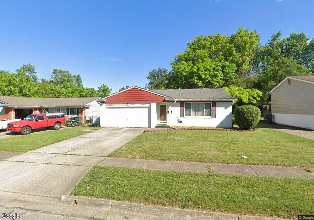
4999 Comstock Dr Columbus, OH 43232
Walnut Heights NeighborhoodEstimated Value: $217,000 - $261,000
3
Beds
2
Baths
1,338
Sq Ft
$176/Sq Ft
Est. Value
About This Home
This home is located at 4999 Comstock Dr, Columbus, OH 43232 and is currently estimated at $235,245, approximately $175 per square foot. 4999 Comstock Dr is a home located in Franklin County with nearby schools including Liberty Elementary School, Yorktown Middle School, and Independence High School.
Ownership History
Date
Name
Owned For
Owner Type
Purchase Details
Closed on
Dec 27, 2017
Sold by
Phillips Demruse J
Bought by
Phillips Williams L and Phillips Demruse J
Current Estimated Value
Home Financials for this Owner
Home Financials are based on the most recent Mortgage that was taken out on this home.
Original Mortgage
$72,000
Outstanding Balance
$59,451
Interest Rate
3.49%
Mortgage Type
Adjustable Rate Mortgage/ARM
Estimated Equity
$175,794
Purchase Details
Closed on
Jul 29, 2011
Sold by
The Estate Of Ruth H Hedges
Bought by
Phillips Demruse J
Home Financials for this Owner
Home Financials are based on the most recent Mortgage that was taken out on this home.
Original Mortgage
$68,127
Interest Rate
5.5%
Mortgage Type
FHA
Purchase Details
Closed on
May 13, 1998
Sold by
Hedges John B and Hedges Helen R
Bought by
Hedges John B and Hedges Ruth H
Create a Home Valuation Report for This Property
The Home Valuation Report is an in-depth analysis detailing your home's value as well as a comparison with similar homes in the area
Home Values in the Area
Average Home Value in this Area
Purchase History
| Date | Buyer | Sale Price | Title Company |
|---|---|---|---|
| Phillips Williams L | -- | None Available | |
| Phillips Demruse J | $69,900 | Attorney | |
| Hedges John B | -- | -- |
Source: Public Records
Mortgage History
| Date | Status | Borrower | Loan Amount |
|---|---|---|---|
| Open | Phillips Williams L | $72,000 | |
| Closed | Phillips Demruse J | $68,127 |
Source: Public Records
Tax History
| Year | Tax Paid | Tax Assessment Tax Assessment Total Assessment is a certain percentage of the fair market value that is determined by local assessors to be the total taxable value of land and additions on the property. | Land | Improvement |
|---|---|---|---|---|
| 2025 | $3,194 | $71,160 | $17,820 | $53,340 |
| 2024 | $3,194 | $71,160 | $17,820 | $53,340 |
| 2023 | $3,153 | $71,155 | $17,815 | $53,340 |
| 2022 | $2,167 | $41,790 | $6,300 | $35,490 |
| 2021 | $2,171 | $41,790 | $6,300 | $35,490 |
| 2020 | $2,174 | $41,790 | $6,300 | $35,490 |
| 2019 | $2,140 | $35,280 | $5,250 | $30,030 |
| 2018 | $1,886 | $35,280 | $5,250 | $30,030 |
| 2017 | $1,970 | $35,280 | $5,250 | $30,030 |
| 2016 | $1,802 | $27,200 | $4,340 | $22,860 |
| 2015 | $1,636 | $27,200 | $4,340 | $22,860 |
| 2014 | $1,640 | $27,200 | $4,340 | $22,860 |
| 2013 | $899 | $30,240 | $4,830 | $25,410 |
Source: Public Records
Map
Nearby Homes
- 5123 Jameson Dr
- 5114 Carbondale Dr
- 5144 Botsford Dr
- 0 Noe Bixby Rd
- 2336 Noe Bixby Rd
- 2348 Noe Bixby Rd
- 2342 Noe Bixby Rd
- 2360 Noe Bixby Rd
- 2354 Noe Bixby Rd
- 5137 Holbrook Dr
- 2651 Brownfield Rd
- 0 Colvin Rd
- 1945 Riverdale Rd
- 5207 Kornwal Dr
- 4942 Talbert Dr
- 2706 Moundcrest St
- 2932 Renfro Rd
- 2900 Gentry Ln
- 5290 Quincy Dr
- 2700 Raphael Dr
- 4991 Comstock Dr
- 5003 Comstock Dr
- 5014 Keelson Dr
- 4985 Comstock Dr
- 5020 Keelson Dr
- 5006 Keelson Dr
- 5009 Comstock Dr
- 5008 Keelson Dr
- 5000 Keelson Dr
- 5000 Keelson Dr
- 4996 Comstock Dr
- 5000 Comstock Dr
- 4977 Comstock Dr
- 4988 Comstock Dr
- 5010 Comstock Dr
- 4992 Keelson Dr
- 5019 Comstock Dr
- 5036 Keelson Dr
- 4969 Comstock Dr
Your Personal Tour Guide
Ask me questions while you tour the home.