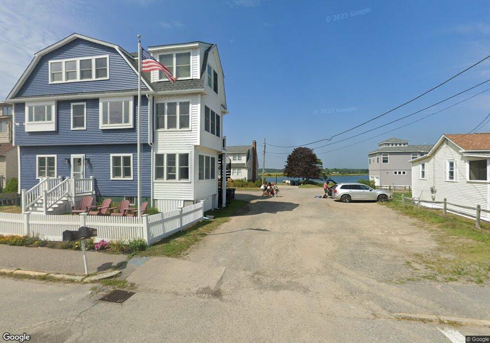
5 5th St W Unit 1 Salisbury, MA 01952
Estimated Value: $1,109,000 - $1,292,000
3
Beds
3
Baths
1,536
Sq Ft
$763/Sq Ft
Est. Value
About This Home
This home is located at 5 5th St W Unit 1, Salisbury, MA 01952 and is currently estimated at $1,171,849, approximately $762 per square foot. 5 5th St W Unit 1 is a home located in Essex County with nearby schools including Triton Regional High School.
Ownership History
Date
Name
Owned For
Owner Type
Purchase Details
Closed on
Sep 27, 2019
Sold by
Donahue Gloria M
Bought by
Davis John W and Davis Patricia M
Current Estimated Value
Home Financials for this Owner
Home Financials are based on the most recent Mortgage that was taken out on this home.
Original Mortgage
$484,000
Outstanding Balance
$424,008
Interest Rate
3.5%
Mortgage Type
New Conventional
Estimated Equity
$747,841
Purchase Details
Closed on
May 25, 2006
Sold by
Cyr John
Bought by
Donahue Andrew R
Home Financials for this Owner
Home Financials are based on the most recent Mortgage that was taken out on this home.
Original Mortgage
$150,000
Interest Rate
6.53%
Mortgage Type
Purchase Money Mortgage
Create a Home Valuation Report for This Property
The Home Valuation Report is an in-depth analysis detailing your home's value as well as a comparison with similar homes in the area
Home Values in the Area
Average Home Value in this Area
Purchase History
| Date | Buyer | Sale Price | Title Company |
|---|---|---|---|
| Davis John W | $733,000 | -- | |
| Donahue Andrew R | -- | -- | |
| Donahue Andrew R | $600,000 | -- |
Source: Public Records
Mortgage History
| Date | Status | Borrower | Loan Amount |
|---|---|---|---|
| Open | Davis John W | $484,000 | |
| Previous Owner | Donahue Andrew R | $130,000 | |
| Previous Owner | Donahue Andrew R | $140,000 | |
| Previous Owner | Donahue Andrew R | $150,000 |
Source: Public Records
Tax History Compared to Growth
Tax History
| Year | Tax Paid | Tax Assessment Tax Assessment Total Assessment is a certain percentage of the fair market value that is determined by local assessors to be the total taxable value of land and additions on the property. | Land | Improvement |
|---|---|---|---|---|
| 2025 | $10,577 | $1,049,300 | $566,000 | $483,300 |
| 2024 | $10,781 | $1,031,700 | $565,000 | $466,700 |
| 2023 | $9,293 | $860,500 | $439,400 | $421,100 |
| 2022 | $8,578 | $770,000 | $364,100 | $405,900 |
| 2021 | $8,291 | $736,300 | $364,100 | $372,200 |
| 2020 | $7,542 | $658,100 | $349,300 | $308,800 |
| 2019 | $7,297 | $615,300 | $337,200 | $278,100 |
| 2018 | $7,226 | $613,400 | $337,200 | $276,200 |
| 2017 | $6,480 | $543,600 | $289,000 | $254,600 |
| 2016 | $6,376 | $546,400 | $301,300 | $245,100 |
| 2015 | $5,792 | $492,900 | $271,100 | $221,800 |
Source: Public Records
Map
Nearby Homes
- 522 N End Blvd
- 595 N End Blvd Unit 2
- 498 N End Blvd
- 492 N End Blvd
- 479 N End Blvd
- 308 State Route 286 Unit Lot 73
- 308 State Route 286 Unit Lot 108
- 308 State Route 286 Unit Lot 87
- 432 N End Blvd
- 308 Route 286 Unit 77
- 308 Route 286 Unit Lot 58
- 312 S Main St
- 10 Liberty St
- 27 Cross Beach Rd
- 9 Tyngsboro St
- 376 Ocean Blvd
- 188 N End Blvd Unit 3
- 178 N End Blvd Unit A
- 178 N End Blvd Unit C
- 178 N End Blvd Unit F
- 5 5th St W
- 3 5th St W
- 4 5th St W
- 557 N End Blvd Unit B
- 557 N End Blvd Unit A
- 557 N End Blvd
- 557 North End Blvd
- 553 North End Blvd
- 559 North End Blvd
- 559 N End Blvd
- 2 5th St W
- 551 North End Blvd
- 561 N End Blvd
- 549 North End Blvd
- 561 North End Blvd
- 5 Blackwater Ln
- 563 North End Blvd
- 3 Blackwater Ln
- 556 North End Blvd
- 554 North End Blvd