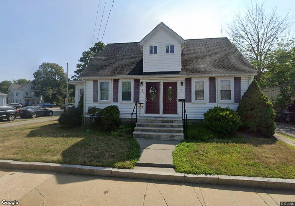
5-7 South St Holbrook, MA 02343
Estimated Value: $672,000 - $880,000
4
Beds
4
Baths
2,300
Sq Ft
$322/Sq Ft
Est. Value
About This Home
This home is located at 5-7 South St, Holbrook, MA 02343 and is currently estimated at $741,570, approximately $322 per square foot. 5-7 South St is a home located in Norfolk County with nearby schools including John F. Kennedy Elementary School, Holbrook Middle High School, and Boston Higashi School.
Ownership History
Date
Name
Owned For
Owner Type
Purchase Details
Closed on
Jan 19, 2019
Sold by
Mento Daniel F and Mento Kristen E
Bought by
Mento
Current Estimated Value
Purchase Details
Closed on
Jan 5, 2010
Sold by
Keelson Dev Llc
Bought by
Mento Daniel F and Smith Jason B
Home Financials for this Owner
Home Financials are based on the most recent Mortgage that was taken out on this home.
Original Mortgage
$230,677
Interest Rate
4.85%
Mortgage Type
Purchase Money Mortgage
Purchase Details
Closed on
Jul 9, 2008
Sold by
Deutsche Bank Natl T C
Bought by
Keelson Dev
Purchase Details
Closed on
Aug 22, 2007
Sold by
Deutsche Bank Natl T C and Jean
Bought by
Deutsche Bank Natl T C
Purchase Details
Closed on
Nov 23, 2005
Sold by
Mento Joseph M
Bought by
Jean Wilfrid
Purchase Details
Closed on
Dec 26, 2003
Sold by
Dawkins Barbara A Est and Salvant
Bought by
Mento Joseph M
Purchase Details
Closed on
Sep 15, 2003
Sold by
Pina Tanya R
Bought by
Salvant Michelle
Purchase Details
Closed on
Oct 19, 1998
Sold by
Carol L Coulter Inv T
Bought by
Dawkins Barbara A
Create a Home Valuation Report for This Property
The Home Valuation Report is an in-depth analysis detailing your home's value as well as a comparison with similar homes in the area
Home Values in the Area
Average Home Value in this Area
Purchase History
| Date | Buyer | Sale Price | Title Company |
|---|---|---|---|
| Mento | -- | -- | |
| Mento | -- | -- | |
| Mento | -- | -- | |
| Mento Daniel F | $210,000 | -- | |
| Mento Daniel F | $210,000 | -- | |
| Mento Daniel F | $210,000 | -- | |
| Mento Daniel F | $210,000 | -- | |
| Keelson Dev | $200,000 | -- | |
| Keelson Dev | $200,000 | -- | |
| Keelson Dev | $200,000 | -- | |
| Keelson Dev | $200,000 | -- | |
| Deutsche Bank Natl T C | $354,201 | -- | |
| Deutsche Bank Natl T C | $354,201 | -- | |
| Deutsche Bank Natl T C | $354,201 | -- | |
| Deutsche Bank Natl T C | $354,201 | -- | |
| Jean Wilfrid | $415,000 | -- | |
| Jean Wilfrid | $415,000 | -- | |
| Jean Wilfrid | $415,000 | -- | |
| Jean Wilfrid | $415,000 | -- | |
| Mento Joseph M | $330,000 | -- | |
| Mento Joseph M | $330,000 | -- | |
| Salvant Michelle | $35,000 | -- | |
| Salvant Michelle | $35,000 | -- | |
| Dawkins Barbara A | $140,000 | -- |
Source: Public Records
Mortgage History
| Date | Status | Borrower | Loan Amount |
|---|---|---|---|
| Previous Owner | Mento Daniel F | $230,677 |
Source: Public Records
Tax History Compared to Growth
Tax History
| Year | Tax Paid | Tax Assessment Tax Assessment Total Assessment is a certain percentage of the fair market value that is determined by local assessors to be the total taxable value of land and additions on the property. | Land | Improvement |
|---|---|---|---|---|
| 2025 | $7,973 | $604,900 | $169,300 | $435,600 |
| 2024 | $7,646 | $568,900 | $153,900 | $415,000 |
| 2023 | $8,168 | $531,100 | $139,900 | $391,200 |
| 2022 | $7,745 | $469,700 | $121,700 | $348,000 |
| 2021 | $7,727 | $448,700 | $113,700 | $335,000 |
| 2020 | $7,706 | $419,500 | $108,300 | $311,200 |
| 2019 | $7,447 | $382,700 | $103,100 | $279,600 |
| 2018 | $6,619 | $320,200 | $79,500 | $240,700 |
| 2017 | $6,550 | $313,400 | $79,500 | $233,900 |
| 2016 | $6,155 | $313,400 | $79,500 | $233,900 |
| 2015 | $5,894 | $308,900 | $79,500 | $229,400 |
| 2014 | $5,924 | $315,600 | $79,500 | $236,100 |
Source: Public Records
Map
Nearby Homes
- 5 Brookville Ave
- 719 S Franklin St Unit L Block 1
- 719 S Franklin St Unit D Block 1
- 719 S Franklin St Unit C Block 1
- 38 Stephen Dr
- 12 Hamilton Way
- 261 Jon Dr
- 18 Brookfield Dr
- 29 Belair Dr
- 68 Spring St
- 28 Border Rd
- 55 Border Rd
- 170 Elsie Rd
- 285 Hovendon Ave
- 13 Mayflower Rd
- 63 Juniper Rd
- 690 N Quincy St
- 35 Marion St
- 375 S Franklin St Unit 1
- 25 Valley Rd
- 7 South St
- 57 South St
- 7 South St Unit 1
- 7 South St Unit 5
- 5 South St Unit 5
- 5 South St Unit 1
- 5 South St
- 860 S Franklin St
- 3 South St
- 880 S Franklin St
- 868 S Franklin (Rt 37)
- 4 South St
- 1 South St
- 882 S Franklin St
- 2 South St
- 30 South St
- 31 South St
- 884 S Franklin St
- 0001 Linwood St Unit 1
- 40 South St