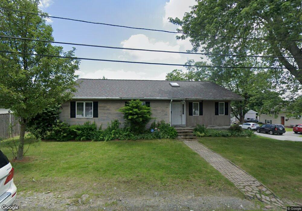
5 Bay St Lowell, MA 01854
Pawtucketville NeighborhoodEstimated Value: $579,000 - $635,000
3
Beds
2
Baths
1,576
Sq Ft
$388/Sq Ft
Est. Value
About This Home
This home is located at 5 Bay St, Lowell, MA 01854 and is currently estimated at $611,264, approximately $387 per square foot. 5 Bay St is a home located in Middlesex County with nearby schools including Joseph McAvinnue Elementary School, Charlotte M. Murkland Elementary School, and Charles W. Morey Elementary School.
Ownership History
Date
Name
Owned For
Owner Type
Purchase Details
Closed on
Apr 5, 2011
Sold by
Walyaki Joseph
Bought by
Lowell City Of
Current Estimated Value
Purchase Details
Closed on
Sep 26, 2005
Sold by
New York Bay Dev Llc
Bought by
Waithera Ann Wanderi and Waiyaki Ignatius P
Home Financials for this Owner
Home Financials are based on the most recent Mortgage that was taken out on this home.
Original Mortgage
$288,000
Interest Rate
5.92%
Mortgage Type
Purchase Money Mortgage
Purchase Details
Closed on
May 12, 2005
Sold by
Drivas Barbara M and Drivas Christos
Bought by
New York Bay Dev Llc
Create a Home Valuation Report for This Property
The Home Valuation Report is an in-depth analysis detailing your home's value as well as a comparison with similar homes in the area
Home Values in the Area
Average Home Value in this Area
Purchase History
| Date | Buyer | Sale Price | Title Company |
|---|---|---|---|
| Lowell City Of | $518 | -- | |
| Lowell City Of | $518 | -- | |
| Waithera Ann Wanderi | $360,000 | -- | |
| Waithera Ann Wanderi | $360,000 | -- | |
| New York Bay Dev Llc | $359,900 | -- | |
| New York Bay Dev Llc | $359,900 | -- |
Source: Public Records
Mortgage History
| Date | Status | Borrower | Loan Amount |
|---|---|---|---|
| Previous Owner | Waithera Ann Wanderi | $288,000 | |
| Previous Owner | New York Bay Dev Llc | $51,000 | |
| Previous Owner | New York Bay Dev Llc | $55,000 |
Source: Public Records
Tax History
| Year | Tax Paid | Tax Assessment Tax Assessment Total Assessment is a certain percentage of the fair market value that is determined by local assessors to be the total taxable value of land and additions on the property. | Land | Improvement |
|---|---|---|---|---|
| 2025 | $6,654 | $579,600 | $187,800 | $391,800 |
| 2024 | $6,124 | $514,200 | $163,900 | $350,300 |
| 2023 | $5,902 | $475,200 | $136,100 | $339,100 |
| 2022 | $5,425 | $427,500 | $123,700 | $303,800 |
| 2021 | $5,307 | $394,300 | $107,600 | $286,700 |
| 2020 | $4,741 | $354,900 | $100,600 | $254,300 |
| 2019 | $4,830 | $344,000 | $93,200 | $250,800 |
| 2018 | $4,717 | $327,800 | $88,800 | $239,000 |
| 2017 | $4,552 | $305,100 | $80,700 | $224,400 |
| 2016 | $4,133 | $272,600 | $67,600 | $205,000 |
| 2015 | $4,163 | $268,900 | $69,200 | $199,700 |
| 2013 | $3,787 | $252,300 | $85,400 | $166,900 |
Source: Public Records
Map
Nearby Homes
- 49 Sparks St
- 75 Sladen St
- 16 Peabody Ave
- 94 Hampson St
- 39 Phoebe Ave
- 244 White St
- 28 Sarah Ave
- 26 Farmland Rd Unit C
- 51 Tobey Rd Unit 46
- 51 Tobey Rd Unit 47
- 25 Tobey Rd Unit 57
- 74 Aiken Ave
- 101 Donohue Rd Unit 19
- 15 Louis Farm Rd Unit 15
- 45 Hoover St
- 417 Hildreth St Unit 2
- 25 Shea St Unit 8
- 19 Louis Farm Rd Unit 19
- 13 Louis Farm Rd Unit 13
- 367 Hildreth St Unit 14
Your Personal Tour Guide
Ask me questions while you tour the home.