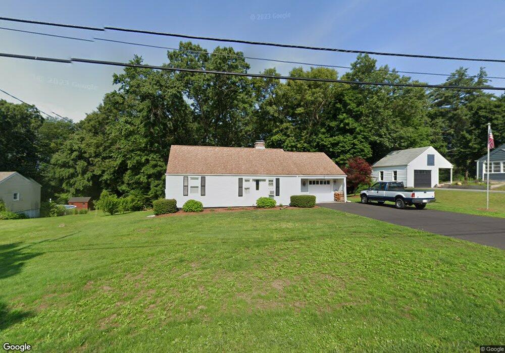
5 Birch St Wilbraham, MA 01095
Estimated Value: $330,794 - $388,000
3
Beds
1
Bath
1,202
Sq Ft
$300/Sq Ft
Est. Value
About This Home
This home is located at 5 Birch St, Wilbraham, MA 01095 and is currently estimated at $360,699, approximately $300 per square foot. 5 Birch St is a home located in Hampden County with nearby schools including Minnechaug Regional High School, Springfield International Charter School, and Wilbraham & Monson Academy.
Ownership History
Date
Name
Owned For
Owner Type
Purchase Details
Closed on
Apr 4, 1990
Sold by
Holt Sherry L
Bought by
Stout Robert
Current Estimated Value
Home Financials for this Owner
Home Financials are based on the most recent Mortgage that was taken out on this home.
Original Mortgage
$103,000
Interest Rate
10.22%
Mortgage Type
Purchase Money Mortgage
Create a Home Valuation Report for This Property
The Home Valuation Report is an in-depth analysis detailing your home's value as well as a comparison with similar homes in the area
Home Values in the Area
Average Home Value in this Area
Purchase History
| Date | Buyer | Sale Price | Title Company |
|---|---|---|---|
| Stout Robert | $123,000 | -- |
Source: Public Records
Mortgage History
| Date | Status | Borrower | Loan Amount |
|---|---|---|---|
| Closed | Stout Robert | $103,000 |
Source: Public Records
Tax History Compared to Growth
Tax History
| Year | Tax Paid | Tax Assessment Tax Assessment Total Assessment is a certain percentage of the fair market value that is determined by local assessors to be the total taxable value of land and additions on the property. | Land | Improvement |
|---|---|---|---|---|
| 2025 | $5,115 | $286,100 | $97,600 | $188,500 |
| 2024 | $5,100 | $275,700 | $97,600 | $178,100 |
| 2023 | $4,784 | $262,800 | $97,600 | $165,200 |
| 2022 | $4,784 | $233,500 | $97,600 | $135,900 |
| 2021 | $4,643 | $202,200 | $104,900 | $97,300 |
| 2020 | $4,525 | $202,200 | $104,900 | $97,300 |
| 2019 | $4,408 | $202,200 | $104,900 | $97,300 |
| 2018 | $4,236 | $187,100 | $104,900 | $82,200 |
| 2017 | $4,116 | $187,100 | $104,900 | $82,200 |
| 2016 | $4,093 | $189,500 | $116,500 | $73,000 |
| 2015 | $3,957 | $189,500 | $116,500 | $73,000 |
Source: Public Records
Map
Nearby Homes
- 28 Decorie Dr
- 79 High Pine Cir
- 69 High Pine Cir
- 2 Bayberry Dr Unit 51
- 54 High Pine Cir
- 20 Old Orchard Rd
- 35 Lake Dr
- 8 Patriot Ridge Ln
- 4 Hillcrest Dr
- 46 Washington Rd
- 2 Vista Rd
- 474 Mountain Rd
- 474-480 Mountain Rd
- 6 Teak Terrace Unit 24
- 99 Sandalwood Dr Unit site 00
- 103 Sandalwood Dr Unit site 00
- 57 Sandalwood Dr Unit site 61
- 111 Sandalwood Dr Unit site 00
- 6 Hilltop Park
- 19 Linwood Dr