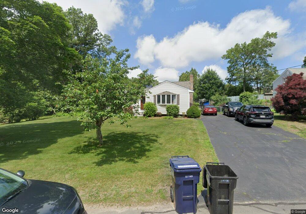
5 Brookside Dr Foxboro, MA 02035
Estimated Value: $529,848 - $555,000
2
Beds
2
Baths
1,340
Sq Ft
$408/Sq Ft
Est. Value
About This Home
This home is located at 5 Brookside Dr, Foxboro, MA 02035 and is currently estimated at $546,212, approximately $407 per square foot. 5 Brookside Dr is a home located in Norfolk County with nearby schools including Foxborough High School, St Mary's Catholic School, and Al-Noor Academy - Mansfield.
Create a Home Valuation Report for This Property
The Home Valuation Report is an in-depth analysis detailing your home's value as well as a comparison with similar homes in the area
Home Values in the Area
Average Home Value in this Area
Tax History
| Year | Tax Paid | Tax Assessment Tax Assessment Total Assessment is a certain percentage of the fair market value that is determined by local assessors to be the total taxable value of land and additions on the property. | Land | Improvement |
|---|---|---|---|---|
| 2025 | $5,744 | $434,500 | $211,400 | $223,100 |
| 2024 | $5,630 | $416,700 | $211,400 | $205,300 |
| 2023 | $5,236 | $368,500 | $201,300 | $167,200 |
| 2022 | $5,346 | $368,200 | $192,600 | $175,600 |
| 2021 | $5,099 | $345,900 | $175,100 | $170,800 |
| 2020 | $4,840 | $332,200 | $175,100 | $157,100 |
| 2019 | $4,672 | $317,800 | $166,800 | $151,000 |
| 2018 | $4,541 | $311,700 | $166,800 | $144,900 |
| 2017 | $4,341 | $288,600 | $155,900 | $132,700 |
| 2016 | $4,280 | $288,800 | $149,900 | $138,900 |
| 2015 | $4,082 | $268,700 | $126,700 | $142,000 |
| 2014 | $4,037 | $269,300 | $124,200 | $145,100 |
Source: Public Records
Map
Nearby Homes
- 261 East St
- 9 Independence Dr Unit 9
- 132 Cannon Forge Dr
- 26 Fredric Ln
- 619 N Main St
- 4 Concetta Cir
- 25 Kingman Ave
- 631 East St Unit L101
- 4 Erick Rd Unit 90
- 81 Chilson Ave
- 122 Samoset Ave
- 46 Hope St
- 3 Wampanoag Rd
- 22 Pleasant St Unit B
- 165 Chestnut St Unit 2
- 266 N Main St Unit 3
- 356 Central St
- 233 Central St
- 150 Rumford Ave Unit 110
- 13 Summerville Rd Unit 13
Your Personal Tour Guide
Ask me questions while you tour the home.