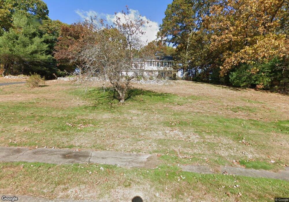
5 Burning Tree Rd Franklin, MA 02038
Estimated Value: $732,000 - $925,000
5
Beds
3
Baths
2,800
Sq Ft
$286/Sq Ft
Est. Value
About This Home
This home is located at 5 Burning Tree Rd, Franklin, MA 02038 and is currently estimated at $800,636, approximately $285 per square foot. 5 Burning Tree Rd is a home located in Norfolk County with nearby schools including Gerald M. Parmenter Elementary School, Remington Middle School, and Franklin High School.
Ownership History
Date
Name
Owned For
Owner Type
Purchase Details
Closed on
Aug 27, 2004
Sold by
Craig Rita M and Craig Scott F
Bought by
Metkarujit Natwalee and Proenca Pedro
Current Estimated Value
Home Financials for this Owner
Home Financials are based on the most recent Mortgage that was taken out on this home.
Original Mortgage
$250,000
Outstanding Balance
$125,011
Interest Rate
6.02%
Mortgage Type
Purchase Money Mortgage
Estimated Equity
$675,625
Purchase Details
Closed on
Aug 3, 2000
Sold by
Deeley Gerald J and Deeley Gloria J
Bought by
Craig Scott F and Craig Rita M
Home Financials for this Owner
Home Financials are based on the most recent Mortgage that was taken out on this home.
Original Mortgage
$200,000
Interest Rate
8.1%
Mortgage Type
Purchase Money Mortgage
Create a Home Valuation Report for This Property
The Home Valuation Report is an in-depth analysis detailing your home's value as well as a comparison with similar homes in the area
Purchase History
| Date | Buyer | Sale Price | Title Company |
|---|---|---|---|
| Metkarujit Natwalee | $470,000 | -- | |
| Craig Scott F | $291,000 | -- |
Source: Public Records
Mortgage History
| Date | Status | Borrower | Loan Amount |
|---|---|---|---|
| Open | Craig Scott F | $150,000 | |
| Open | Metkarujit Natwalee | $250,000 | |
| Closed | Metkarujit Natwalee | $126,000 | |
| Previous Owner | Craig Scott F | $200,000 | |
| Previous Owner | Craig Scott F | $240,000 |
Source: Public Records
Tax History
| Year | Tax Paid | Tax Assessment Tax Assessment Total Assessment is a certain percentage of the fair market value that is determined by local assessors to be the total taxable value of land and additions on the property. | Land | Improvement |
|---|---|---|---|---|
| 2025 | $7,544 | $649,200 | $335,800 | $313,400 |
| 2024 | $7,518 | $637,700 | $335,800 | $301,900 |
| 2023 | $7,217 | $573,700 | $286,200 | $287,500 |
| 2022 | $6,744 | $480,000 | $225,400 | $254,600 |
| 2021 | $6,581 | $449,200 | $253,100 | $196,100 |
| 2020 | $6,232 | $429,500 | $242,700 | $186,800 |
| 2019 | $6,144 | $419,100 | $232,400 | $186,700 |
| 2018 | $5,747 | $392,300 | $224,100 | $168,200 |
| 2017 | $5,478 | $375,700 | $207,500 | $168,200 |
| 2016 | $5,630 | $388,300 | $222,300 | $166,000 |
| 2015 | $5,598 | $377,200 | $211,200 | $166,000 |
| 2014 | $5,075 | $351,200 | $185,200 | $166,000 |
Source: Public Records
Map
Nearby Homes
- 3 Oak View Terrace Unit 3
- 65 Jordan Rd
- 18 Northern Spy Rd
- 30 Partridge View Ln S
- 9 Elliot Mills Unit 5
- 8 Elliot Mills Unit 30
- 5 Elliot Mills Unit 3
- 7 Elliot Mills Unit 4
- 10 Elliot Mills Unit 29
- 50 Reed Fulton Ave Unit Lot 61
- 14 Waites Crossing
- 10 Waites Crossing
- 62 Uncas Ave Unit 1
- 60 Uncas Ave Unit 1
- 66 Uncas Ave Unit 1
- 68 Uncas Ave Unit 1
- 76 Uncas Ave Unit 1
- 80 Uncas Ave Unit 1
- 82 Uncas Ave Unit 1
- 500 Franklin St
- 7 Burning Tree Rd
- 3 Burning Tree Rd
- 8 Burning Tree Rd
- 118 Country Club Dr
- 5 Pearly Ln
- 7 Pearly Ln
- 10 Burning Tree Rd
- 3 Pearly Ln
- 101 Jordan Rd
- 6 Burning Tree Rd
- 130 Country Club Dr
- 1 Burning Tree Rd
- 4 Burning Tree Rd
- 9 Pearly Ln
- 84 Country Club Dr
- 1 Pearly Ln
- 150 Country Club Dr
- 121 Country Club Dr
- 107 Country Club Dr
- 102 Jordan Rd
Your Personal Tour Guide
Ask me questions while you tour the home.