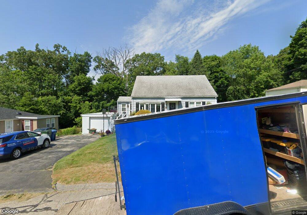
5 Carroll St Auburn, MA 01501
Stoneville NeighborhoodEstimated Value: $407,000 - $446,000
4
Beds
2
Baths
1,408
Sq Ft
$302/Sq Ft
Est. Value
About This Home
This home is located at 5 Carroll St, Auburn, MA 01501 and is currently estimated at $424,736, approximately $301 per square foot. 5 Carroll St is a home located in Worcester County with nearby schools including Auburn Senior High School, Canterbury Street School, and Shrewsbury Montessori School - Auburn Campus.
Ownership History
Date
Name
Owned For
Owner Type
Purchase Details
Closed on
Sep 17, 2012
Sold by
Desrosiers Russell A
Bought by
Paradis Kristin A
Current Estimated Value
Home Financials for this Owner
Home Financials are based on the most recent Mortgage that was taken out on this home.
Original Mortgage
$157,102
Outstanding Balance
$108,964
Interest Rate
3.62%
Mortgage Type
FHA
Estimated Equity
$315,772
Create a Home Valuation Report for This Property
The Home Valuation Report is an in-depth analysis detailing your home's value as well as a comparison with similar homes in the area
Home Values in the Area
Average Home Value in this Area
Purchase History
| Date | Buyer | Sale Price | Title Company |
|---|---|---|---|
| Paradis Kristin A | $147,000 | -- |
Source: Public Records
Mortgage History
| Date | Status | Borrower | Loan Amount |
|---|---|---|---|
| Open | Paradis Kristin A | $157,102 |
Source: Public Records
Tax History
| Year | Tax Paid | Tax Assessment Tax Assessment Total Assessment is a certain percentage of the fair market value that is determined by local assessors to be the total taxable value of land and additions on the property. | Land | Improvement |
|---|---|---|---|---|
| 2025 | $54 | $380,000 | $124,700 | $255,300 |
| 2024 | $4,922 | $329,700 | $118,200 | $211,500 |
| 2023 | $4,697 | $295,800 | $107,500 | $188,300 |
| 2022 | $4,417 | $262,600 | $107,500 | $155,100 |
| 2021 | $4,183 | $230,600 | $94,800 | $135,800 |
| 2020 | $4,116 | $228,900 | $94,800 | $134,100 |
| 2019 | $3,982 | $216,200 | $93,800 | $122,400 |
| 2018 | $2,587 | $206,300 | $87,700 | $118,600 |
| 2017 | $3,593 | $195,900 | $79,600 | $116,300 |
| 2016 | $3,594 | $198,700 | $83,300 | $115,400 |
| 2015 | $3,407 | $197,400 | $83,300 | $114,100 |
| 2014 | $3,314 | $191,700 | $79,300 | $112,400 |
Source: Public Records
Map
Nearby Homes
- 177 Boyce St
- 5 Commonwealth Ave
- 99 Clover St
- 25 Vinal St Unit 28
- 25 Vinal St Unit 26
- 25 Vinal St Unit 29
- 25 Vinal St Unit 30
- 177 Oxford St N
- 27 Havana Rd
- 35 Genessee St Unit E
- 19-20 Williams St
- 11 Hulbert Rd Unit 13
- 40 Bryn Mawr Ave
- 6 Buron Terrace
- 103 Henshaw St
- 1-9 Helens Way
- 55 Grandview Ave
- 31-33 Walsh Ave
- 33 Walsh Ave
- 31 Walsh Ave
Your Personal Tour Guide
Ask me questions while you tour the home.