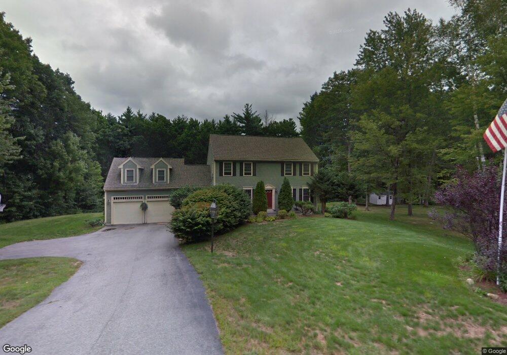
5 Devonshire Way Bedford, NH 03110
Bedford NeighborhoodEstimated Value: $758,836 - $832,000
3
Beds
3
Baths
2,784
Sq Ft
$287/Sq Ft
Est. Value
About This Home
This home is located at 5 Devonshire Way, Bedford, NH 03110 and is currently estimated at $797,959, approximately $286 per square foot. 5 Devonshire Way is a home located in Hillsborough County with nearby schools including Mckelvie Intermediate School, Ross A. Lurgio Middle School, and Bedford High School.
Ownership History
Date
Name
Owned For
Owner Type
Purchase Details
Closed on
Jul 16, 2018
Sold by
Dow John D and Dow Doreen J
Bought by
Maria T Peguri T
Current Estimated Value
Purchase Details
Closed on
Jul 31, 2001
Sold by
Brackett Edward J and Brackett Joan F
Bought by
Dow John D and Dow Doreen J
Home Financials for this Owner
Home Financials are based on the most recent Mortgage that was taken out on this home.
Original Mortgage
$200,000
Interest Rate
7.18%
Create a Home Valuation Report for This Property
The Home Valuation Report is an in-depth analysis detailing your home's value as well as a comparison with similar homes in the area
Home Values in the Area
Average Home Value in this Area
Purchase History
| Date | Buyer | Sale Price | Title Company |
|---|---|---|---|
| Maria T Peguri T | -- | -- | |
| Dow John D | $356,900 | -- |
Source: Public Records
Mortgage History
| Date | Status | Borrower | Loan Amount |
|---|---|---|---|
| Previous Owner | Dow John D | $200,000 |
Source: Public Records
Tax History Compared to Growth
Tax History
| Year | Tax Paid | Tax Assessment Tax Assessment Total Assessment is a certain percentage of the fair market value that is determined by local assessors to be the total taxable value of land and additions on the property. | Land | Improvement |
|---|---|---|---|---|
| 2024 | $11,135 | $704,300 | $255,800 | $448,500 |
| 2023 | $10,424 | $704,300 | $255,800 | $448,500 |
| 2022 | $9,625 | $546,900 | $189,600 | $357,300 |
| 2021 | $9,374 | $546,900 | $189,600 | $357,300 |
| 2020 | $9,151 | $457,100 | $145,700 | $311,400 |
| 2019 | $8,662 | $457,100 | $145,700 | $311,400 |
| 2018 | $8,658 | $424,400 | $145,700 | $278,700 |
| 2017 | $8,025 | $424,400 | $145,700 | $278,700 |
| 2016 | $8,411 | $376,000 | $116,600 | $259,400 |
| 2015 | $8,558 | $376,000 | $116,600 | $259,400 |
| 2014 | $8,460 | $376,000 | $116,600 | $259,400 |
| 2013 | $8,336 | $376,000 | $116,600 | $259,400 |
Source: Public Records
Map
Nearby Homes
- 197 Liberty Hill Rd
- 10 Barrington Dr
- 18 Horizon Dr
- 116 Nashua Rd
- 7 Hamilton Way
- 155 Wallace Rd
- 29 Pebble Beach Dr
- 15 Spyglass Point Cir
- 20 Pebble Beach Dr Unit 22-89-20
- 150 Wallace Rd
- 56 Greenfield Pkwy
- 40 Seton Dr
- 16 Summit Rd
- 82 Pilgrim Dr
- 34 Chatham Dr
- 17-4-28 Boiling Kettle Way
- 17-4-28 Boiling Kettle Way Unit 28
- 12 Knoll Crest Dr Unit Lot 5 - The Hannah
- 32 Puritan Dr
- 20 Liberty Hill Rd
- 1 Devonshire Way
- 78 Meadowcrest Dr
- 8 Forest Dr
- 10 Forest Dr
- 4 Devonshire Way
- 8 Devonshire Way
- 14 Forest Dr
- 4 Forest Dr
- 16 Forest Dr
- 11 Devonshire Way
- 12 Devonshire Way
- 2 Devonshire Way
- 9 Forest Dr
- 75 Meadowcrest Dr
- 13 Forest Dr
- 43 Camelot Dr
- 79 Meadowcrest Dr
- 81 Meadowcrest Dr
- 20 Forest Dr
- 5 Forest Dr