Estimated Value: $203,684 - $274,000
3
Beds
2
Baths
2,326
Sq Ft
$104/Sq Ft
Est. Value
About This Home
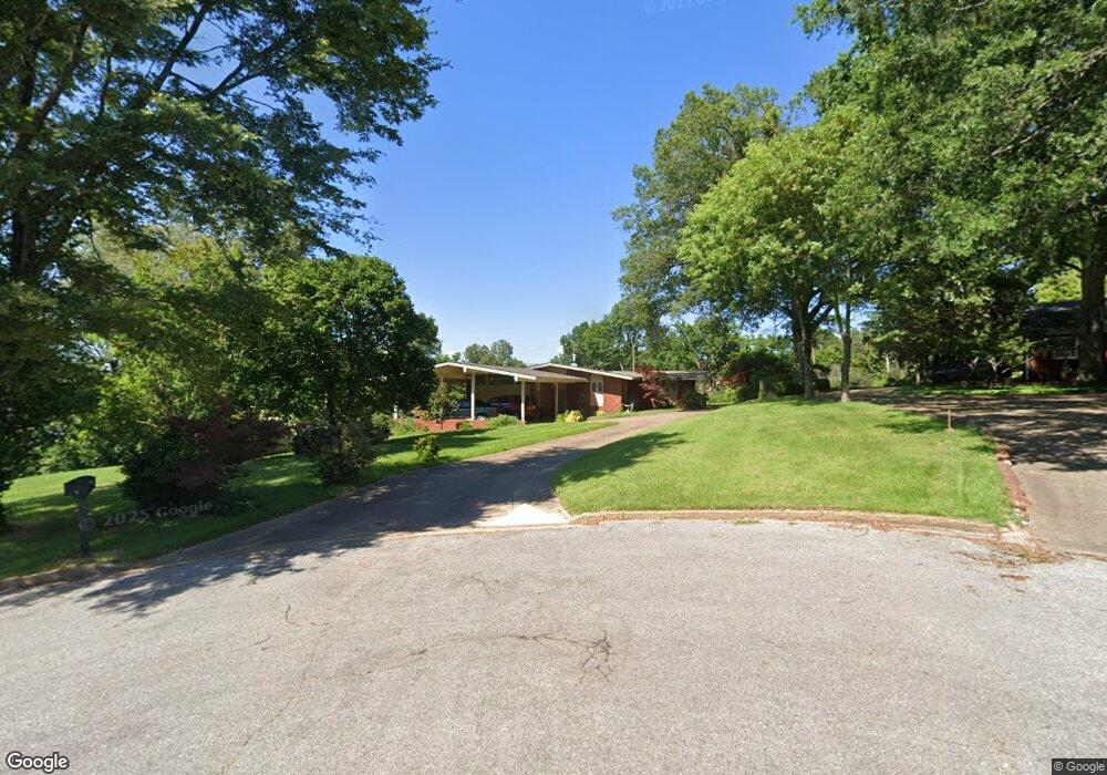
This home is located at 5 Donegal Cir, Wynne, AR 72396 and is currently estimated at $240,921, approximately $103 per square foot. 5 Donegal Cir is a home located in Cross County with nearby schools including Wynne Intermediate School, Wynne Primary School, and Wynne Junior High School.
Ownership History
Date
Name
Owned For
Owner Type
Purchase Details
Closed on
Jul 1, 2010
Sold by
Smith Larry B and Smith Gaybreia L
Bought by
Damron Katherine O
Current Estimated Value
Home Financials for this Owner
Home Financials are based on the most recent Mortgage that was taken out on this home.
Original Mortgage
$130,000
Interest Rate
4.41%
Mortgage Type
Purchase Money Mortgage
Purchase Details
Closed on
Sep 24, 2001
Bought by
Smith Larry B and Smith Smith
Purchase Details
Closed on
Apr 2, 2001
Bought by
Damron Kathryn
Purchase Details
Closed on
Oct 11, 2000
Bought by
Damron Michael and Damron Kathryn
Purchase Details
Closed on
Mar 27, 1997
Bought by
Baddour, Stella D.Revoc. Trust
Create a Home Valuation Report for This Property
The Home Valuation Report is an in-depth analysis detailing your home's value as well as a comparison with similar homes in the area
Home Values in the Area
Average Home Value in this Area
Purchase History
| Date | Buyer | Sale Price | Title Company |
|---|---|---|---|
| Damron Katherine O | $130,000 | None Available | |
| Smith Larry B | $138,000 | -- | |
| Damron Kathryn | -- | -- | |
| Damron Kathryn | -- | -- | |
| Damron Michael | $130,000 | -- | |
| Baddour, Stella D.Revoc. Trust | -- | -- |
Source: Public Records
Mortgage History
| Date | Status | Borrower | Loan Amount |
|---|---|---|---|
| Previous Owner | Damron Katherine O | $130,000 |
Source: Public Records
Tax History Compared to Growth
Tax History
| Year | Tax Paid | Tax Assessment Tax Assessment Total Assessment is a certain percentage of the fair market value that is determined by local assessors to be the total taxable value of land and additions on the property. | Land | Improvement |
|---|---|---|---|---|
| 2024 | $1,035 | $31,070 | $4,880 | $26,190 |
| 2023 | $1,113 | $31,070 | $4,880 | $26,190 |
| 2022 | $1,163 | $31,070 | $4,880 | $26,190 |
| 2021 | $1,116 | $31,070 | $4,880 | $26,190 |
| 2020 | $1,049 | $31,070 | $4,880 | $26,190 |
| 2019 | $981 | $27,390 | $4,050 | $23,340 |
| 2018 | $1,006 | $27,390 | $4,050 | $23,340 |
| 2017 | $1,006 | $27,390 | $4,050 | $23,340 |
| 2016 | $1,006 | $27,390 | $4,050 | $23,340 |
| 2015 | $1,006 | $27,390 | $4,050 | $23,340 |
| 2014 | $1,141 | $30,130 | $4,920 | $25,210 |
Source: Public Records
Map
Nearby Homes
- 2 Donegal Cir
- 6 A Londonderry Cir
- 568 Killough Rd N
- 1484 Hamilton Ave E
- 594 Malone St N
- 116 Bailey St S
- 35 Morningside Dr
- 102 Lombardy Ln
- 29 Sunset Dr
- 226 Nathan Dr E
- 1011 Hilltop Dr
- 206 Maple Dr
- 1404 Airpark Rd
- 108 Nathan Dr E
- 129 Lombardy Ln
- 109 Nathan Dr E
- 4 Briarcliff Cir
- 1310 Bridges Ave E
- 106 Eldridge Ct
- 919 Hamilton Ave E
- 6 Donegal Cir
- 1603 Poplar Ave E
- 3 Londonderry Cir
- 3 Donegal Cir
- 1212 Woodruff 391
- 1617 Poplar Ave E
- 1450 Hamilton Ave E
- 2 Londonderry Cir
- 1410 Poplar Ave E
- 1600 Poplar Ave E
- 1470 Hamilton Ave E
- 1420 Hamilton Ave E
- 1320 Marion Dr
- 1325 Marion Dr
- 595 Killough Rd N
- 6 Londonderry Cir
- 6 Londonderry Cir
- 1402 Poplar Ave E
- 503 Killough Rd N
- 7 Londonderry Cir