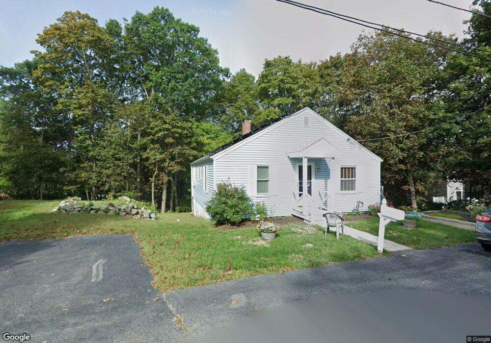
5 Echo Ave Gloucester, MA 01930
Estimated Value: $570,000 - $587,724
2
Beds
1
Bath
952
Sq Ft
$610/Sq Ft
Est. Value
About This Home
This home is located at 5 Echo Ave, Gloucester, MA 01930 and is currently estimated at $580,431, approximately $609 per square foot. 5 Echo Ave is a home located in Essex County with nearby schools including Beeman Memorial, Ralph B O'maley Middle School, and Gloucester High School.
Ownership History
Date
Name
Owned For
Owner Type
Purchase Details
Closed on
Oct 29, 2019
Sold by
Anderson Karen and Anderson Philip A
Bought by
Philip Jr & K A Anderson Lt
Current Estimated Value
Purchase Details
Closed on
Apr 2, 2003
Sold by
Sardinha Helena and Sardinha Manuel
Bought by
Portside Rlty Dev Llc
Create a Home Valuation Report for This Property
The Home Valuation Report is an in-depth analysis detailing your home's value as well as a comparison with similar homes in the area
Purchase History
| Date | Buyer | Sale Price | Title Company |
|---|---|---|---|
| Philip Jr & K A Anderson Lt | -- | -- | |
| Portside Rlty Dev Llc | $700,000 | -- |
Source: Public Records
Mortgage History
| Date | Status | Borrower | Loan Amount |
|---|---|---|---|
| Previous Owner | Portside Rlty Dev Llc | $75,000 | |
| Previous Owner | Portside Rlty Dev Llc | $70,000 | |
| Previous Owner | Portside Rlty Dev Llc | $102,000 |
Source: Public Records
Tax History
| Year | Tax Paid | Tax Assessment Tax Assessment Total Assessment is a certain percentage of the fair market value that is determined by local assessors to be the total taxable value of land and additions on the property. | Land | Improvement |
|---|---|---|---|---|
| 2025 | $4,339 | $446,400 | $198,500 | $247,900 |
| 2024 | $4,213 | $433,000 | $189,000 | $244,000 |
| 2023 | $4,219 | $398,400 | $168,800 | $229,600 |
| 2022 | $3,955 | $337,200 | $146,800 | $190,400 |
| 2021 | $3,960 | $318,300 | $133,500 | $184,800 |
| 2020 | $3,849 | $312,200 | $133,500 | $178,700 |
| 2019 | $3,810 | $300,200 | $133,500 | $166,700 |
| 2018 | $3,755 | $290,400 | $133,500 | $156,900 |
| 2017 | $3,656 | $277,200 | $127,100 | $150,100 |
| 2016 | $3,547 | $260,600 | $132,500 | $128,100 |
| 2015 | $3,505 | $256,800 | $132,500 | $124,300 |
Source: Public Records
Map
Nearby Homes
- 3 Deacon Farm Ln
- 31 Echo Ave
- 13 Honeysuckle Rd
- 2 Breezy Point Rd
- 13 Mystic Ave
- 8 Mystic Ave
- 6 Monroe Ct
- 98 Maplewood Ave
- 9 Cleveland Place
- 672 Washington St
- 40 Sargent St
- 19 Trask St Unit 2
- 15 Harvard St
- 33 Maplewood Ave Unit 310
- 113 Pleasant St
- 167 Atlantic St
- 178 Atlantic St
- 20 Beacon St
- 20 Beacon St Unit 2
- 20 Beacon St Unit 1
Your Personal Tour Guide
Ask me questions while you tour the home.