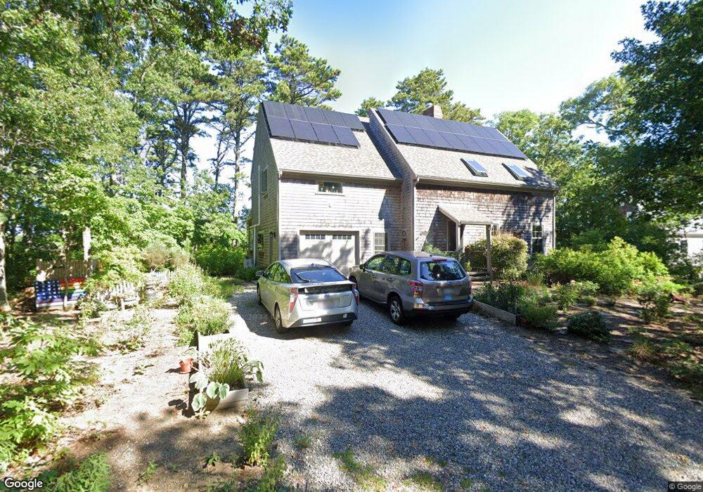
5 Fisher Point Rd Brewster, MA 02631
Estimated Value: $920,000 - $1,050,000
2
Beds
3
Baths
2,177
Sq Ft
$451/Sq Ft
Est. Value
About This Home
This home is located at 5 Fisher Point Rd, Brewster, MA 02631 and is currently estimated at $981,622, approximately $450 per square foot. 5 Fisher Point Rd is a home located in Barnstable County with nearby schools including Stony Brook Elementary School, Eddy Elementary School, and Nauset Regional Middle School.
Ownership History
Date
Name
Owned For
Owner Type
Purchase Details
Closed on
Dec 5, 1997
Sold by
Reed Janet S
Bought by
Keith John S and Keith Carolyn S
Current Estimated Value
Purchase Details
Closed on
Mar 13, 1992
Sold by
Nelson Leonard C
Bought by
Reed David B and Reed Janet S
Purchase Details
Closed on
Oct 18, 1989
Sold by
Borner Thomas A
Bought by
Reed David B
Home Financials for this Owner
Home Financials are based on the most recent Mortgage that was taken out on this home.
Original Mortgage
$150,000
Interest Rate
10.06%
Mortgage Type
Purchase Money Mortgage
Create a Home Valuation Report for This Property
The Home Valuation Report is an in-depth analysis detailing your home's value as well as a comparison with similar homes in the area
Home Values in the Area
Average Home Value in this Area
Purchase History
| Date | Buyer | Sale Price | Title Company |
|---|---|---|---|
| Keith John S | $345,000 | -- | |
| Reed David B | $50,000 | -- | |
| Reed David B | $237,500 | -- |
Source: Public Records
Mortgage History
| Date | Status | Borrower | Loan Amount |
|---|---|---|---|
| Previous Owner | Reed David B | $148,000 | |
| Previous Owner | Reed David B | $150,000 |
Source: Public Records
Tax History Compared to Growth
Tax History
| Year | Tax Paid | Tax Assessment Tax Assessment Total Assessment is a certain percentage of the fair market value that is determined by local assessors to be the total taxable value of land and additions on the property. | Land | Improvement |
|---|---|---|---|---|
| 2025 | $6,325 | $919,400 | $287,200 | $632,200 |
| 2024 | $6,391 | $938,400 | $341,200 | $597,200 |
| 2023 | $5,905 | $844,800 | $304,500 | $540,300 |
| 2022 | $6,140 | $782,200 | $283,600 | $498,600 |
| 2021 | $5,893 | $686,800 | $246,500 | $440,300 |
| 2020 | $4,065 | $491,600 | $246,500 | $245,100 |
| 2019 | $3,871 | $473,600 | $237,100 | $236,500 |
| 2018 | $3,822 | $462,700 | $237,100 | $225,600 |
| 2017 | $3,686 | $433,700 | $237,100 | $196,600 |
| 2016 | $3,530 | $418,800 | $232,500 | $186,300 |
| 2015 | $3,386 | $409,900 | $227,900 | $182,000 |
Source: Public Records
Map
Nearby Homes
- 12 Cranberry Trail
- 1 Shore Dr
- 310 Old Chatham Rd Unit C14
- 310 Old Chatham Rd Unit E47
- 310 Old Chatham Rd Unit D-30
- 310 Old Chatham Rd Unit A-141
- 310 Old Chatham Rd Unit A21
- 310 Old Chatham Rd Unit J-12
- 310 Old Chatham Rd Unit G8
- 310 Old Chatham Rd Unit H-12
- 310 Old Chatham Rd
- 310 Old Chatham Rd Unit E1
- 310 Old Chatham Rd Unit A7
- 432 Old Chatham Rd Unit 403
- 103 Main Extension St
- 4 Landing Ln
- 213 S Westgate Rd
- 37 Cyprus Rd
- 37 Cyprus Rd
- 96 Gages Way
- 15 Fisher Point Rd
- 0 Fisher Point Rd
- 4 Fisher Point Rd
- 21 Fisher Point Rd
- 44 Captain Connolly Rd
- 34 Captain Connolly Rd
- 757 Slough Rd
- 23 Captain Connolly Rd
- 60 Captain Connolly Rd
- 61 Captain Connolly Rd
- 24 Captain Connolly Rd
- 14 Captain Connolly Rd
- 9 Captain Connolly Rd
- 727 Slough Rd
- 29 Elbow Pond Dr
- 18 Elbow Pond Dr
- 744 Slough Rd
- 40 Elbow Pond Dr
- 204 Cranview Rd
- 712 Slough Rd