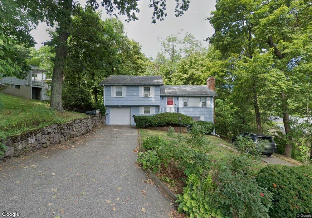
5 Gibson Rd Lexington, MA 02421
Follen Heights NeighborhoodEstimated Value: $1,174,000 - $1,474,000
3
Beds
2
Baths
1,100
Sq Ft
$1,156/Sq Ft
Est. Value
About This Home
This home is located at 5 Gibson Rd, Lexington, MA 02421 and is currently estimated at $1,271,392, approximately $1,155 per square foot. 5 Gibson Rd is a home located in Middlesex County with nearby schools including Bowman Elementary School, Jonas Clarke Middle School, and Lexington High School.
Ownership History
Date
Name
Owned For
Owner Type
Purchase Details
Closed on
Jul 25, 1995
Sold by
Puvirajasingham J and Puvirajasingham P
Bought by
Ma Jason C and Ma Carrie C
Current Estimated Value
Purchase Details
Closed on
Aug 14, 1987
Sold by
Hopkins Stanley W
Bought by
Moore Homes Inc
Create a Home Valuation Report for This Property
The Home Valuation Report is an in-depth analysis detailing your home's value as well as a comparison with similar homes in the area
Home Values in the Area
Average Home Value in this Area
Purchase History
| Date | Buyer | Sale Price | Title Company |
|---|---|---|---|
| Ma Jason C | $261,000 | -- | |
| Moore Homes Inc | $270,000 | -- |
Source: Public Records
Mortgage History
| Date | Status | Borrower | Loan Amount |
|---|---|---|---|
| Open | Moore Homes Inc | $370,000 | |
| Closed | Moore Homes Inc | $360,000 |
Source: Public Records
Tax History Compared to Growth
Tax History
| Year | Tax Paid | Tax Assessment Tax Assessment Total Assessment is a certain percentage of the fair market value that is determined by local assessors to be the total taxable value of land and additions on the property. | Land | Improvement |
|---|---|---|---|---|
| 2025 | $15,067 | $1,232,000 | $941,000 | $291,000 |
| 2024 | $14,835 | $1,211,000 | $896,000 | $315,000 |
| 2023 | $14,170 | $1,090,000 | $814,000 | $276,000 |
| 2022 | $13,469 | $976,000 | $740,000 | $236,000 |
| 2021 | $8,318 | $931,000 | $705,000 | $226,000 |
| 2020 | $13,179 | $938,000 | $705,000 | $233,000 |
| 2019 | $12,637 | $895,000 | $671,000 | $224,000 |
| 2018 | $12,041 | $842,000 | $622,000 | $220,000 |
| 2017 | $11,157 | $770,000 | $592,000 | $178,000 |
| 2016 | $10,439 | $715,000 | $544,000 | $171,000 |
| 2015 | $10,001 | $673,000 | $494,000 | $179,000 |
| 2014 | $9,042 | $583,000 | $443,000 | $140,000 |
Source: Public Records
Map
Nearby Homes
- 35 Tower Rd
- 36 Independence Ave
- 25 Maple St
- 20 Marrett Rd
- 34 Oak St
- 55 Pleasant St
- 1 Tricorne Rd
- 24 Rockville Ave
- 9 Linc Cole Ln
- 6 Linc Cole Ln
- 18 Emerson Gardens Rd Unit 18
- 1 Beech Tree Ln
- 16 Solomon Pierce Rd
- 10 Eliot Rd
- 37 Philip Rd
- 19 Crescent Rd
- 2 Percy Rd
- 22 Bryant Rd
- 7 Lothrop Cir
- 14 Percy Rd
- 65 Follen Rd
- 65 Follen Rd Unit SingFam
- 822 Massachusetts Ave Unit 2
- 822 Massachusetts Ave Unit 1
- 77 Follen Rd
- 6 Gibson Rd
- 812 Massachusetts Ave
- 812 Massachusetts Ave Unit 2
- 812 Massachusetts Ave Unit 812
- 812 Massachusetts Ave Unit 1
- 840 Massachusetts Ave
- 51 Follen Rd
- 814 Massachusetts Ave Unit 2
- 814 Massachusetts Ave Unit 1
- 10 Independence Ave
- 794 Massachusetts Ave
- 4 Gibson Rd
- 4 Gibson Rd Unit 2
- 4 Gibson Rd Unit 4
- 12 Independence Ave