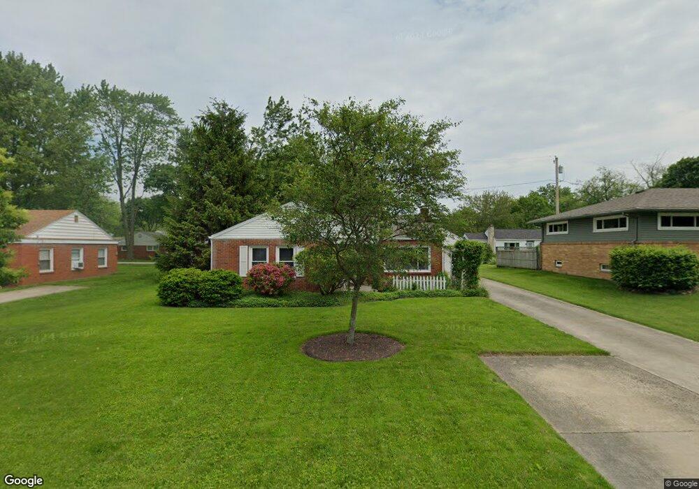
5 Greenbrier Ct Bowling Green, OH 43402
Estimated Value: $183,816 - $218,000
3
Beds
1
Bath
1,166
Sq Ft
$171/Sq Ft
Est. Value
About This Home
This home is located at 5 Greenbrier Ct, Bowling Green, OH 43402 and is currently estimated at $199,954, approximately $171 per square foot. 5 Greenbrier Ct is a home located in Wood County with nearby schools including Bowling Green High School, Bowling Green Christian Academy, and Montessori School Of Bowling Green.
Ownership History
Date
Name
Owned For
Owner Type
Purchase Details
Closed on
Oct 30, 2000
Sold by
Staup Darrell J and Burger Wendy J
Bought by
Brown Rosemary D
Current Estimated Value
Purchase Details
Closed on
Nov 7, 1994
Sold by
Porter Robert D
Bought by
Staup Darrell J and Burger Wendy J
Home Financials for this Owner
Home Financials are based on the most recent Mortgage that was taken out on this home.
Original Mortgage
$61,750
Interest Rate
8.75%
Mortgage Type
New Conventional
Purchase Details
Closed on
Jul 23, 1987
Bought by
Porter Robert D
Create a Home Valuation Report for This Property
The Home Valuation Report is an in-depth analysis detailing your home's value as well as a comparison with similar homes in the area
Home Values in the Area
Average Home Value in this Area
Purchase History
| Date | Buyer | Sale Price | Title Company |
|---|---|---|---|
| Brown Rosemary D | $111,000 | -- | |
| Staup Darrell J | $65,000 | -- | |
| Porter Robert D | -- | -- |
Source: Public Records
Mortgage History
| Date | Status | Borrower | Loan Amount |
|---|---|---|---|
| Previous Owner | Staup Darrell J | $61,750 |
Source: Public Records
Tax History Compared to Growth
Tax History
| Year | Tax Paid | Tax Assessment Tax Assessment Total Assessment is a certain percentage of the fair market value that is determined by local assessors to be the total taxable value of land and additions on the property. | Land | Improvement |
|---|---|---|---|---|
| 2024 | $1,615 | $46,410 | $12,565 | $33,845 |
| 2023 | $1,615 | $46,420 | $12,570 | $33,850 |
| 2021 | $1,240 | $37,140 | $10,290 | $26,850 |
| 2020 | $1,244 | $37,140 | $10,290 | $26,850 |
| 2019 | $1,145 | $33,640 | $10,290 | $23,350 |
| 2018 | $1,138 | $33,640 | $10,290 | $23,350 |
| 2017 | $513 | $33,640 | $10,290 | $23,350 |
| 2016 | $1,010 | $30,800 | $10,290 | $20,510 |
| 2015 | $1,010 | $30,800 | $10,290 | $20,510 |
| 2014 | $1,040 | $30,800 | $10,290 | $20,510 |
| 2013 | $559 | $30,800 | $10,290 | $20,510 |
Source: Public Records
Map
Nearby Homes
- 733 Conneaut Ave
- 545 Wallace Ave
- 1048 N Main St
- 853 Champagne Ave
- 1054 Bourgogne Ave
- 0 Haskins Rd Unit 6132516
- 834 N Christopher St
- 210 W Wooster St
- 315 Parkview Dr
- 893 W Wooster St
- 915 Manitoba Dr
- 1206 N Dixie Hwy
- 1303 Finch Dr
- 1362 Conneaut Ave
- 1273 Sora Way
- Water Lily Plan at Aspire at Toussaint Springs
- Sweet Pea Plan at Aspire at Toussaint Springs
- Goldenrod Plan at Aspire at Toussaint Springs
- Oleander Plan at Aspire at Toussaint Springs
- Forsythia Plan at Aspire at Toussaint Springs