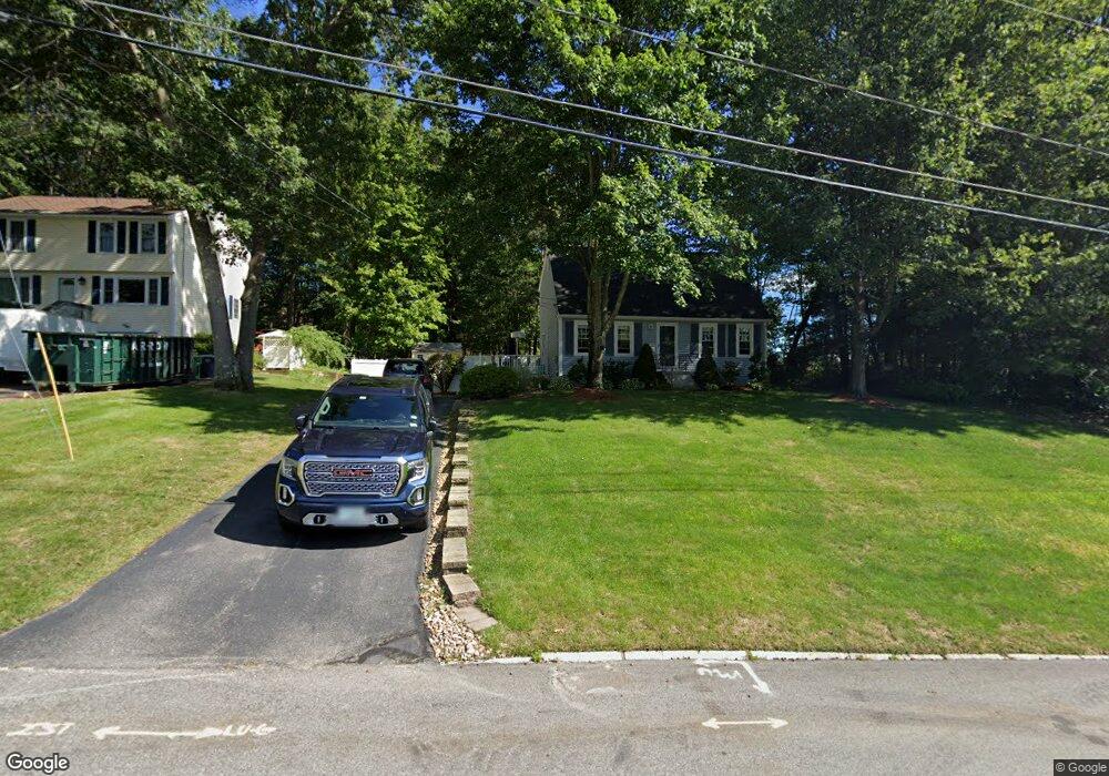
5 Hazel Ave Nashua, NH 03062
West Hollis NeighborhoodEstimated Value: $527,712 - $584,000
4
Beds
2
Baths
1,818
Sq Ft
$309/Sq Ft
Est. Value
About This Home
This home is located at 5 Hazel Ave, Nashua, NH 03062 and is currently estimated at $560,928, approximately $308 per square foot. 5 Hazel Ave is a home located in Hillsborough County with nearby schools including Main Dunstable School, Elm Street Middle School, and Nashua High School South.
Ownership History
Date
Name
Owned For
Owner Type
Purchase Details
Closed on
May 26, 2011
Sold by
Andrew Stone Joint Ret and Andrea Stone Joint Ret
Bought by
Joel S Porter Ret and Gray
Current Estimated Value
Purchase Details
Closed on
Mar 28, 2003
Sold by
Sloan Cristen Ann
Bought by
Goupil Andrea F
Home Financials for this Owner
Home Financials are based on the most recent Mortgage that was taken out on this home.
Original Mortgage
$228,150
Interest Rate
5.91%
Mortgage Type
Purchase Money Mortgage
Create a Home Valuation Report for This Property
The Home Valuation Report is an in-depth analysis detailing your home's value as well as a comparison with similar homes in the area
Home Values in the Area
Average Home Value in this Area
Purchase History
| Date | Buyer | Sale Price | Title Company |
|---|---|---|---|
| Joel S Porter Ret | $132,500 | -- | |
| Goupil Andrea F | $230,000 | -- |
Source: Public Records
Mortgage History
| Date | Status | Borrower | Loan Amount |
|---|---|---|---|
| Previous Owner | Goupil Andrea F | $35,000 | |
| Previous Owner | Goupil Andrea F | $225,000 | |
| Previous Owner | Goupil Andrea F | $228,150 |
Source: Public Records
Tax History
| Year | Tax Paid | Tax Assessment Tax Assessment Total Assessment is a certain percentage of the fair market value that is determined by local assessors to be the total taxable value of land and additions on the property. | Land | Improvement |
|---|---|---|---|---|
| 2025 | $8,467 | $503,100 | $174,000 | $329,100 |
| 2024 | $7,999 | $503,100 | $174,000 | $329,100 |
| 2023 | $7,631 | $418,600 | $139,200 | $279,400 |
| 2022 | $7,564 | $418,600 | $139,200 | $279,400 |
| 2021 | $6,952 | $299,400 | $97,400 | $202,000 |
| 2020 | $6,769 | $299,400 | $97,400 | $202,000 |
| 2019 | $6,515 | $299,400 | $97,400 | $202,000 |
| 2018 | $6,350 | $299,400 | $97,400 | $202,000 |
| 2017 | $5,945 | $230,500 | $78,300 | $152,200 |
| 2016 | $5,779 | $230,500 | $78,300 | $152,200 |
| 2015 | $5,654 | $230,500 | $78,300 | $152,200 |
| 2014 | $5,544 | $230,500 | $78,300 | $152,200 |
Source: Public Records
Map
Nearby Homes
- 36 Silverton Dr Unit U85
- 17 Twilight Dr
- 103 Saranac Dr
- 4 Burlington Rd
- 23 Spring Cove Rd Unit U152
- 30 Spring Cove Rd Unit U112
- 47 Dogwood Dr Unit U202
- 4 Kittery Dr
- 45 Dogwood Dr Unit U208
- 16 Champagne Dr Unit U31
- 9 Leslie Ln
- 668 W Hollis St
- 27 Hyacinth Dr
- 14 Millbrook Dr
- 12 Pioneer Dr
- 5 Lowther Place Unit U6
- 8 Althea Ln Unit U26
- 2 Henry David Dr Unit 207
- 5 Ronnie Dr
- 10 Houston Dr
- 7 Hazel Ave
- 9 Hazel Ave
- 3 Hazel Ave
- 8 Hazel Ave
- 6 Hazel Ave
- 10 Hazel Ave
- 4 Hazel Ave
- 25 Cortez Dr Unit 25 157
- 11 Hazel Ave
- 1 Hazel Ave
- 24 Cortez Dr Unit U56
- 23 Cortez Dr Unit U55
- 22 Cortez Dr Unit U54
- 22 Cortez Dr Unit 22
- 10 Grenada Cir
- 25 Gosselin Rd
- 26 Cortez Dr Unit U58
- 23A Gosselin Rd
- 12 Hazel Ave
- 27 Cortez Dr Unit U59
Your Personal Tour Guide
Ask me questions while you tour the home.