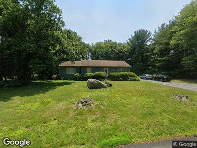
5 Highland Ridge Rd Assonet, MA 02702
Assonet Bay NeighborhoodEstimated Value: $458,555 - $525,000
2
Beds
1
Bath
1,448
Sq Ft
$343/Sq Ft
Est. Value
About This Home
This home is located at 5 Highland Ridge Rd, Assonet, MA 02702 and is currently estimated at $496,639, approximately $342 per square foot. 5 Highland Ridge Rd is a home located in Bristol County with nearby schools including Freetown Elementary School, George R Austin Intermediate School, and Freetown-Lakeville Middle School.
Ownership History
Date
Name
Owned For
Owner Type
Purchase Details
Closed on
Mar 24, 2006
Sold by
Frizado Andrea and Levesque Andrea
Bought by
Frizado Andrea and Frizado Paul
Current Estimated Value
Home Financials for this Owner
Home Financials are based on the most recent Mortgage that was taken out on this home.
Original Mortgage
$221,000
Interest Rate
6.28%
Purchase Details
Closed on
Jan 31, 2003
Sold by
Fournier Francis G
Bought by
Frizado Paul and Levesque Andrea
Home Financials for this Owner
Home Financials are based on the most recent Mortgage that was taken out on this home.
Original Mortgage
$227,332
Interest Rate
6.09%
Mortgage Type
Purchase Money Mortgage
Create a Home Valuation Report for This Property
The Home Valuation Report is an in-depth analysis detailing your home's value as well as a comparison with similar homes in the area
Home Values in the Area
Average Home Value in this Area
Purchase History
| Date | Buyer | Sale Price | Title Company |
|---|---|---|---|
| Frizado Andrea | -- | -- | |
| Frizado Paul | $230,900 | -- |
Source: Public Records
Mortgage History
| Date | Status | Borrower | Loan Amount |
|---|---|---|---|
| Open | Frizado Paul | $60,000 | |
| Open | Frizado Paul W | $211,820 | |
| Closed | Frizado Andrea | $220,000 | |
| Closed | Frizado Andrea | $221,000 | |
| Previous Owner | Fournier Francis G | $227,332 | |
| Previous Owner | Fournier Francis G | $30,000 |
Source: Public Records
Tax History Compared to Growth
Tax History
| Year | Tax Paid | Tax Assessment Tax Assessment Total Assessment is a certain percentage of the fair market value that is determined by local assessors to be the total taxable value of land and additions on the property. | Land | Improvement |
|---|---|---|---|---|
| 2025 | $4,276 | $431,500 | $176,500 | $255,000 |
| 2024 | $4,247 | $407,200 | $166,500 | $240,700 |
| 2023 | $4,145 | $387,000 | $150,000 | $237,000 |
| 2022 | $3,948 | $327,400 | $127,100 | $200,300 |
| 2021 | $3,785 | $298,000 | $115,500 | $182,500 |
| 2020 | $3,751 | $288,100 | $111,100 | $177,000 |
| 2019 | $3,547 | $269,700 | $105,800 | $163,900 |
| 2018 | $3,358 | $252,300 | $105,800 | $146,500 |
| 2017 | $3,270 | $245,500 | $105,800 | $139,700 |
| 2016 | $3,147 | $240,400 | $102,800 | $137,600 |
| 2015 | $3,052 | $236,600 | $102,800 | $133,800 |
| 2014 | $2,856 | $226,500 | $100,600 | $125,900 |
Source: Public Records
Map
Nearby Homes
- 2 Highland Ridge Rd
- 75 Narrows Rd
- 16 Riverside Dr
- 62 Riverside Dr
- 3 Ashlawn Rd
- 1 Water St
- 15 N Main St
- 2 Freeman St
- 38 N Main St
- 5 Nottingham Way
- 5455 N Main St Unit 12F
- 5455 N Main St Unit 6B
- 5455 N Main St Unit 7B
- 75 Broad Cove St
- 10 Ferry Ln
- 8 Ferry Ln
- 5 Friend St
- 5239 N Main St Unit 7
- 5239 N Main St Unit 4
- 562 Main St
- 5 Highland Ridge Rd
- 4 Green Lawn Rd
- 7 Highland Ridge Rd
- 6 Highland Ridge Rd
- 3 Highland Ridge Rd
- 4 Woodlawn Rd
- 5 Green Lawn Rd
- 8 Highland Ridge Rd
- 3 Woodlawn Rd
- 9 Highland Ridge Rd
- 5 Woodlawn Rd
- 10 Highland Ridge Rd
- 35 Narrows Rd
- 47 Narrows Rd
- 7 Woodlawn Rd
- 11 Highland Ridge Rd
- 12 Highland Ridge Rd
- 8 Woodlawn Rd
- 49 Narrows Rd
- 4 Oaklawn Rd