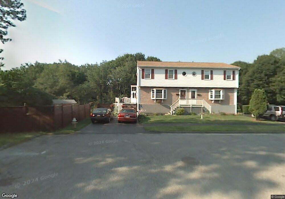
5 Kermit Rd Unit 5 Worcester, MA 01603
Webster Square NeighborhoodEstimated Value: $361,000 - $422,000
2
Beds
3
Baths
1,427
Sq Ft
$272/Sq Ft
Est. Value
About This Home
This home is located at 5 Kermit Rd Unit 5, Worcester, MA 01603 and is currently estimated at $388,261, approximately $272 per square foot. 5 Kermit Rd Unit 5 is a home located in Worcester County with nearby schools including Gates Lane, Jacob Hiatt Magnet School, and Chandler Magnet.
Ownership History
Date
Name
Owned For
Owner Type
Purchase Details
Closed on
Apr 9, 2018
Sold by
Delvalle Josephine
Bought by
Josephine Delvalle Ret and Delvalle
Current Estimated Value
Purchase Details
Closed on
Mar 31, 2016
Sold by
Benoit-Mccormick Helen
Bought by
Delvalle Josephine
Home Financials for this Owner
Home Financials are based on the most recent Mortgage that was taken out on this home.
Original Mortgage
$165,000
Interest Rate
3.65%
Mortgage Type
VA
Purchase Details
Closed on
Apr 4, 1988
Sold by
Gelardi Charles A
Bought by
Mccormick J E
Create a Home Valuation Report for This Property
The Home Valuation Report is an in-depth analysis detailing your home's value as well as a comparison with similar homes in the area
Home Values in the Area
Average Home Value in this Area
Purchase History
| Date | Buyer | Sale Price | Title Company |
|---|---|---|---|
| Josephine Delvalle Ret | -- | -- | |
| Josephine Delvalle Ret | -- | -- | |
| Delvalle Josephine | $165,000 | -- | |
| Mccormick J E | $98,000 | -- |
Source: Public Records
Mortgage History
| Date | Status | Borrower | Loan Amount |
|---|---|---|---|
| Previous Owner | Delvalle Josephine | $165,000 | |
| Previous Owner | Mccormick J E | $60,000 | |
| Previous Owner | Mccormick J E | $19,000 | |
| Closed | Mccormick J E | $0 |
Source: Public Records
Tax History Compared to Growth
Tax History
| Year | Tax Paid | Tax Assessment Tax Assessment Total Assessment is a certain percentage of the fair market value that is determined by local assessors to be the total taxable value of land and additions on the property. | Land | Improvement |
|---|---|---|---|---|
| 2025 | $4,334 | $328,600 | $92,400 | $236,200 |
| 2024 | $4,135 | $300,700 | $92,400 | $208,300 |
| 2023 | $3,921 | $273,400 | $80,300 | $193,100 |
| 2022 | $3,529 | $232,000 | $64,200 | $167,800 |
| 2021 | $3,310 | $203,300 | $51,400 | $151,900 |
| 2020 | $3,267 | $192,200 | $51,000 | $141,200 |
| 2019 | $3,119 | $173,300 | $44,500 | $128,800 |
| 2018 | $3,133 | $165,700 | $44,500 | $121,200 |
| 2017 | $2,973 | $154,700 | $44,500 | $110,200 |
| 2016 | $2,805 | $136,100 | $32,300 | $103,800 |
| 2015 | $2,732 | $136,100 | $32,300 | $103,800 |
| 2014 | $2,659 | $136,100 | $32,300 | $103,800 |
Source: Public Records
Map
Nearby Homes
- 128 Wildwood Ave
- 15 Teddy Rd
- 76 Parsons Hill Dr Unit A
- 19 Monticello Dr
- 25 Wyola Dr
- 11 Timrod Dr
- 26 Sylvan St
- 13 Merchant St
- 57 1st St
- 34 Scandinavia Ave
- 1511 Main St Unit C405
- 1511 Main St Unit C306
- 170 Stafford St
- 47 4th St
- 45 Fourth St
- 45 Fourth St Unit Right
- 29 Passway 5
- 35 Genessee St Unit I
- 23 Lakewood St
- 5 Swan Ave
- 5 Kermit Rd
- 3 Kermit Rd
- 3 Kermit Rd Unit 1
- 118 Wildwood Ave
- 7 Laurel Brook Dr
- 102 Wildwood Ave
- 102 Wildwood Ave Unit 1
- 5 Laurel Brook Dr
- 5 Laurel Brook Dr
- 116 Wildwood Ave
- 96 Wildwood Ave
- 3 Laurel Brook Dr
- 1 Monticello Dr W
- 8 Oak Leaf Cir
- 10 Oak Leaf Cir
- 6 Oak Leaf Cir
- 1 Laurel Brook Dr
- 95 Wildwood Ave
- 93 Wildwood Ave
- 99 Wildwood Ave