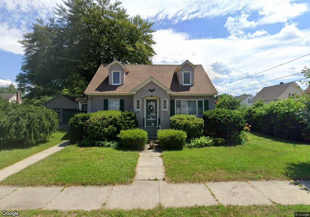
5 King St Unit 101 Nashua, NH 03060
Downtown Nashua NeighborhoodEstimated Value: $436,000 - $473,711
3
Beds
2
Baths
1,320
Sq Ft
$345/Sq Ft
Est. Value
About This Home
This home is located at 5 King St Unit 101, Nashua, NH 03060 and is currently estimated at $455,178, approximately $344 per square foot. 5 King St Unit 101 is a home located in Hillsborough County with nearby schools including Dr. Norman W. Crisp Elementary School, Elm Street Middle School, and Nashua High School North.
Ownership History
Date
Name
Owned For
Owner Type
Purchase Details
Closed on
Nov 29, 2012
Sold by
Kelson Barbara R
Bought by
B Romaine Kelson Ret and Kelson
Current Estimated Value
Create a Home Valuation Report for This Property
The Home Valuation Report is an in-depth analysis detailing your home's value as well as a comparison with similar homes in the area
Home Values in the Area
Average Home Value in this Area
Purchase History
| Date | Buyer | Sale Price | Title Company |
|---|---|---|---|
| B Romaine Kelson Ret | -- | -- | |
| B Romaine Kelson Ret | -- | -- |
Source: Public Records
Mortgage History
| Date | Status | Borrower | Loan Amount |
|---|---|---|---|
| Open | B Romaine Kelson Ret | $169,700 | |
| Previous Owner | B Romaine Kelson Ret | $135,000 | |
| Previous Owner | B Romaine Kelson Ret | $20,000 |
Source: Public Records
Tax History Compared to Growth
Tax History
| Year | Tax Paid | Tax Assessment Tax Assessment Total Assessment is a certain percentage of the fair market value that is determined by local assessors to be the total taxable value of land and additions on the property. | Land | Improvement |
|---|---|---|---|---|
| 2024 | $6,888 | $433,200 | $170,600 | $262,600 |
| 2023 | $6,470 | $354,900 | $126,600 | $228,300 |
| 2022 | $6,413 | $354,900 | $126,600 | $228,300 |
| 2021 | $6,209 | $267,400 | $84,400 | $183,000 |
| 2020 | $6,046 | $267,400 | $84,400 | $183,000 |
| 2019 | $5,819 | $267,400 | $84,400 | $183,000 |
| 2018 | $5,342 | $267,400 | $84,400 | $183,000 |
| 2017 | $9,635 | $212,500 | $77,100 | $135,400 |
| 2016 | $5,327 | $212,500 | $77,100 | $135,400 |
| 2015 | $5,213 | $212,500 | $77,100 | $135,400 |
| 2014 | $5,111 | $212,500 | $77,100 | $135,400 |
Source: Public Records
Map
Nearby Homes
- 65 Allds St
- 2 Lyons St
- 1 Circle Ave
- 13 Mulvanity St
- 24 E Otterson St
- 18 Harbor Ave Unit 208
- 27 Fifield St Unit 13
- 76 Gillis St
- 15 Lovell St Unit 3
- 15 Lovell St Unit 7
- 15 Lovell St Unit 10
- 5 Mulberry St
- 4 Chase St
- 8 Buck St Unit 10
- 22 Wilder St
- 38 Central St
- 10 Cedar St
- 36 Eastman St Unit 26
- 7 Hickory St
- 6 Hayden St
- 7 King St Unit 96A99A
- 3 King St Unit 5
- 3 King St
- 10 King St Unit 51
- 1 King St
- 77 Underhill St
- 1 Barker Ave
- 7 Barker Ave Unit 7
- 14 King St
- 55 Allds St Unit 494
- 14A King St
- 10 Barker Ave
- 22 1/2 Haines St
- 2-2 1/2, L Haines St
- 74 Underhill St
- 9 Barker Ave Unit 9
- 16 King St Unit 94
- 15 King St Unit 90A
- 73 Underhill St
- 49 Allds St