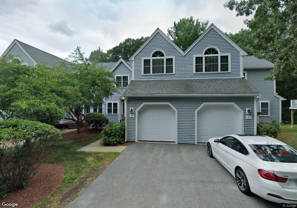
5 Knollwood Ct Burlington, MA 01803
Burlington Town Center NeighborhoodEstimated Value: $853,934 - $1,012,000
2
Beds
3
Baths
1,353
Sq Ft
$670/Sq Ft
Est. Value
About This Home
This home is located at 5 Knollwood Ct, Burlington, MA 01803 and is currently estimated at $906,234, approximately $669 per square foot. 5 Knollwood Ct is a home located in Middlesex County with nearby schools including Burlington High School, Marshall Simonds Middle School, and Mount Hope Christian School.
Ownership History
Date
Name
Owned For
Owner Type
Purchase Details
Closed on
May 28, 2019
Sold by
Hsu Ruchu and Hsu Janet
Bought by
Hsu Janet
Current Estimated Value
Purchase Details
Closed on
Dec 10, 2010
Sold by
5 Knollwood Court Rt
Bought by
Hsu Ruchu and Hsu Janet
Purchase Details
Closed on
Apr 22, 2004
Sold by
Lawson Ralph M
Bought by
5 Knollwood Court Rt
Create a Home Valuation Report for This Property
The Home Valuation Report is an in-depth analysis detailing your home's value as well as a comparison with similar homes in the area
Home Values in the Area
Average Home Value in this Area
Purchase History
| Date | Buyer | Sale Price | Title Company |
|---|---|---|---|
| Hsu Janet | -- | -- | |
| Hsu Ruchu | $373,500 | -- | |
| 5 Knollwood Court Rt | -- | -- |
Source: Public Records
Tax History Compared to Growth
Tax History
| Year | Tax Paid | Tax Assessment Tax Assessment Total Assessment is a certain percentage of the fair market value that is determined by local assessors to be the total taxable value of land and additions on the property. | Land | Improvement |
|---|---|---|---|---|
| 2025 | $6,902 | $797,000 | $0 | $797,000 |
| 2024 | $6,191 | $692,500 | $0 | $692,500 |
| 2023 | $6,075 | $646,300 | $0 | $646,300 |
| 2022 | $5,515 | $554,300 | $0 | $554,300 |
| 2021 | $5,515 | $554,300 | $0 | $554,300 |
| 2020 | $5,343 | $554,300 | $0 | $554,300 |
| 2019 | $4,956 | $472,900 | $0 | $472,900 |
| 2018 | $5,022 | $472,900 | $0 | $472,900 |
| 2017 | $5,457 | $472,900 | $0 | $472,900 |
| 2016 | $5,372 | $468,800 | $0 | $468,800 |
| 2015 | $5,136 | $452,500 | $0 | $452,500 |
| 2014 | $5,108 | $425,700 | $0 | $425,700 |
Source: Public Records
Map
Nearby Homes
- 6 Kendal Dr
- 23 Ward St Unit A
- 16 Sunnyside Rd
- 6 Tidd Ave
- 6R & 6 Tidd Ave
- 846 Main St
- 210 Winn St
- 4 Ardmore Ave
- 29 Grove Ln Unit 29
- 26 E Dexter Ave
- 29 Overlook Ave
- 45 Merrimac St Unit 30 AKA 13A
- 50 Hill Cir
- 21 Spring Valley Rd
- 20 Barbara Cir
- 38 Freeport Dr
- 129 Cambridge St Unit 1
- 18 Hamilton Rd
- 6 Callahan Dr
- 104 Forest Park Rd
- 7 Knollwood Ct
- 1 Knollwood Ct
- 3 Knollwood Ct
- 11 Knollwood Ct Unit 12
- 13 Knollwood Ct
- 11 Knollwood Ct
- 11 Knollwood Ct Unit 11
- 10 Knollwood Ct
- 6 Knollwood Ct
- 4 Knollwood Ct
- 2 Knollwood Ct
- 6 Knollwood Ct Unit 6
- 25 Greystone Ct
- 23 Greystone Ct
- 21 Greystone Ct
- 19 Greystone Ct
- 17 Greystone Ct
- 21 Greystone Ct Unit 21
- 18 Knollwood Ct
- 16 Knollwood Ct