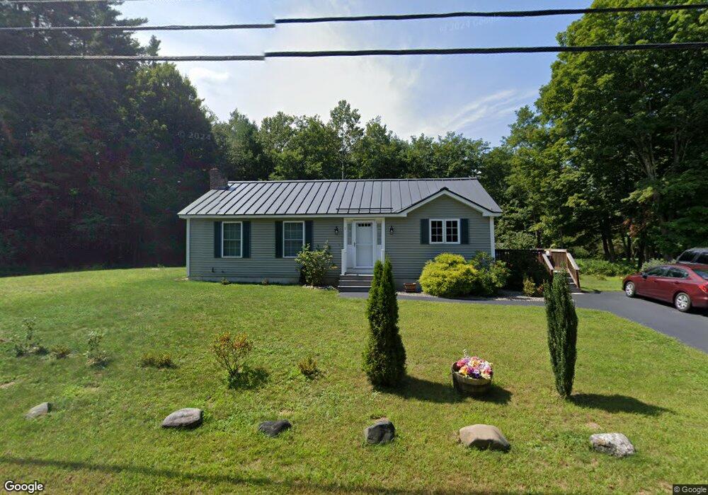
5 Ladd Rd Brentwood, NH 03833
Estimated Value: $418,000 - $491,000
2
Beds
1
Bath
1,092
Sq Ft
$429/Sq Ft
Est. Value
About This Home
This home is located at 5 Ladd Rd, Brentwood, NH 03833 and is currently estimated at $468,907, approximately $429 per square foot. 5 Ladd Rd is a home with nearby schools including Swasey Central School, Cooperative Middle School, and Exeter High School.
Ownership History
Date
Name
Owned For
Owner Type
Purchase Details
Closed on
Oct 8, 2003
Sold by
Sultaire Olive M
Bought by
Whitney Shelly
Current Estimated Value
Home Financials for this Owner
Home Financials are based on the most recent Mortgage that was taken out on this home.
Original Mortgage
$85,600
Interest Rate
6.35%
Create a Home Valuation Report for This Property
The Home Valuation Report is an in-depth analysis detailing your home's value as well as a comparison with similar homes in the area
Home Values in the Area
Average Home Value in this Area
Purchase History
| Date | Buyer | Sale Price | Title Company |
|---|---|---|---|
| Whitney Shelly | $107,000 | -- |
Source: Public Records
Mortgage History
| Date | Status | Borrower | Loan Amount |
|---|---|---|---|
| Open | Whitney Shelly | $109,000 | |
| Open | Whitney Shelly | $174,600 | |
| Closed | Whitney Shelly | $211,000 | |
| Closed | Whitney Shelly | $85,600 |
Source: Public Records
Tax History Compared to Growth
Tax History
| Year | Tax Paid | Tax Assessment Tax Assessment Total Assessment is a certain percentage of the fair market value that is determined by local assessors to be the total taxable value of land and additions on the property. | Land | Improvement |
|---|---|---|---|---|
| 2024 | $7,209 | $286,400 | $105,500 | $180,900 |
| 2023 | $6,739 | $286,400 | $105,500 | $180,900 |
| 2022 | $6,344 | $286,400 | $105,500 | $180,900 |
| 2021 | $6,370 | $286,400 | $105,500 | $180,900 |
| 2020 | $6,642 | $286,400 | $105,500 | $180,900 |
| 2019 | $6,293 | $227,200 | $81,900 | $145,300 |
| 2018 | $5,869 | $227,200 | $81,900 | $145,300 |
| 2017 | $5,632 | $227,200 | $81,900 | $145,300 |
| 2016 | $5,510 | $227,200 | $81,900 | $145,300 |
| 2015 | $5,271 | $227,200 | $81,900 | $145,300 |
| 2013 | $5,445 | $228,000 | $74,500 | $153,500 |
Source: Public Records
Map
Nearby Homes
- 4 Kennedy Cir
- 14 River Rd
- 13 Edgewater Dr Unit 24
- 17 Edgewater Dr Unit 26
- Lot G Longview Place
- 18 Edgewater Dr Unit 33
- 23 Edgewater Dr Unit 29
- 16 Edgewater Dr Unit 34
- 25 Edgewater Dr
- 14 Edgewater Dr Unit 31
- 24 Edgewater Dr
- 21 Edgewater Dr
- 11 Edgewater Dr Unit 23
- 26 Edgewater Dr
- 15 Edgewater Dr
- 30 Edgewater Dr
- 19 Edgewater Dr Unit 27
- 316 South Rd
- 8 Stone Creek Dr
- Lot A Longview Place
- 8 Ladd Rd
- 392 South Rd
- 1 Ladd Rd
- 390 South Rd
- 10 Ladd Rd
- 396 South Rd
- 9 Ladd Rd
- 393 South Rd
- 386 South Rd
- 389 South Rd
- 400 South Rd
- 13 Ladd Rd
- 14 Ladd Rd
- 49 Route 107
- 399 South Rd
- 402 South Rd Unit 30
- 18 Ladd Rd
- 42 Mill Pond Rd Unit AKA 42 Forest Lane
- 42 Mill Pond Rd Unit AKA 42 Forest Lane
- 31 Route 107