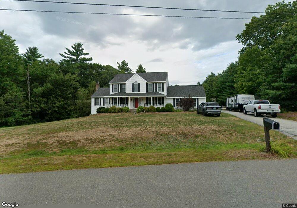
5 Lancy Brook Rd Brookline, NH 03033
Estimated Value: $725,883 - $847,000
4
Beds
4
Baths
3,084
Sq Ft
$254/Sq Ft
Est. Value
About This Home
This home is located at 5 Lancy Brook Rd, Brookline, NH 03033 and is currently estimated at $783,721, approximately $254 per square foot. 5 Lancy Brook Rd is a home with nearby schools including Richard Maghakian Memorial School, Captain Samuel Douglass Academy, and Hollis-Brookline Middle School.
Ownership History
Date
Name
Owned For
Owner Type
Purchase Details
Closed on
Dec 22, 2017
Sold by
Hawkinson Douglas J and Hawkinson Joyce V
Bought by
Hawkinson Ft
Current Estimated Value
Purchase Details
Closed on
Aug 14, 2008
Sold by
Albert William A and Albert Kristine L
Bought by
Hawkinson Douglas John and Hawkinson Joyce Vivian
Home Financials for this Owner
Home Financials are based on the most recent Mortgage that was taken out on this home.
Original Mortgage
$365,180
Interest Rate
6.4%
Mortgage Type
Purchase Money Mortgage
Purchase Details
Closed on
Oct 7, 2004
Sold by
Glendale Homes Inc
Bought by
Albert William A and Albert Kristine L
Home Financials for this Owner
Home Financials are based on the most recent Mortgage that was taken out on this home.
Original Mortgage
$292,800
Interest Rate
5.84%
Mortgage Type
Purchase Money Mortgage
Create a Home Valuation Report for This Property
The Home Valuation Report is an in-depth analysis detailing your home's value as well as a comparison with similar homes in the area
Home Values in the Area
Average Home Value in this Area
Purchase History
| Date | Buyer | Sale Price | Title Company |
|---|---|---|---|
| Hawkinson Ft | -- | -- | |
| Hawkinson Douglas John | $370,000 | -- | |
| Albert William A | $366,000 | -- |
Source: Public Records
Mortgage History
| Date | Status | Borrower | Loan Amount |
|---|---|---|---|
| Previous Owner | Albert William A | $370,193 | |
| Previous Owner | Albert William A | $365,180 | |
| Previous Owner | Albert William A | $292,800 |
Source: Public Records
Tax History Compared to Growth
Tax History
| Year | Tax Paid | Tax Assessment Tax Assessment Total Assessment is a certain percentage of the fair market value that is determined by local assessors to be the total taxable value of land and additions on the property. | Land | Improvement |
|---|---|---|---|---|
| 2024 | $15,533 | $687,000 | $228,000 | $459,000 |
| 2023 | $13,962 | $671,900 | $228,000 | $443,900 |
| 2022 | $12,179 | $409,800 | $137,300 | $272,500 |
| 2021 | $11,712 | $409,800 | $137,300 | $272,500 |
| 2020 | $11,392 | $409,800 | $137,300 | $272,500 |
| 2019 | $12,241 | $409,800 | $137,300 | $272,500 |
| 2018 | $12,114 | $409,800 | $137,300 | $272,500 |
| 2017 | $10,626 | $322,600 | $111,000 | $211,600 |
| 2016 | $10,504 | $322,600 | $111,000 | $211,600 |
| 2015 | $10,017 | $322,600 | $111,000 | $211,600 |
| 2014 | $10,597 | $322,600 | $111,000 | $211,600 |
| 2013 | $10,039 | $317,400 | $111,000 | $206,400 |
Source: Public Records
Map
Nearby Homes
- 38 Countryside Dr
- 3 Ben Farnsworth Rd
- 104 N Mason Rd
- 9 Winterberry Rd
- 7 Winterberry Rd
- 59 Cleveland Hill Rd
- 5 Carons Way
- 1235 Townsend Rd
- 22 Hobart Hill Rd
- 8 Colburn Rd
- 301 Mile Slip Rd
- 6 Laurelcrest Dr
- 81 Badger Hill Dr
- 131 Badger Hill Dr
- 303 Route 13
- 75 Merriam Hill Rd
- 4 Bohanon Bridge Rd
- 1275 Valley Rd
- 18 Sawtelle Rd
- 47 Pepperell Rd
- 3 Lancy Brook Rd
- 4 Lancy Brook Rd
- 6 Lancy Brook Rd
- 1 Lancy Brook Rd
- 22 Pigeon Hill Rd
- 28 Pigeon Hill Rd
- 23 Pigeon Hill Rd
- 19 Pigeon Hill Rd
- 27 Pigeon Hill Rd
- 21 Pigeon Hill Rd
- 17 Pigeon Hill Rd
- 91 Mason Rd
- 15 Pigeon Hill Rd
- 12 Pigeon Hill Rd
- 97 Mason Rd
- 97 Babb Meadow Ln
- 18 Conneck Rd
- 87 Babb Meadow Ln
- 93 Mason Rd
- 85 Mason Rd