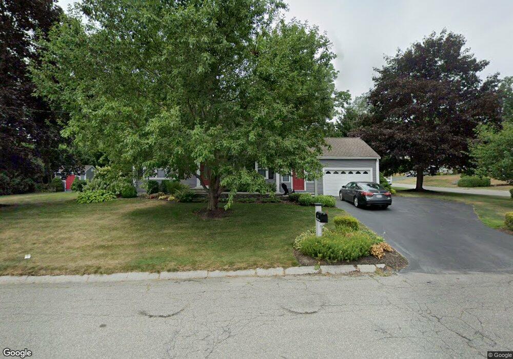
5 Larson Rd Milford, MA 01757
Milford AreaEstimated Value: $610,906 - $672,000
About This Home
This home is located at 5 Larson Rd, Milford, MA 01757 and is currently estimated at $631,727, approximately $320 per square foot. 5 Larson Rd is a home located in Worcester County with nearby schools including Milford High School and Bethany Christian Academy.
Ownership History
We collect this data history from publicly available records. To have your information removed, we recommend requesting removal directly through your county’s website.
Purchase Details
Purchase Details
Home Values in the Area
Average Home Value in this Area
Purchase History
We collect this data history from publicly available records. To have your information removed, we recommend requesting removal directly through your county’s website.
| Date | Buyer | Sale Price | Title Company |
|---|---|---|---|
| -- | -- | ||
| -- | -- |
Mortgage History
We collect this data history from publicly available records. To have your information removed, we recommend requesting removal directly through your county’s website.
| Date | Status | Borrower | Loan Amount |
|---|---|---|---|
| Previous Owner | $200,000 | ||
| Previous Owner | $65,000 | ||
| Previous Owner | $15,000 | ||
| Closed | $225,000 |
Tax History
We collect this data history from publicly available records. To have your information removed, we recommend requesting removal directly through your county’s website.
| Year | Tax Paid | Tax Assessment Tax Assessment Total Assessment is a certain percentage of the fair market value that is determined by local assessors to be the total taxable value of land and additions on the property. | Land | Improvement |
|---|---|---|---|---|
| 2025 | $6,755 | $527,700 | $185,300 | $342,400 |
| 2024 | $6,677 | $502,400 | $177,900 | $324,500 |
| 2023 | $6,331 | $438,100 | $153,800 | $284,300 |
| 2022 | $5,976 | $388,300 | $140,800 | $247,500 |
| 2021 | $5,706 | $357,100 | $140,800 | $216,300 |
| 2020 | $5,640 | $353,400 | $140,800 | $212,600 |
| 2019 | $5,526 | $334,100 | $140,800 | $193,300 |
| 2018 | $5,471 | $330,400 | $137,100 | $193,300 |
| 2017 | $5,363 | $319,400 | $137,100 | $182,300 |
| 2016 | $5,285 | $307,600 | $137,100 | $170,500 |
| 2015 | $5,168 | $294,500 | $129,700 | $164,800 |
Map
- 19 Lantern Ln
- 102 Purchase St
- 12 Edgewood Dr
- 85 Purchase St
- 6 Dilla St
- 146 Purchase St
- 12 Sunset Dr
- 16 Jionzo Rd
- 59 Purchase St
- 37 Jillson Cir
- 190 Congress St
- 9 Packard Rd
- 217 Congress St
- 2 Walker Ave
- 23 Shadowbrook Ln Unit 10
- 16 Shadowbrook Ln Unit 14
- 16 Shadowbrook Ln Unit 33
- 17 Bandy Ln
- 50 Sunset Dr
- 46 W Fountain St
Ask me questions while you tour the home.