B
Seller's Agent in 2025
Brian Jarrett
Taylor Agency
(413) 527-3375
38 in this area
123 Total Sales
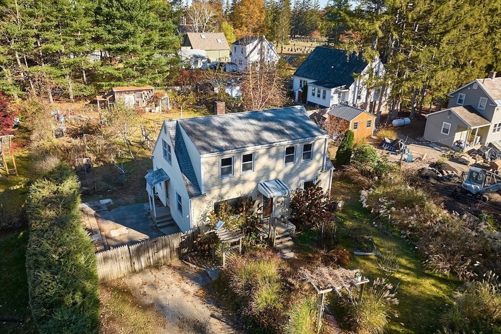


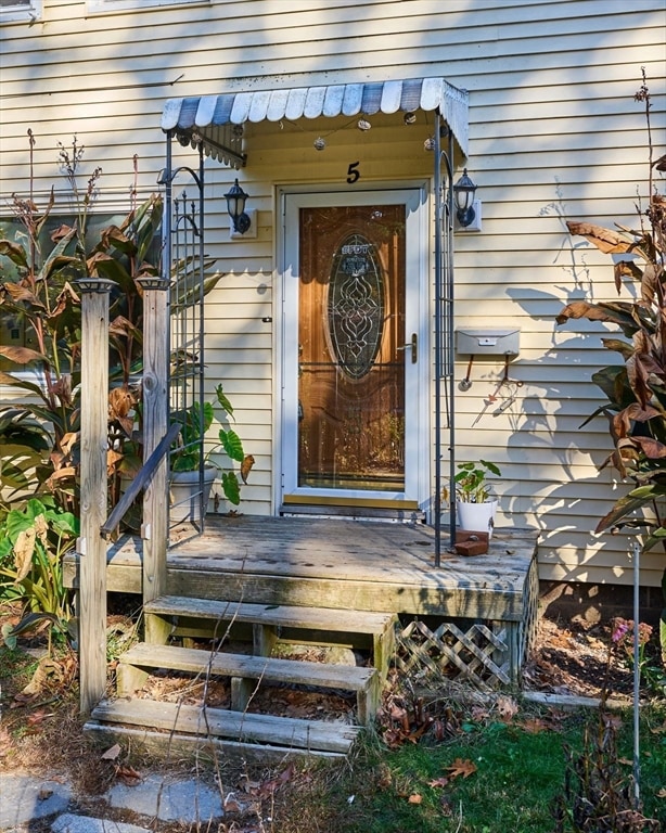

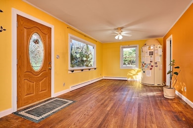
This 1400 square foot Cape style home is PERFECTLY SITUATED just steps away from Nonotuck Park where you can enjoy basketball, tennis & pickleball courts, play grounds, soccer fields, scenic walking trails, a pool and a spray park. Plus you're only about a 1/2 mile from Easthampton's vibrant downtown, filled with restaurants & shops!! Home has seen many important updates over the years with the roof, siding, windows & exterior doors done about 15 years ago and the kitchen had a complete remodel done about 10 years ago. Other great features include nice rear yard space, hardwood flooring, 1st floor bedroom and a partially finished basement.
Last Buyer's Agent
Kristine Cook
Real Broker MA, LLC
| Date | Type | Sale Price | Title Company |
|---|---|---|---|
| Deed | $325,000 | -- | |
| Quit Claim Deed | -- | -- | |
| Deed | -- | -- | |
| Deed | $103,000 | -- | |
| Deed | $103,000 | -- |
| Date | Status | Loan Amount | Loan Type |
|---|---|---|---|
| Open | $260,000 | New Conventional | |
| Previous Owner | $150,035 | FHA | |
| Previous Owner | $35,000 | Purchase Money Mortgage | |
| Previous Owner | $131,000 | No Value Available |
| Date | Event | Price | List to Sale | Price per Sq Ft |
|---|---|---|---|---|
| 12/30/2025 12/30/25 | Sold | $325,000 | -4.4% | $235 / Sq Ft |
| 11/23/2025 11/23/25 | Pending | -- | -- | -- |
| 11/17/2025 11/17/25 | Price Changed | $339,900 | -2.9% | $246 / Sq Ft |
| 10/28/2025 10/28/25 | For Sale | $349,900 | -- | $253 / Sq Ft |
| Year | Tax Paid | Tax Assessment Tax Assessment Total Assessment is a certain percentage of the fair market value that is determined by local assessors to be the total taxable value of land and additions on the property. | Land | Improvement |
|---|---|---|---|---|
| 2025 | $4,128 | $302,000 | $108,100 | $193,900 |
| 2024 | $3,984 | $293,800 | $104,900 | $188,900 |
| 2023 | $3,003 | $205,000 | $82,600 | $122,400 |
| 2022 | $3,389 | $205,000 | $82,600 | $122,400 |
| 2021 | $3,727 | $212,500 | $82,600 | $129,900 |
| 2020 | $3,641 | $205,000 | $82,600 | $122,400 |
| 2019 | $3,053 | $197,500 | $82,600 | $114,900 |
| 2018 | $2,944 | $184,000 | $77,900 | $106,100 |
| 2017 | $2,872 | $177,200 | $74,900 | $102,300 |
| 2016 | $2,895 | $185,700 | $74,900 | $110,800 |
| 2015 | $2,813 | $185,700 | $74,900 | $110,800 |
B
Seller's Agent in 2025
Brian Jarrett
Taylor Agency
(413) 527-3375
38 in this area
123 Total Sales
K
Buyer's Agent in 2025
Kristine Cook
Real Broker MA, LLC
Source: MLS Property Information Network (MLS PIN)
MLS Number: 73448464
APN: EHAM-000156-000073
Disclaimer: Certain information contained herein is derived from information provided by parties other than Homes.com. All information provided is deemed reliable, but is not guaranteed to be accurate and should be independently verified.
![]() The property listing data and information, or the Images, set forth herein were provided to MLS Property Information Network, Inc. from third party sources, including sellers, lessors and public records, and were compiled by MLS Property Information Network, Inc. The property listing data and information, and the Images, are for the personal, non-commercial use of consumers having a good faith interest in purchasing or leasing listed properties of the type displayed to them and may not be used for any purpose other than to identify prospective properties which such consumers may have a good faith interest in purchasing or leasing. MLS Property Information Network, Inc. and its subscribers disclaim any and all representations and warranties as to the accuracy of the property listing data and information, or as to the accuracy of any of the Images, set forth herein.
The property listing data and information, or the Images, set forth herein were provided to MLS Property Information Network, Inc. from third party sources, including sellers, lessors and public records, and were compiled by MLS Property Information Network, Inc. The property listing data and information, and the Images, are for the personal, non-commercial use of consumers having a good faith interest in purchasing or leasing listed properties of the type displayed to them and may not be used for any purpose other than to identify prospective properties which such consumers may have a good faith interest in purchasing or leasing. MLS Property Information Network, Inc. and its subscribers disclaim any and all representations and warranties as to the accuracy of the property listing data and information, or as to the accuracy of any of the Images, set forth herein.
Ask me questions while you tour the home.
