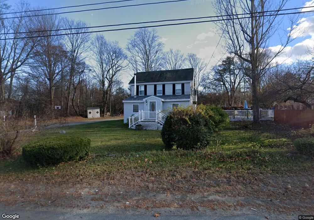
5 Main St Salisbury, MA 01952
Estimated Value: $488,000 - $598,000
3
Beds
2
Baths
1,426
Sq Ft
$378/Sq Ft
Est. Value
About This Home
This home is located at 5 Main St, Salisbury, MA 01952 and is currently estimated at $538,505, approximately $377 per square foot. 5 Main St is a home located in Essex County with nearby schools including Triton Regional High School.
Ownership History
Date
Name
Owned For
Owner Type
Purchase Details
Closed on
Mar 3, 2020
Sold by
Trudel Joseph and Trudel Sheri
Bought by
Trudel Sheri and Tulliani Joseph
Current Estimated Value
Purchase Details
Closed on
Oct 4, 2004
Sold by
Backlund David G and Backlund Sharon L
Bought by
Trudel Joseph and Trudel Sheri
Home Financials for this Owner
Home Financials are based on the most recent Mortgage that was taken out on this home.
Original Mortgage
$184,000
Interest Rate
5.81%
Mortgage Type
Purchase Money Mortgage
Create a Home Valuation Report for This Property
The Home Valuation Report is an in-depth analysis detailing your home's value as well as a comparison with similar homes in the area
Home Values in the Area
Average Home Value in this Area
Purchase History
| Date | Buyer | Sale Price | Title Company |
|---|---|---|---|
| Trudel Sheri | -- | None Available | |
| Trudel Joseph | $230,000 | -- |
Source: Public Records
Mortgage History
| Date | Status | Borrower | Loan Amount |
|---|---|---|---|
| Previous Owner | Trudel Joseph | $238,500 | |
| Previous Owner | Trudel Joseph | $184,000 |
Source: Public Records
Tax History
| Year | Tax Paid | Tax Assessment Tax Assessment Total Assessment is a certain percentage of the fair market value that is determined by local assessors to be the total taxable value of land and additions on the property. | Land | Improvement |
|---|---|---|---|---|
| 2025 | $3,727 | $369,700 | $165,200 | $204,500 |
| 2024 | $3,746 | $358,500 | $165,200 | $193,300 |
| 2023 | $3,687 | $341,400 | $165,200 | $176,200 |
| 2022 | $3,251 | $291,800 | $148,700 | $143,100 |
| 2021 | $3,161 | $280,700 | $148,700 | $132,000 |
| 2020 | $3,004 | $262,100 | $148,700 | $113,400 |
| 2019 | $2,984 | $251,600 | $144,600 | $107,000 |
| 2018 | $2,797 | $237,400 | $134,600 | $102,800 |
| 2017 | $2,612 | $219,100 | $123,900 | $95,200 |
| 2016 | $2,466 | $211,300 | $119,800 | $91,500 |
| 2015 | $2,463 | $209,600 | $111,500 | $98,100 |
Source: Public Records
Map
Nearby Homes
- 241 & 245 Lafayette Rd
- 35 Brooks Rd Unit 1
- 6 Janvrin Dr
- 6 Forest Dr
- 188 Lafayette Rd
- 151 Walton Rd
- 167 Staples St
- 4 Woodland Ave
- 176 Lower Collins St
- 7 Toll Rd
- 69 Nashville St
- 154 Lafayette Rd
- 25 Bayberry Ln
- 47 Scott Ave
- 42 Kendell Ln
- 19 Viola Cir
- 6 Mason Ln
- 35 New Zealand Rd
- 64 Seabrook Rd
- 44 Seabrook Rd
- 7 Main St
- 1 Main St
- 6 Main St
- 9 Main St
- 6 Smiths Ln Unit 7
- 6 Smiths Ln
- 6 Smiths Ln Unit 12-14
- 6 Smiths Ln Unit 16 - 18
- 11 Main St
- 25 Us-1 Unit 1,3,25
- 5 Main St
- 3 Lafayette Rd
- 15 Main St Unit 212
- 15 Main St Unit 210
- 15 Main St Unit 208 Gym
- 15 Main St Unit 204/206
- 15 Main St Unit 105
- 15 Main St Unit 103
- 15 Main St Unit 102
- 15 Main St Unit 101
Your Personal Tour Guide
Ask me questions while you tour the home.