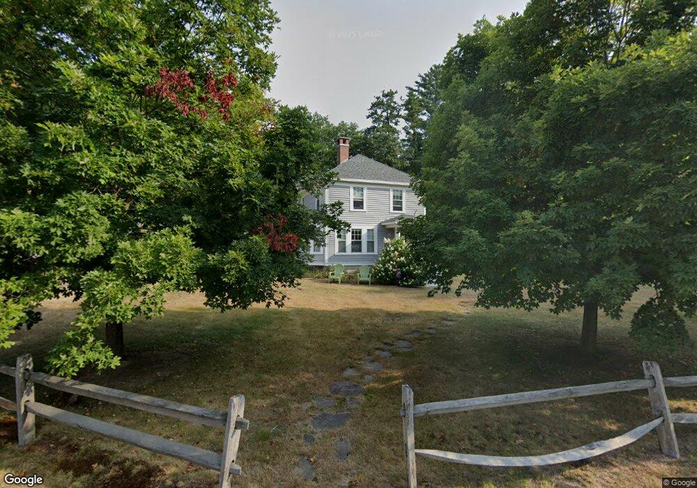
5 Mason Rd North Conway, NH 03860
Estimated Value: $458,951 - $538,000
3
Beds
2
Baths
1,228
Sq Ft
$402/Sq Ft
Est. Value
About This Home
This home is located at 5 Mason Rd, North Conway, NH 03860 and is currently estimated at $493,738, approximately $402 per square foot. 5 Mason Rd is a home with nearby schools including A. Crosby Kennett Middle School, Kennett High School, and The Lilliputian School.
Ownership History
Date
Name
Owned For
Owner Type
Purchase Details
Closed on
Mar 19, 2007
Sold by
Casinelli Julius Anthony
Bought by
Jones Roger A and Jones Deborah J
Current Estimated Value
Home Financials for this Owner
Home Financials are based on the most recent Mortgage that was taken out on this home.
Original Mortgage
$180,000
Outstanding Balance
$109,784
Interest Rate
6.4%
Estimated Equity
$383,954
Create a Home Valuation Report for This Property
The Home Valuation Report is an in-depth analysis detailing your home's value as well as a comparison with similar homes in the area
Home Values in the Area
Average Home Value in this Area
Purchase History
| Date | Buyer | Sale Price | Title Company |
|---|---|---|---|
| Jones Roger A | $160,000 | -- | |
| Jones Roger A | $160,000 | -- |
Source: Public Records
Mortgage History
| Date | Status | Borrower | Loan Amount |
|---|---|---|---|
| Open | Jones Roger A | $180,000 | |
| Closed | Jones Roger A | $180,000 |
Source: Public Records
Tax History Compared to Growth
Tax History
| Year | Tax Paid | Tax Assessment Tax Assessment Total Assessment is a certain percentage of the fair market value that is determined by local assessors to be the total taxable value of land and additions on the property. | Land | Improvement |
|---|---|---|---|---|
| 2024 | $5,480 | $434,900 | $173,300 | $261,600 |
| 2023 | $4,984 | $434,900 | $173,300 | $261,600 |
| 2022 | $3,911 | $203,900 | $86,300 | $117,600 |
| 2021 | $3,332 | $203,900 | $86,300 | $117,600 |
| 2020 | $3,807 | $203,900 | $86,300 | $117,600 |
| 2019 | $3,272 | $188,900 | $71,300 | $117,600 |
| 2018 | $3,729 | $168,500 | $71,300 | $97,200 |
| 2017 | $3,367 | $168,500 | $71,300 | $97,200 |
| 2016 | $3,254 | $168,500 | $71,300 | $97,200 |
| 2015 | $3,217 | $168,500 | $71,300 | $97,200 |
| 2014 | $3,178 | $168,500 | $71,300 | $97,200 |
| 2013 | $3,038 | $170,100 | $71,300 | $98,800 |
Source: Public Records
Map
Nearby Homes
- 2760 New Hampshire 16 Unit E008A Week 29
- 2906 White Mountain Hwy
- 2955 White Mountain Hwy Unit 106 (W5)
- 2955 White Mountain Hwy Unit 123 (E20)
- 2955 White Mountain Hwy Unit 204 W28
- 2955 White Mountain Hwy Unit 114 (W25)
- 2955 White Mountain Hwy Unit 207 (W-31)
- 3002 White Mountain Hwy Unit Lots 29 and 30 - 300
- 137 Skimobile Rd Unit 3
- 11 Black Diamond Rd Unit 3
- 7 Black Diamond Rd Unit 2
- 15 Black Diamond Rd Unit 4
- 17 Purple Finch Rd Unit 73
- 168 Old Bartlett Rd Unit A
- 243 Skimobile Rd Unit 352
- 243 Skimobile Rd Unit 252
- 243 Skimobile Rd Unit 355
- 243 Skimobile Rd Unit 255
- 00 Artist Falls Rd
- 235 Skimobile Rd Unit 1404
- 12 Mason Rd
- 6 Mason Rd
- 84 Pine St
- 76 Pine St
- 27 Mason Rd
- 44 Pine St
- 99 Pine St #3 St
- 20 Mason Rd
- 99 Pine St Unit 2
- 99 Pine St Unit 3
- 48 Crawford Hollow
- 30 Mason Rd
- 31 Mason Rd
- 106 Pine St
- 26 Mason Rd
- 36 Mason Rd
- 109 Pine St
- 32 Mason Rd
- 2779 White Mountain Hwy Unit "Library"
- 2779 White Mountain Hwy Unit Projector Room