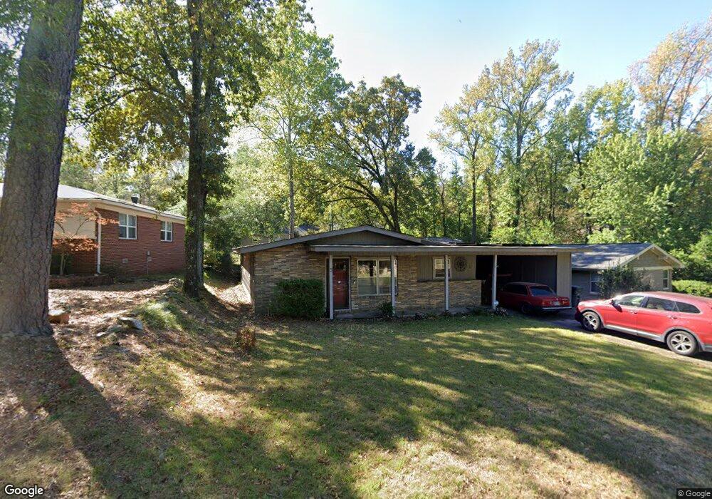
5 Mohawk Cir Little Rock, AR 72207
Kingwood NeighborhoodEstimated Value: $285,000 - $353,000
4
Beds
2
Baths
2,154
Sq Ft
$152/Sq Ft
Est. Value
About This Home
This home is located at 5 Mohawk Cir, Little Rock, AR 72207 and is currently estimated at $328,416, approximately $152 per square foot. 5 Mohawk Cir is a home located in Pulaski County with nearby schools including Jefferson Elementary School, Pulaski Heights Middle School, and Central High School.
Ownership History
Date
Name
Owned For
Owner Type
Purchase Details
Closed on
Dec 28, 2009
Sold by
Ji Yewei and Wang Aiai
Bought by
Lewis Steven D
Current Estimated Value
Home Financials for this Owner
Home Financials are based on the most recent Mortgage that was taken out on this home.
Original Mortgage
$171,830
Outstanding Balance
$111,616
Interest Rate
4.82%
Mortgage Type
FHA
Estimated Equity
$216,800
Purchase Details
Closed on
Mar 26, 2002
Sold by
Smith David Earl and Smith Donna Jo
Bought by
Ji Yewei and Wang Aiai
Home Financials for this Owner
Home Financials are based on the most recent Mortgage that was taken out on this home.
Original Mortgage
$142,750
Interest Rate
6.24%
Mortgage Type
FHA
Create a Home Valuation Report for This Property
The Home Valuation Report is an in-depth analysis detailing your home's value as well as a comparison with similar homes in the area
Home Values in the Area
Average Home Value in this Area
Purchase History
| Date | Buyer | Sale Price | Title Company |
|---|---|---|---|
| Lewis Steven D | $175,000 | Pulaski County Title | |
| Ji Yewei | $145,000 | -- |
Source: Public Records
Mortgage History
| Date | Status | Borrower | Loan Amount |
|---|---|---|---|
| Open | Lewis Steven D | $171,830 | |
| Previous Owner | Ji Yewei | $142,750 |
Source: Public Records
Tax History Compared to Growth
Tax History
| Year | Tax Paid | Tax Assessment Tax Assessment Total Assessment is a certain percentage of the fair market value that is determined by local assessors to be the total taxable value of land and additions on the property. | Land | Improvement |
|---|---|---|---|---|
| 2025 | $3,525 | $51,107 | $20,000 | $31,107 |
| 2024 | $3,231 | $51,107 | $20,000 | $31,107 |
| 2023 | $3,231 | $51,107 | $20,000 | $31,107 |
| 2022 | $3,084 | $51,107 | $20,000 | $31,107 |
| 2021 | $2,958 | $41,960 | $23,400 | $18,560 |
| 2020 | $2,562 | $41,960 | $23,400 | $18,560 |
| 2019 | $2,562 | $41,960 | $23,400 | $18,560 |
| 2018 | $2,587 | $41,960 | $23,400 | $18,560 |
| 2017 | $2,587 | $41,960 | $23,400 | $18,560 |
| 2016 | $2,831 | $45,440 | $8,000 | $37,440 |
| 2015 | $3,185 | $45,440 | $8,000 | $37,440 |
| 2014 | $3,185 | $45,440 | $8,000 | $37,440 |
Source: Public Records
Map
Nearby Homes
- 201 S Ridge Rd
- 108 Indian Trail
- 109 Winnwood Rd
- 124 Indian Trail
- 2408 Blackwood Rd
- 723 Pine Valley Rd
- 301 Kings Row Dr
- 73 White Oak Ln
- 6 White Oak Cir
- 22 White Oak Cir
- 2916 Dalewood Rd
- 122 Glen Dr
- 2219 & 2221 Blackwood Rd
- 15 Indian Trail
- 2100 Durwood Rd
- 7219 Richwood Rd
- 2805 Foxcroft Rd
- 1812 N Mississippi St
- 2801 Foxcroft Rd
- 1919 Georgia Ave