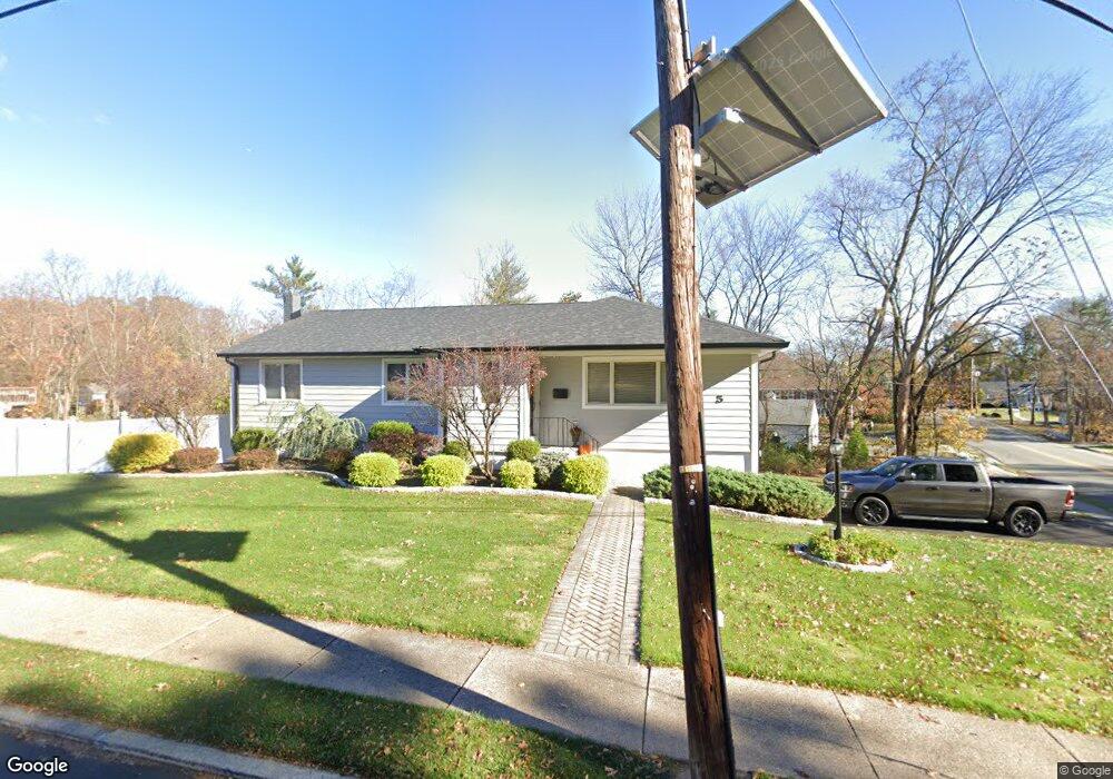
5 Munsey Rd Emerson, NJ 07630
Estimated Value: $716,700 - $942,000
--
Bed
--
Bath
1,384
Sq Ft
$619/Sq Ft
Est. Value
About This Home
This home is located at 5 Munsey Rd, Emerson, NJ 07630 and is currently estimated at $857,175, approximately $619 per square foot. 5 Munsey Rd is a home located in Bergen County with nearby schools including Memorial Elementary School, Patrick M. Villano Elementary School, and Emerson Jr Sr High School.
Ownership History
Date
Name
Owned For
Owner Type
Purchase Details
Closed on
May 29, 2007
Sold by
Shteyn Leon and Shteyn Irena
Bought by
Maietti Michael and Maietti Johanna
Current Estimated Value
Home Financials for this Owner
Home Financials are based on the most recent Mortgage that was taken out on this home.
Original Mortgage
$31,500
Outstanding Balance
$19,275
Interest Rate
6.19%
Mortgage Type
New Conventional
Estimated Equity
$837,900
Create a Home Valuation Report for This Property
The Home Valuation Report is an in-depth analysis detailing your home's value as well as a comparison with similar homes in the area
Home Values in the Area
Average Home Value in this Area
Purchase History
| Date | Buyer | Sale Price | Title Company |
|---|---|---|---|
| Maietti Michael | $630,000 | -- |
Source: Public Records
Mortgage History
| Date | Status | Borrower | Loan Amount |
|---|---|---|---|
| Open | Maietti Michael | $31,500 | |
| Open | Maietti Michael | $567,000 |
Source: Public Records
Tax History Compared to Growth
Tax History
| Year | Tax Paid | Tax Assessment Tax Assessment Total Assessment is a certain percentage of the fair market value that is determined by local assessors to be the total taxable value of land and additions on the property. | Land | Improvement |
|---|---|---|---|---|
| 2025 | $15,897 | $481,300 | $267,100 | $214,200 |
| 2024 | $15,479 | $481,300 | $267,100 | $214,200 |
| 2023 | $14,574 | $481,300 | $267,100 | $214,200 |
| 2022 | $14,574 | $481,300 | $267,100 | $214,200 |
| 2021 | $14,076 | $474,100 | $267,100 | $207,000 |
| 2020 | $13,801 | $474,100 | $267,100 | $207,000 |
| 2019 | $13,480 | $473,800 | $267,100 | $206,700 |
| 2018 | $12,873 | $473,800 | $267,100 | $206,700 |
| 2017 | $12,613 | $473,800 | $267,100 | $206,700 |
| 2016 | $12,338 | $473,800 | $267,100 | $206,700 |
| 2015 | $12,082 | $473,800 | $267,100 | $206,700 |
| 2014 | $11,826 | $465,900 | $267,100 | $198,800 |
Source: Public Records
Map
Nearby Homes
- 784 Austin Ave
- 59 Colonial Rd
- 105 Longview Dr
- 890 Oradell Ave
- 513 Hensler Ln
- 812 Golf Place
- 647 Orchard St
- 75 Demarest Ave
- 15 Spruce Ave
- 552 Burlington St
- 532 Hobart Rd
- 557 Forest Ave
- 87 Palisade Ave
- 541 Forest Ave
- 764 Sherwood Ct
- 506 Salem St
- 623 Alberta Dr
- 530 Forest Ave
- 138 Palisade Ave
- 131 4th Ave
- 575 Blauvelt Dr
- 13 Munsey Rd
- 16 Munsey Rd
- 585 Blauvelt Dr
- 837 Soldier Hill Rd
- 827 Soldier Hill Rd
- 798 Soldier Hill Rd
- 23 Munsey Rd
- 817 Soldier Hill Rd
- 595 Blauvelt Dr
- 560 Summit Ave
- 574 Blauvelt Dr
- 11 Ross Ave
- 26 Munsey Rd
- 584 Blauvelt Dr
- 31 Munsey Rd
- 554 Summit Ave
- 23 Ross Ave
- 611 Blauvelt Dr
- 594 Blauvelt Dr