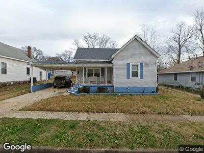
5 New St Lagrange, GA 30241
Estimated Value: $63,000 - $117,938
2
Beds
1
Bath
1,044
Sq Ft
$85/Sq Ft
Est. Value
About This Home
This home is located at 5 New St, Lagrange, GA 30241 and is currently estimated at $89,235, approximately $85 per square foot. 5 New St is a home located in Troup County with nearby schools including Franklin Forest Elementary School, Hollis Hand Elementary School, and Ethel W. Kight Elementary School.
Ownership History
Date
Name
Owned For
Owner Type
Purchase Details
Closed on
May 1, 2002
Sold by
Fred Isreal Assoc
Bought by
Young Gwinuette
Current Estimated Value
Purchase Details
Closed on
Jan 17, 2002
Sold by
Amy Richard and Amy Taylor
Bought by
Fred Isreal Assoc
Purchase Details
Closed on
Jan 15, 2002
Sold by
Commerical Bank & Trust
Bought by
Amy Richard and Amy Taylor
Purchase Details
Closed on
Nov 27, 1997
Sold by
Jolly L Spates
Bought by
Commerical Bank & Trust
Purchase Details
Closed on
Nov 26, 1997
Sold by
Jolly L Spates
Bought by
Jolly L Spates
Purchase Details
Closed on
Sep 25, 1991
Sold by
Spates
Bought by
Jolly L Spates
Purchase Details
Closed on
Jan 1, 1973
Sold by
Spates P L
Bought by
Spates
Purchase Details
Closed on
Jan 1, 1959
Bought by
Spates P L
Create a Home Valuation Report for This Property
The Home Valuation Report is an in-depth analysis detailing your home's value as well as a comparison with similar homes in the area
Home Values in the Area
Average Home Value in this Area
Purchase History
| Date | Buyer | Sale Price | Title Company |
|---|---|---|---|
| Young Gwinuette | $50,000 | -- | |
| Fred Isreal Assoc | $8,500 | -- | |
| Amy Richard | -- | -- | |
| Commerical Bank & Trust | $49,500 | -- | |
| Jolly L Spates | -- | -- | |
| Jolly L Spates | -- | -- | |
| Spates | $8,000 | -- | |
| Spates P L | -- | -- |
Source: Public Records
Mortgage History
| Date | Status | Borrower | Loan Amount |
|---|---|---|---|
| Open | Young Gwinuette | $72,751 | |
| Closed | Young Gwinuette | $44,100 | |
| Closed | Young Gwinuette P | $44,200 |
Source: Public Records
Tax History Compared to Growth
Tax History
| Year | Tax Paid | Tax Assessment Tax Assessment Total Assessment is a certain percentage of the fair market value that is determined by local assessors to be the total taxable value of land and additions on the property. | Land | Improvement |
|---|---|---|---|---|
| 2024 | $199 | $29,920 | $3,080 | $26,840 |
| 2023 | $151 | $25,080 | $3,080 | $22,000 |
| 2022 | $139 | $23,040 | $3,080 | $19,960 |
| 2021 | $562 | $20,640 | $2,560 | $18,080 |
| 2020 | $563 | $20,640 | $2,560 | $18,080 |
| 2019 | $540 | $19,880 | $2,560 | $17,320 |
| 2018 | $545 | $20,048 | $2,648 | $17,400 |
| 2017 | $545 | $20,048 | $2,648 | $17,400 |
| 2016 | $527 | $19,452 | $2,648 | $16,804 |
| 2015 | $528 | $19,452 | $2,648 | $16,804 |
| 2014 | $502 | $18,567 | $2,648 | $15,919 |
| 2013 | -- | $19,613 | $2,648 | $16,965 |
Source: Public Records
Map
Nearby Homes
- 5 Curran Ave
- 21 Barnard Ave
- 211 Rutland Cir
- 902 Georgia Ave
- 1206 Pool Mill St
- 914 Greenville St
- 347 Brookridge Dr
- 209 Lenox Cir
- 4 Louise St
- 45 N Cary St
- 600 S Harlem Cir
- 205 Lenox Cir
- 207 Lenox Cir
- 13 Fulton St
- 218 Hearthstone Dr
- 109 Horace King St
- 405 Sanford Ave
- 405 N Sanford Ave
- 424 Sweetwood Ct
- 417 Sweetwood Ct