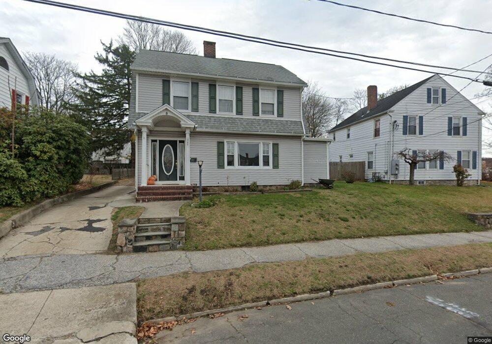
5 Ninth Ave Danbury, CT 06810
Germantown NeighborhoodEstimated Value: $413,072 - $444,000
3
Beds
2
Baths
1,640
Sq Ft
$259/Sq Ft
Est. Value
About This Home
This home is located at 5 Ninth Ave, Danbury, CT 06810 and is currently estimated at $425,018, approximately $259 per square foot. 5 Ninth Ave is a home located in Fairfield County with nearby schools including Stadley Rough School, Broadview Middle School, and Danbury High School.
Ownership History
Date
Name
Owned For
Owner Type
Purchase Details
Closed on
May 7, 2004
Sold by
Orourke Thomas and Orourcke Dana
Bought by
Romero Juan and Alcantara Guadalupe
Current Estimated Value
Home Financials for this Owner
Home Financials are based on the most recent Mortgage that was taken out on this home.
Original Mortgage
$232,400
Interest Rate
7.2%
Purchase Details
Closed on
Sep 23, 1994
Sold by
Schmiedel Joan and Mortimer Mary
Bought by
Orourke Thomas and Aurigemma Dana
Home Financials for this Owner
Home Financials are based on the most recent Mortgage that was taken out on this home.
Original Mortgage
$114,975
Interest Rate
8.56%
Mortgage Type
Unknown
Create a Home Valuation Report for This Property
The Home Valuation Report is an in-depth analysis detailing your home's value as well as a comparison with similar homes in the area
Home Values in the Area
Average Home Value in this Area
Purchase History
| Date | Buyer | Sale Price | Title Company |
|---|---|---|---|
| Romero Juan | $290,500 | -- | |
| Orourke Thomas | $125,000 | -- |
Source: Public Records
Mortgage History
| Date | Status | Borrower | Loan Amount |
|---|---|---|---|
| Open | Orourke Thomas | $273,000 | |
| Closed | Orourke Thomas | $232,400 | |
| Previous Owner | Orourke Thomas | $100,000 | |
| Previous Owner | Orourke Thomas | $114,975 |
Source: Public Records
Tax History
| Year | Tax Paid | Tax Assessment Tax Assessment Total Assessment is a certain percentage of the fair market value that is determined by local assessors to be the total taxable value of land and additions on the property. | Land | Improvement |
|---|---|---|---|---|
| 2025 | $4,952 | $198,170 | $58,240 | $139,930 |
| 2024 | $4,843 | $198,170 | $58,240 | $139,930 |
| 2023 | $4,623 | $198,170 | $58,240 | $139,930 |
| 2022 | $4,552 | $161,300 | $61,000 | $100,300 |
| 2021 | $4,452 | $161,300 | $61,000 | $100,300 |
| 2020 | $4,452 | $161,300 | $61,000 | $100,300 |
| 2019 | $4,452 | $161,300 | $61,000 | $100,300 |
| 2018 | $4,452 | $161,300 | $61,000 | $100,300 |
| 2017 | $4,308 | $148,800 | $58,100 | $90,700 |
| 2016 | $4,268 | $148,800 | $58,100 | $90,700 |
| 2015 | $4,205 | $148,800 | $58,100 | $90,700 |
| 2014 | $4,107 | $148,800 | $58,100 | $90,700 |
Source: Public Records
Map
Nearby Homes
- 43 Ninth Ave
- 18 James St
- 45 Ninth Ave
- 63 Brentwood Cir Unit 63
- 14 E Cross Trail Unit 14
- 185 Brentwood Cir Unit 185
- 37 Taylor St
- 35 Taylor St
- 65 Sheridan St Unit 11
- 19 Mcdermott St
- 126 Triangle St Unit B13
- 126 Triangle St Unit B43
- 34 Patriot Dr Unit A6
- 16 Springside Ave
- 68 Virginia Ave Unit 11
- 39 Balmforth Ave
- 1 Union Ave Unit 11
- 14 Newtown Rd Unit B6
- 63A Main St
- 30 Grove Place
Your Personal Tour Guide
Ask me questions while you tour the home.