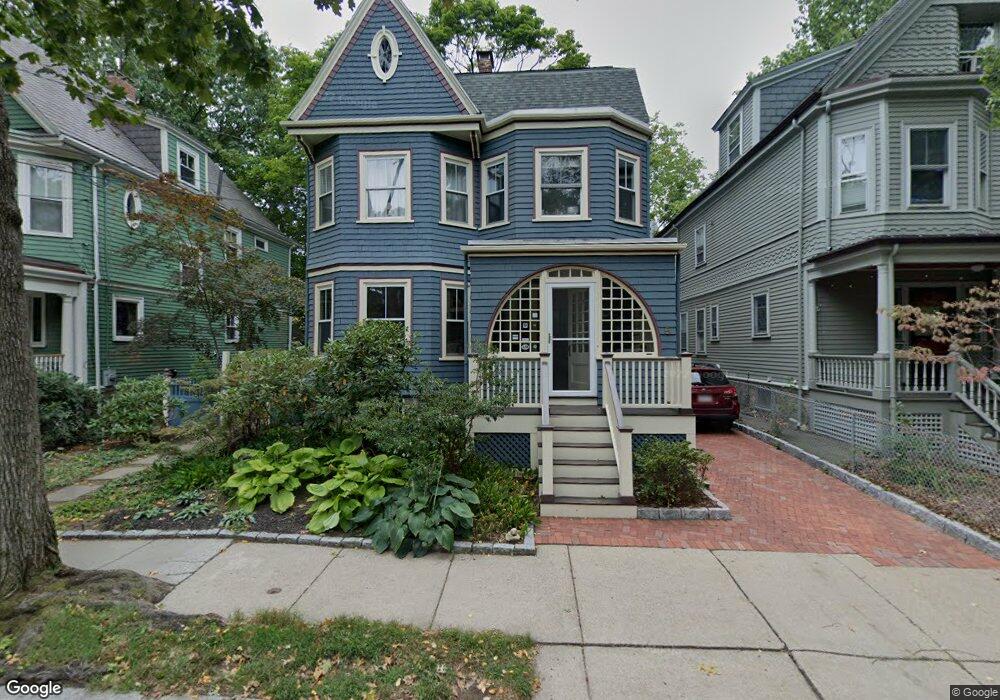
5 Osborne Rd Brookline, MA 02446
Coolidge Corner NeighborhoodEstimated Value: $2,527,000 - $2,862,000
5
Beds
2
Baths
2,969
Sq Ft
$902/Sq Ft
Est. Value
About This Home
This home is located at 5 Osborne Rd, Brookline, MA 02446 and is currently estimated at $2,679,139, approximately $902 per square foot. 5 Osborne Rd is a home located in Norfolk County with nearby schools including Match Charter Public School, New England Hebrew Academy, and Boston University Academy.
Ownership History
Date
Name
Owned For
Owner Type
Purchase Details
Closed on
Jun 22, 2020
Sold by
Parker-Johnson Paul E and Parker-Johnson Deborah A
Bought by
Paul E Parker-Johnson Ret
Current Estimated Value
Purchase Details
Closed on
Jan 13, 1984
Bought by
Parker Johnson Paul E and Parker Debora
Create a Home Valuation Report for This Property
The Home Valuation Report is an in-depth analysis detailing your home's value as well as a comparison with similar homes in the area
Home Values in the Area
Average Home Value in this Area
Purchase History
| Date | Buyer | Sale Price | Title Company |
|---|---|---|---|
| Paul E Parker-Johnson Ret | -- | None Available | |
| Parker Johnson Paul E | $150,000 | -- |
Source: Public Records
Mortgage History
| Date | Status | Borrower | Loan Amount |
|---|---|---|---|
| Previous Owner | Parker Johnson Paul E | $245,000 |
Source: Public Records
Tax History Compared to Growth
Tax History
| Year | Tax Paid | Tax Assessment Tax Assessment Total Assessment is a certain percentage of the fair market value that is determined by local assessors to be the total taxable value of land and additions on the property. | Land | Improvement |
|---|---|---|---|---|
| 2025 | $21,775 | $2,206,200 | $1,170,300 | $1,035,900 |
| 2024 | $20,738 | $2,122,600 | $1,125,200 | $997,400 |
| 2023 | $19,985 | $2,004,500 | $1,029,500 | $975,000 |
| 2022 | $19,452 | $1,908,900 | $980,400 | $928,500 |
| 2021 | $17,988 | $1,835,500 | $942,700 | $892,800 |
| 2020 | $16,412 | $1,736,700 | $857,000 | $879,700 |
| 2019 | $15,498 | $1,654,000 | $816,200 | $837,800 |
| 2018 | $16,835 | $1,779,600 | $680,200 | $1,099,400 |
| 2017 | $16,588 | $1,678,900 | $641,700 | $1,037,200 |
| 2016 | $16,349 | $1,569,000 | $599,700 | $969,300 |
| 2015 | $15,661 | $1,466,400 | $560,500 | $905,900 |
| 2014 | $15,318 | $1,344,900 | $467,000 | $877,900 |
Source: Public Records
Map
Nearby Homes
- 11 Abbottsford Rd
- 85 Naples Rd Unit 2
- 116 Thorndike St
- 116 Thorndike St Unit 2
- 116 Thorndike St Unit 1
- 57 Brighton Ave Unit C
- 57 Brighton Ave Unit B
- 57 Brighton Ave Unit A
- 59 Brighton Ave Unit 1
- 233 Freeman St Unit 1
- 6 Elba St
- 99 Crowninshield Rd Unit 99
- 125 Crowninshield Rd Unit 125
- 106 Chester St Unit 3
- 5 Fiske Terrace
- 28 Verndale St
- 45 Dwight St
- 58 Dwight St Unit 6
- 52 Babcock St Unit 6
- 373 Harvard St Unit 1
- 1 Osborne Rd
- 9 Osborne Rd
- 51 Abbottsford Rd
- 49 Abbottsford Rd Unit 1
- 49 Abbottsford Rd
- 145 Naples Rd
- 140 Naples Rd
- 11 Osborne Rd
- 12 Osborne Rd Unit 1
- 12 Osborne Rd
- 14 Osborne Rd Unit 14
- 14 Osborne Rd
- 14 Osborne Rd Unit 2B
- 146 Naples Rd Unit 148
- 149 Naples Rd
- 43 Abbottsford Rd
- 150 Naples Rd
- 17 Osborne Rd
- 17 Osborne Rd Unit 1
- 17 Osborne Rd Unit 2